
| Birth | : | 26 Apr 1883 Shawnee County, Kansas, USA |
| Death | : | 8 May 1976 Eskridge, Wabaunsee County, Kansas, USA |
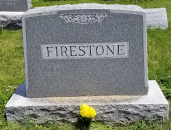
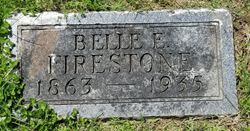
| Burial | : | Oak Forest Cemetery, Etowah, Henderson County, USA |
| Coordinate | : | 35.3081017, -82.5858002 |
| Plot | : | Singing Tower |
frequently asked questions (FAQ):
-
Where is Ethel Firestone Dagg's memorial?
Ethel Firestone Dagg's memorial is located at: Oak Forest Cemetery, Etowah, Henderson County, USA.
-
When did Ethel Firestone Dagg death?
Ethel Firestone Dagg death on 8 May 1976 in Eskridge, Wabaunsee County, Kansas, USA
-
Where are the coordinates of the Ethel Firestone Dagg's memorial?
Latitude: 35.3081017
Longitude: -82.5858002
Family Members:
Parent
Spouse

Siblings
Children
Flowers:


Nearby Cemetories:
1. Oak Forest Cemetery
Etowah, Henderson County, USA
Coordinate: 35.3081017, -82.5858002
2. Thomas Fletcher Cemetery
Etowah, Henderson County, USA
Coordinate: 35.2969017, -82.5947037
3. Old Beulah Cemetery
Henderson County, USA
Coordinate: 35.2961006, -82.6082993
4. Pleasant Grove Cemetery
Etowah, Henderson County, USA
Coordinate: 35.2888985, -82.5999985
5. Beulah Baptist Church Cemetery
Henderson County, USA
Coordinate: 35.3041992, -82.5580978
6. Follies Cemeteries
Etowah, Henderson County, USA
Coordinate: 35.2660600, -82.5817900
7. Sentell Family Cemetery
Henderson County, USA
Coordinate: 35.2752991, -82.5468979
8. Jeremiah Osborne Cemetery
Horse Shoe, Henderson County, USA
Coordinate: 35.3527400, -82.5551720
9. Sentell Cemetery
Henderson County, USA
Coordinate: 35.2593994, -82.6061020
10. Boylston Baptist Church Cemetery
Mills River, Henderson County, USA
Coordinate: 35.3296013, -82.6430969
11. Brown Family Cemetery
Henderson County, USA
Coordinate: 35.2779600, -82.5336300
12. Shaws Creek Methodist Campground Cemetery
Horse Shoe, Henderson County, USA
Coordinate: 35.3437996, -82.5345001
13. Piney Grove Cemetery
Penrose, Transylvania County, USA
Coordinate: 35.2629800, -82.6318300
14. Anderson Cemetery
Henderson County, USA
Coordinate: 35.2502000, -82.6002300
15. Crab Creek Church Cemetery
Henderson County, USA
Coordinate: 35.2536490, -82.5572710
16. McCall Cemetery
Transylvania County, USA
Coordinate: 35.2569008, -82.6268997
17. Old French Broad Baptist Church
Rugby, Henderson County, USA
Coordinate: 35.3588340, -82.5418500
18. Cantrell Family Cemetery
Henderson County, USA
Coordinate: 35.2869119, -82.5096819
19. Hoxit Family Cemetery
Henderson County, USA
Coordinate: 35.2409400, -82.5958000
20. Holly Springs Baptist Church Cemetery
Henderson County, USA
Coordinate: 35.2406960, -82.5968940
21. Saint Francis Chapel Memorial Garden
Henderson County, USA
Coordinate: 35.2641670, -82.5200440
22. Crab Creek Baptist Church Cemetery
Henderson County, USA
Coordinate: 35.2454987, -82.5476990
23. Mills River Presbyterian Church Cemetery
Mills River, Henderson County, USA
Coordinate: 35.3777733, -82.5728073
24. Osborne Cemetery
Penrose, Transylvania County, USA
Coordinate: 35.2546997, -82.6446991