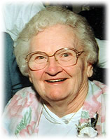
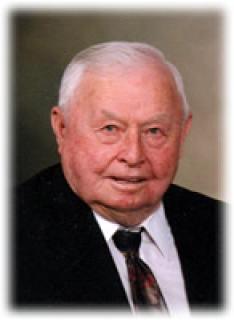
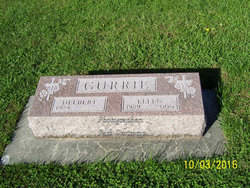
Ethel M. Currie Grotjohn
| Birth | : | 24 Aug 1920 Schaller, Sac County, Iowa, USA |
| Death | : | 31 Mar 2005 Storm Lake, Buena Vista County, Iowa, USA |
| Burial | : | Cedars Cemetery, Fort Hall, Bingham County, USA |
| Coordinate | : | 42.9664800, -112.5528900 |
| Description | : | Ethel M. Grotjohn, age 84, of Storm Lake, Iowa and formerly of Schaller, Iowa, passed away Thursday, March 31, 2005 at Buena Vista Regional Medical Center in Storm Lake after a lengthy illness. Funeral Services will be Monday, April 4, 2005 at 10:30 a.m. at Immanuel Reformed United Church of Christ in rural Schaller, with Reverend Henry Huddleston and Pastor Doug Corlew officiating. Burial will be in the Schaller Cemetery. The Fratzke & Jensen Funeral Home in Schaller is in charge of the arrangements. Friends may call on Sunday, April 3, 2005 from 2-5:00 p.m. at the Fratzke & Jensen Funeral Home... Read More |
frequently asked questions (FAQ):
-
Where is Ethel M. Currie Grotjohn's memorial?
Ethel M. Currie Grotjohn's memorial is located at: Cedars Cemetery, Fort Hall, Bingham County, USA.
-
When did Ethel M. Currie Grotjohn death?
Ethel M. Currie Grotjohn death on 31 Mar 2005 in Storm Lake, Buena Vista County, Iowa, USA
-
Where are the coordinates of the Ethel M. Currie Grotjohn's memorial?
Latitude: 42.9664800
Longitude: -112.5528900
Family Members:
Parent
Spouse
Siblings
Flowers:
Nearby Cemetories:
1. Cedars Cemetery
Fort Hall, Bingham County, USA
Coordinate: 42.9664800, -112.5528900
2. Cedar Cemetery
Bannock County, USA
Coordinate: 42.9675000, -112.5525000
3. Family Life Center Cemetery
Bannock County, USA
Coordinate: 42.8926100, -112.6411500
4. Bannock Creek Cemetery
Power County, USA
Coordinate: 42.8806000, -112.6316986
5. Sand Hill Cemetery
Fort Hall, Bingham County, USA
Coordinate: 43.0499600, -112.4653200
6. Good Shepherd Cemetery
Fort Hall, Bingham County, USA
Coordinate: 43.0260500, -112.4269000
7. Kutch Family Cemetery
Fort Hall, Bingham County, USA
Coordinate: 43.0240000, -112.3845000
8. Mountain View Cemetery
Pocatello, Bannock County, USA
Coordinate: 42.8558589, -112.4311120
9. Springfield-Sterling Cemetery
Springfield, Bingham County, USA
Coordinate: 43.0807991, -112.6712036
10. Chief Pocatello Burial Site
American Falls, Power County, USA
Coordinate: 42.9177150, -112.7375790
11. Restlawn Memorial Gardens
Pocatello, Bannock County, USA
Coordinate: 42.8460800, -112.4163600
12. Aberdeen Cemetery
Aberdeen, Bingham County, USA
Coordinate: 42.9423700, -112.8218800
13. Gibson Cemetery
Fort Hall, Bingham County, USA
Coordinate: 43.1267014, -112.3818970
14. Ross Fork Cemeteries
Fort Hall, Bingham County, USA
Coordinate: 43.0475006, -112.2746964
15. Riverside-Thomas Cemetery
Blackfoot, Bingham County, USA
Coordinate: 43.1972008, -112.4839020
16. Wilson Family Cemetery
Inkom, Bannock County, USA
Coordinate: 42.8734000, -112.2448000
17. Homestead Cemetery
Aberdeen, Bingham County, USA
Coordinate: 42.9075012, -112.8880997
18. Moreland Cemetery
Moreland, Bingham County, USA
Coordinate: 43.2271996, -112.4692001
19. State Hospital South Cemetery
Blackfoot, Bingham County, USA
Coordinate: 43.1820490, -112.3277300
20. Idaho State Veterans Cemetery
Blackfoot, Bingham County, USA
Coordinate: 43.1825390, -112.3177910
21. Grove City Cemetery
Blackfoot, Bingham County, USA
Coordinate: 43.2005997, -112.3272018
22. Inkom Cemetery
Inkom, Bannock County, USA
Coordinate: 42.8058014, -112.2266998
23. Groveland Cemetery
Blackfoot, Bingham County, USA
Coordinate: 43.2271996, -112.3806000
24. Falls View Cemetery
American Falls, Power County, USA
Coordinate: 42.7717018, -112.8719025

