
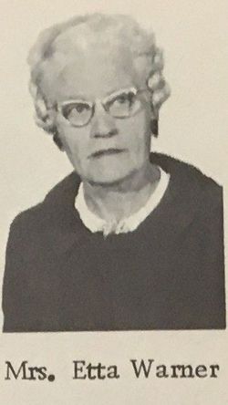


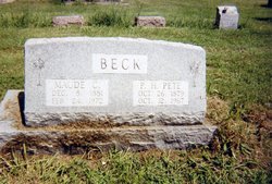
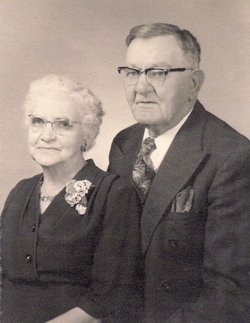
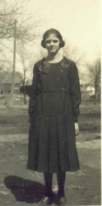
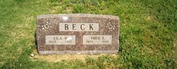
Etta Elizabeth Beck Warner
| Birth | : | 9 Jan 1902 Glasco, Cloud County, Kansas, USA |
| Death | : | 8 Jul 2002 Topeka, Shawnee County, Kansas, USA |
| Burial | : | Seagrave Swan Street Cemetery, Seagrave, Charnwood Borough, England |
| Coordinate | : | 52.7520370, -1.0883200 |
| Description | : | OBITUARY, The Glasco Sun, July 11, 2002, Glasco, Kansas Etta Warner of Topeka, died on July 8, 2002. She was born on January 9, 1902, on a farm near Glasco, Kansas, to Peter and Maude Hillan Beck. She was the oldest of four children. She was married to John E. Warner. He preceded her in death. Etta was a life-long educator. She graduated from Glasco High School in 1920, having taken normal training courses, which qualified her to teach grade school. She first taught at a one-room school near her home. Two of her students... Read More |
frequently asked questions (FAQ):
-
Where is Etta Elizabeth Beck Warner's memorial?
Etta Elizabeth Beck Warner's memorial is located at: Seagrave Swan Street Cemetery, Seagrave, Charnwood Borough, England.
-
When did Etta Elizabeth Beck Warner death?
Etta Elizabeth Beck Warner death on 8 Jul 2002 in Topeka, Shawnee County, Kansas, USA
-
Where are the coordinates of the Etta Elizabeth Beck Warner's memorial?
Latitude: 52.7520370
Longitude: -1.0883200
Family Members:
Parent
Siblings

Children
Flowers:


Nearby Cemetories:
1. Seagrave Swan Street Cemetery
Seagrave, Charnwood Borough, England
Coordinate: 52.7520370, -1.0883200
2. All Saints Churchyard
Seagrave, Charnwood Borough, England
Coordinate: 52.7525110, -1.0829090
3. Sileby Cemetery
Sileby, Charnwood Borough, England
Coordinate: 52.7299340, -1.1004210
4. Ratcliffe College
Ratcliffe on the Wreake, Charnwood Borough, England
Coordinate: 52.7294430, -1.0758320
5. St. Mary's Churchyard
Sileby, Charnwood Borough, England
Coordinate: 52.7308600, -1.1121420
6. St Mary Churchyard
Walton-on-the-Wolds, Charnwood Borough, England
Coordinate: 52.7712900, -1.1241310
7. St Botolphs Churchyard
Ratcliffe on the Wreake, Charnwood Borough, England
Coordinate: 52.7248680, -1.0680400
8. Holy Trinity Churchyard
Thrussington, Charnwood Borough, England
Coordinate: 52.7359030, -1.0381780
9. Holy Trinity Churchyard
Barrow-upon-Soar, Charnwood Borough, England
Coordinate: 52.7526930, -1.1470900
10. All Saints Churchyard
Cossington, Charnwood Borough, England
Coordinate: 52.7173590, -1.1073300
11. St. Peter's Churchyard
Mountsorrel, Charnwood Borough, England
Coordinate: 52.7304450, -1.1408620
12. Burton-on-the-Wolds Burial Ground
Burton-on-the-Wolds, Charnwood Borough, England
Coordinate: 52.7864470, -1.1207120
13. Christchurch Churchyard
Mountsorrel, Charnwood Borough, England
Coordinate: 52.7268480, -1.1409340
14. St Michael and All Angels Churchyard
Rearsby, Charnwood Borough, England
Coordinate: 52.7255100, -1.0373500
15. Mountsorrel Cemetery
Mountsorrel, Charnwood Borough, England
Coordinate: 52.7378380, -1.1547880
16. Barrow-Upon-Soar Cemetery
Barrow-upon-Soar, Charnwood Borough, England
Coordinate: 52.7620220, -1.1585640
17. All Saints Churchyard
Melton Mowbray, Melton Borough, England
Coordinate: 52.7728700, -1.0209400
18. All Saints Church
Melton Borough, England
Coordinate: 52.7728570, -1.0209240
19. Rothley Cemetery
Rothley, Charnwood Borough, England
Coordinate: 52.7162850, -1.1367740
20. All Saints Churchyard
Hoby, Melton Borough, England
Coordinate: 52.7496100, -1.0101660
21. Prestwold Natural Burial Ground
Loughborough, Charnwood Borough, England
Coordinate: 52.7779510, -1.1538520
22. St. Andrew's Churchyard
Prestwold, Charnwood Borough, England
Coordinate: 52.7875000, -1.1446400
23. St Bartholomews Parish Churchyard
Quorn, Charnwood Borough, England
Coordinate: 52.7440274, -1.1703330
24. St Michael and All Angels Churchyard, Brooksby Hall
Melton Mowbray, Melton Borough, England
Coordinate: 52.7375450, -1.0076900