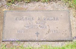
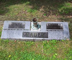
Eugene Alderson Rader
| Birth | : | 30 May 1892 Nicholas County, West Virginia, USA |
| Death | : | 16 May 1982 Santa Barbara County, California, USA |
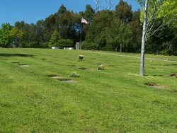
| Burial | : | Green Valley Cemetery, Miami County, USA |
| Coordinate | : | 38.4700012, -95.0472031 |
| Plot | : | 6 East |
frequently asked questions (FAQ):
-
Where is Eugene Alderson Rader's memorial?
Eugene Alderson Rader's memorial is located at: Green Valley Cemetery, Miami County, USA.
-
When did Eugene Alderson Rader death?
Eugene Alderson Rader death on 16 May 1982 in Santa Barbara County, California, USA
-
Where are the coordinates of the Eugene Alderson Rader's memorial?
Latitude: 38.4700012
Longitude: -95.0472031
Family Members:
Parent
Spouse
Siblings
Children
Nearby Cemetories:
1. Green Valley Cemetery
Miami County, USA
Coordinate: 38.4700012, -95.0472031
2. Lane Cemetery
Lane, Franklin County, USA
Coordinate: 38.4411011, -95.0699997
3. Spring Grove Quaker Cemetery
Miami County, USA
Coordinate: 38.4409600, -95.0185100
4. Myers Cemetery
Lane, Franklin County, USA
Coordinate: 38.4578820, -95.0935150
5. Shively Cemetery
Rantoul, Franklin County, USA
Coordinate: 38.5159500, -95.0747400
6. Indianapolis Cemetery
Osawatomie, Miami County, USA
Coordinate: 38.5046997, -94.9931030
7. Needham Cemetery
Lane, Franklin County, USA
Coordinate: 38.4700012, -95.1231003
8. Crescent Hill Cemetery
Osawatomie, Miami County, USA
Coordinate: 38.4513700, -94.9705800
9. Sturgeon Cemetery
Lane, Franklin County, USA
Coordinate: 38.4376100, -95.1254100
10. Stanton Cemetery
Stanton, Miami County, USA
Coordinate: 38.5426000, -95.0596100
11. Baker Cemetery
Lane, Franklin County, USA
Coordinate: 38.4371986, -95.1333008
12. Chandler Family Cemetery
Beagle, Miami County, USA
Coordinate: 38.4057600, -94.9951200
13. Brown Cemetery
Osawatomie, Miami County, USA
Coordinate: 38.4980300, -94.9566500
14. Lockhart Cemetery
Beagle, Miami County, USA
Coordinate: 38.4112400, -94.9828500
15. Pottawatomie Baptist Mission Cemetery
Lane, Franklin County, USA
Coordinate: 38.4049500, -95.1028200
16. Oakwood Cemetery
Osawatomie, Miami County, USA
Coordinate: 38.5024300, -94.9510300
17. Elmdale Cemetery
Osawatomie, Miami County, USA
Coordinate: 38.5017014, -94.9381027
18. Ruhamah Cemetery
Rantoul, Franklin County, USA
Coordinate: 38.5350914, -95.1310425
19. Beagle Cemetery
Beagle, Miami County, USA
Coordinate: 38.4178300, -94.9493400
20. Mound Creek Cemetery
Beagle, Miami County, USA
Coordinate: 38.3958015, -94.9760971
21. Lanter Family Cemetery
Anderson County, USA
Coordinate: 38.3827100, -95.1059000
22. Osawatomie State Hospital Burial Ground
Osawatomie, Miami County, USA
Coordinate: 38.5128600, -94.9326300
23. Mount Nebo Family Cemetery
Osawatomie Township, Miami County, USA
Coordinate: 38.4540400, -94.9208400
24. Ray Cemetery
Franklin County, USA
Coordinate: 38.4927140, -95.1754620


