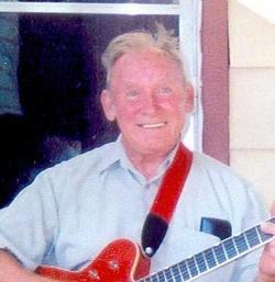
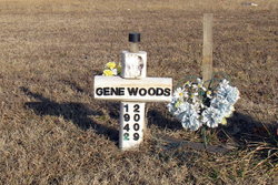
Eugene M “Gene” Woods
| Birth | : | 17 Sep 1942 Baxter Springs, Cherokee County, Kansas, USA |
| Death | : | 28 Aug 2009 Arma, Crawford County, Kansas, USA |
| Burial | : | Garston Cemetery, Garston, Southland District, New Zealand |
| Coordinate | : | -45.4694520, 168.6840050 |
| Description | : | Eugene M. "Gene" Woods 17 September 1942 - 28 August 2009 *** Eugene M. "Gene" Woods ARMA — Eugene M. "Gene" Woods, 66, of Arma, KS, formerly of Weir, KS died, with family and friends surrounding him, at 11 a.m., Friday, August 28, 2009 at his home from Lou Gehrig's Disease. Gene was born September 17, 1942 in Baxter Springs, KS to James Walter and Mildred M. (Pierce) Woods. He attended area schools later getting his GED. Gene married Terri. They later divorced. He then married Shirley Johnson. She preceded him in death. He later married Alice J. Hatfield, on September 18, 1998 in... Read More |
frequently asked questions (FAQ):
-
Where is Eugene M “Gene” Woods's memorial?
Eugene M “Gene” Woods's memorial is located at: Garston Cemetery, Garston, Southland District, New Zealand.
-
When did Eugene M “Gene” Woods death?
Eugene M “Gene” Woods death on 28 Aug 2009 in Arma, Crawford County, Kansas, USA
-
Where are the coordinates of the Eugene M “Gene” Woods's memorial?
Latitude: -45.4694520
Longitude: 168.6840050
Family Members:
Parent
Siblings
Flowers:
Nearby Cemetories:
1. Garston Cemetery
Garston, Southland District, New Zealand
Coordinate: -45.4694520, 168.6840050
2. Athol Cemetery
Athol, Southland District, New Zealand
Coordinate: -45.5088440, 168.5772790
3. Nokomai Southern Cemetery
Gore District, New Zealand
Coordinate: -45.5533090, 168.6607170
4. Kingston Cemetery
Kingston, Queenstown-Lakes District, New Zealand
Coordinate: -45.3376030, 168.7252250
5. Jollies Graves
Eyre Creek, Southland District, New Zealand
Coordinate: -45.5790700, 168.4913300
6. Waikaia Cemetery
Waikaia, Southland District, New Zealand
Coordinate: -45.7169300, 168.8490600
7. Potters
Roxburgh, Central Otago District, New Zealand
Coordinate: -45.4702550, 169.1115970
8. Nevis Cemetery
Central Otago District, New Zealand
Coordinate: -45.2240700, 168.9529050
9. Lumsden Cemetery
Lumsden, Southland District, New Zealand
Coordinate: -45.7418320, 168.4534090
10. Balfour Cemetery
Balfour, Southland District, New Zealand
Coordinate: -45.8391000, 168.5986640
11. Centre Hill Cemetery
Mossburn, Southland District, New Zealand
Coordinate: -45.6973670, 168.1959000
12. Gorge Creek Miners' Monument
Roxburgh, Central Otago District, New Zealand
Coordinate: -45.3759790, 169.2764350
13. Queenstown Cemetery
Queenstown, Queenstown-Lakes District, New Zealand
Coordinate: -45.0298090, 168.6554360
14. Roxburgh Cemetery
Roxburgh, Central Otago District, New Zealand
Coordinate: -45.5267800, 169.3107700
15. Riversdale Cemetery
Riversdale, Southland District, New Zealand
Coordinate: -45.9180100, 168.7263600
16. Frankton Cemetery
Queenstown, Queenstown-Lakes District, New Zealand
Coordinate: -45.0155230, 168.7325580
17. Lower Shotover Cemetery
Lower Shotover, Queenstown-Lakes District, New Zealand
Coordinate: -45.0004018, 168.7673740
18. Dipton Cemetery
Dipton, Southland District, New Zealand
Coordinate: -45.8957730, 168.3508000
19. Ettrick Cemetery
Millers Flat, Central Otago District, New Zealand
Coordinate: -45.6318900, 169.3645500
20. Waikaka Cemetery
Waikaka, Gore District, New Zealand
Coordinate: -45.9312400, 169.0188900
21. St. Michael & All Angels Church Cemetery
Clyde, Central Otago District, New Zealand
Coordinate: -45.1887000, 169.3172167
22. Clyde Cemetery
Clyde, Central Otago District, New Zealand
Coordinate: -45.1941880, 169.3398930
23. Arrowtown Cemetery
Arrowtown, Queenstown-Lakes District, New Zealand
Coordinate: -44.9402010, 168.8273840
24. Arrowtown War Memorial
Arrowtown, Queenstown-Lakes District, New Zealand
Coordinate: -44.9397300, 168.8284300


