
| Memorials | : | 0 |
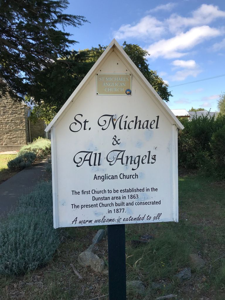
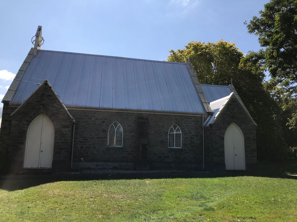
| Location | : | Clyde, Central Otago District, New Zealand |
| Coordinate | : | -45.1887000, 169.3172167 |
| Description | : | Churchyard Cemetery |
frequently asked questions (FAQ):
-
Where is St. Michael & All Angels Church Cemetery?
St. Michael & All Angels Church Cemetery is located at 10 Matau Street Clyde, Central Otago District ,Otago ,New Zealand.
-
St. Michael & All Angels Church Cemetery cemetery's updated grave count on graveviews.com?
0 memorials
-
Where are the coordinates of the St. Michael & All Angels Church Cemetery?
Latitude: -45.1887000
Longitude: 169.3172167
Nearby Cemetories:
1. Clyde Cemetery
Clyde, Central Otago District, New Zealand
Coordinate: -45.1941880, 169.3398930
2. Alexandra Cemetery
Alexandra, Central Otago District, New Zealand
Coordinate: -45.2397700, 169.3935560
3. Manuherikia Junction Cemetery
Alexandra, Central Otago District, New Zealand
Coordinate: -45.2614850, 169.3977150
4. St. Andrew's Anglican Church
Cromwell, Central Otago District, New Zealand
Coordinate: -45.0475370, 169.2098760
5. Litany Street Cemetery
Cromwell, Central Otago District, New Zealand
Coordinate: -45.0428540, 169.2100400
6. Cromwell Cemetery
Cromwell, Central Otago District, New Zealand
Coordinate: -45.0528700, 169.1732500
7. Gorge Creek Miners' Monument
Roxburgh, Central Otago District, New Zealand
Coordinate: -45.3759790, 169.2764350
8. Blacks Cemetery
Omakau, Central Otago District, New Zealand
Coordinate: -45.0895900, 169.6034000
9. Nevis Cemetery
Central Otago District, New Zealand
Coordinate: -45.2240700, 168.9529050
10. Moa Creek Cemetery
Moa Creek, Central Otago District, New Zealand
Coordinate: -45.2102100, 169.6869300
11. Drybread Cemetery
Lauder, Central Otago District, New Zealand
Coordinate: -44.9974100, 169.6075300
12. Potters
Roxburgh, Central Otago District, New Zealand
Coordinate: -45.4702550, 169.1115970
13. Roxburgh Cemetery
Roxburgh, Central Otago District, New Zealand
Coordinate: -45.5267800, 169.3107700
14. Tarras Cemetery
Tarras, Central Otago District, New Zealand
Coordinate: -44.8356000, 169.4408100
15. Cardrona Cemetery
Cardrona, Queenstown-Lakes District, New Zealand
Coordinate: -44.8653020, 169.0172270
16. Arrowtown War Memorial
Arrowtown, Queenstown-Lakes District, New Zealand
Coordinate: -44.9397300, 168.8284300
17. Arrowtown Cemetery
Arrowtown, Queenstown-Lakes District, New Zealand
Coordinate: -44.9402010, 168.8273840
18. Lower Shotover Cemetery
Lower Shotover, Queenstown-Lakes District, New Zealand
Coordinate: -45.0004018, 168.7673740
19. Kingston Cemetery
Kingston, Queenstown-Lakes District, New Zealand
Coordinate: -45.3376030, 168.7252250
20. Ettrick Cemetery
Millers Flat, Central Otago District, New Zealand
Coordinate: -45.6318900, 169.3645500
21. Frankton Cemetery
Queenstown, Queenstown-Lakes District, New Zealand
Coordinate: -45.0155230, 168.7325580
22. St Bathans Public Cemetery
Saint Bathans, Central Otago District, New Zealand
Coordinate: -44.8734250, 169.7990450
23. St Bathans Catholic Cemetery
Saint Bathans, Central Otago District, New Zealand
Coordinate: -44.8699930, 169.8090290
24. Millers Flat Cemetery
Millers Flat, Central Otago District, New Zealand
Coordinate: -45.6648030, 169.4147400