
| Birth | : | 3 Jul 1865 Jefferson County, Iowa, USA |
| Death | : | 12 Apr 1941 Kansas, USA |
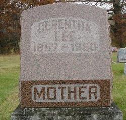
| Burial | : | Mount Hope Cemetery, Lebanon, Smith County, USA |
| Coordinate | : | 39.9721800, -98.5799700 |
| Description | : | Della Russell On Saturday, April 12,1941, at 3pm, death entered our midst and a beloved mother was called to her Eternal Home. Della Long Russell, daughter of Isaac and Sarah James Long, was born in Jefferson County, Iowa, on July 3, 1865. On December 22, 1881, she married Leroy Russell, who preceded her in death in January of 1930. To this union were born six sons and one daughter. Three sons and her daughter survive her. Harley C., the oldest son, died in 1917, Owen S. died in September 1940, and Clark died in infancy. The early years... Read More |
frequently asked questions (FAQ):
-
Where is Eunice Ludella “Della” Long Russell's memorial?
Eunice Ludella “Della” Long Russell's memorial is located at: Mount Hope Cemetery, Lebanon, Smith County, USA.
-
When did Eunice Ludella “Della” Long Russell death?
Eunice Ludella “Della” Long Russell death on 12 Apr 1941 in Kansas, USA
-
Where are the coordinates of the Eunice Ludella “Della” Long Russell's memorial?
Latitude: 39.9721800
Longitude: -98.5799700
Family Members:
Parent

Spouse
Siblings
Children
Flowers:


Nearby Cemetories:
1. Oriole Cemetery
Lebanon, Smith County, USA
Coordinate: 39.9366400, -98.5938300
2. Gust Cemetery
Webster County, USA
Coordinate: 40.0172005, -98.5421982
3. Webb Hill Cemetery
Lebanon, Smith County, USA
Coordinate: 39.9520200, -98.5045200
4. Mount Pleasant Cemetery
Webster County, USA
Coordinate: 40.0491982, -98.6125031
5. Pleasant Plains Cemetery
Lebanon, Smith County, USA
Coordinate: 39.8793400, -98.5419400
6. Womer Cemetery
Womer, Smith County, USA
Coordinate: 39.9736400, -98.7110800
7. Cedar Hill Cemetery
Cora, Smith County, USA
Coordinate: 39.8863200, -98.6550000
8. Amity Cemetery
Jewell County, USA
Coordinate: 39.9153170, -98.4673780
9. Murphy Cemetery
Red Cloud, Webster County, USA
Coordinate: 40.0744019, -98.5522003
10. Miner Ranch Cemetery
Red Cloud, Webster County, USA
Coordinate: 40.0774500, -98.5733500
11. Walnut Creek Cemetery
Inavale, Webster County, USA
Coordinate: 40.0463982, -98.6793976
12. Old Highland Township Cemetery
Jewell County, USA
Coordinate: 39.9430600, -98.4458900
13. Salem Cemetery
Esbon, Jewell County, USA
Coordinate: 39.8755989, -98.5006027
14. Highland Cemetery
Jewell County, USA
Coordinate: 39.9660988, -98.4300003
15. Sacred Heart Cemetery
Red Cloud, Webster County, USA
Coordinate: 40.0807300, -98.5286700
16. Red Cloud Cemetery
Red Cloud, Webster County, USA
Coordinate: 40.0806961, -98.5270920
17. Wagoner Cemetery
Red Cloud, Webster County, USA
Coordinate: 40.0307999, -98.4488983
18. Oak Hill Cemetery
Lebanon, Smith County, USA
Coordinate: 39.8437010, -98.6186200
19. Martin Cemetery
Webster County, USA
Coordinate: 40.0606003, -98.4518967
20. Spring Vale Cemetery
Washington Township, Smith County, USA
Coordinate: 39.9154700, -98.7424900
21. Northbranch Friends Cemetery
Northbranch, Jewell County, USA
Coordinate: 39.9728300, -98.3708300
22. Oak Creek Cemetery
Jewell County, USA
Coordinate: 39.9014015, -98.3918991
23. Providence Cemetery
Jewell County, USA
Coordinate: 39.8866997, -98.4008026
24. Prairie Home Cemetery
Esbon, Jewell County, USA
Coordinate: 39.8278008, -98.4661026