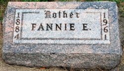
Fannie Edith Ridenour Bauer
| Birth | : | 11 Oct 1884 |
| Death | : | 10 Jan 1961 |
| Burial | : | St George Churchyard, Beckington, Mendip District, England |
| Coordinate | : | 51.2635260, -2.2856810 |
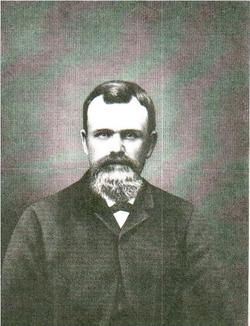
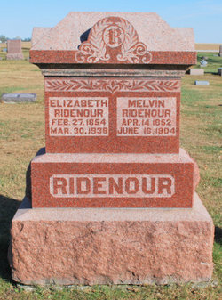
| Description | : | The Jefferson Bee 17 Jan 1961 FUNERAL SERVICES FOR FANNIE BAUER HELD JANUARY 12 Funeral services for Fannie Edith Bauer, 76, of Paton were held Thursday, Jan. 12 at the Slininger chapel in Jefferson with the Rev. Duane Manning of the Paton Methodist church in charge. Burial was in the Dawson Township cemtery. Casket bearers were Rudy Mannel, Lloyd Berry, Allen Rothm Dr. N.E, Waples, Gerald Clause, and Dean Baker. Soloist was Keith Sutton, accompanied by Mrs. Curtis Wilson. Fannie Edith Bauer, daughter of Melvin and Elizabeth Ridenour, was born Oct. 11, 1884, in Paton township, Greene county,... Read More |
frequently asked questions (FAQ):
-
Where is Fannie Edith Ridenour Bauer's memorial?
Fannie Edith Ridenour Bauer's memorial is located at: St George Churchyard, Beckington, Mendip District, England.
-
When did Fannie Edith Ridenour Bauer death?
Fannie Edith Ridenour Bauer death on 10 Jan 1961 in
-
Where are the coordinates of the Fannie Edith Ridenour Bauer's memorial?
Latitude: 51.2635260
Longitude: -2.2856810
Family Members:
Parent
Spouse
Siblings
Children
Flowers:
Nearby Cemetories:
1. St George Churchyard
Beckington, Mendip District, England
Coordinate: 51.2635260, -2.2856810
2. Beckington Baptist Chapel Burial Ground
Beckington, Mendip District, England
Coordinate: 51.2610760, -2.2897000
3. St Lawrence Churchyard
Rode, Mendip District, England
Coordinate: 51.2792750, -2.2765370
4. All Saints Churchyard
Lullington, Mendip District, England
Coordinate: 51.2661940, -2.3121800
5. St. Mary's Berkley
Berkley, Mendip District, England
Coordinate: 51.2435080, -2.2720990
6. Christ Church Churchyard
Rode, Mendip District, England
Coordinate: 51.2861620, -2.2790890
7. St. Lawrence Churchyard
Woolverton, Mendip District, England
Coordinate: 51.2851540, -2.3021790
8. St Mary's Churchyard
Laverton, Mendip District, England
Coordinate: 51.2757380, -2.3195910
9. St Mary the Virgin Churchyard
Orchardleigh, Mendip District, England
Coordinate: 51.2576210, -2.3259440
10. All Saints Churchyard
Rodden, Mendip District, England
Coordinate: 51.2283600, -2.2892740
11. All Saints Churchyard
Tellisford, Mendip District, England
Coordinate: 51.2997270, -2.2877180
12. East Hill Cemetery
Frome, Mendip District, England
Coordinate: 51.2275940, -2.3030250
13. East Hill
Frome St Quintin, West Dorset District, England
Coordinate: 51.2272132, -2.3024896
14. Frome Dissenters' Cemetery
Frome, Mendip District, England
Coordinate: 51.2317000, -2.3215000
15. Holy Trinity Church
Frome, Mendip District, England
Coordinate: 51.2341720, -2.3275820
16. St. John the Baptist Churchyard
Frome, Mendip District, England
Coordinate: 51.2296780, -2.3209480
17. Sheppards Barton Meeting House Burial Ground
Frome, Mendip District, England
Coordinate: 51.2300570, -2.3247620
18. Saint Michael & All Angels Churchyard
Buckland Dinham, Mendip District, England
Coordinate: 51.2600540, -2.3522580
19. Christ Church Churchyard
Frome, Mendip District, England
Coordinate: 51.2295340, -2.3260130
20. Norton St. Philip Churchyard
Norton St Philip, Mendip District, England
Coordinate: 51.3001680, -2.3279700
21. St. Margaret Churchyard Extension
Corsley, Wiltshire Unitary Authority, England
Coordinate: 51.2191491, -2.2469419
22. St Leonard Churchyard
Farleigh Hungerford, Mendip District, England
Coordinate: 51.3155390, -2.2884820
23. Penknap Providence Baptist Chapelyard
Dilton Marsh, Wiltshire Unitary Authority, England
Coordinate: 51.2467910, -2.2059510
24. Saint Mary Magdalene Churchyard
Great Elm, Mendip District, England
Coordinate: 51.2426040, -2.3647230

