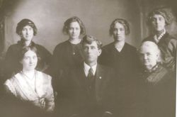
| Birth | : | 24 Jun 1919 Rock Dell, Olmsted County, Minnesota, USA |
| Death | : | 10 Jul 2016 Billings, Yellowstone County, Montana, USA |
| Burial | : | Orville Cemetery, Flaxville, Daniels County, USA |
| Coordinate | : | 48.7364006, -105.2016983 |
| Description | : | Ferris T. Mohn, 97, of Billings, formerly of Flaxville, passed away peacefully at Billings Clinic on July 10, 2016. Ferris was born in Rock Dell, Minn., on June 24, 1919, to Thomas and Ellen Mohn. The family moved to Canada and later to Montana when he was young and settled in the Flaxville area, where his father farmed. As a young man, Ferris worked for a CCC Camp in Glacier Park and, during WWII, he worked in the shipyards in Tacoma, Wash., and Portland, Ore. He married Irene Goulet on Aug. 31, 1940, and she joined him on... Read More |
frequently asked questions (FAQ):
-
Where is Ferris Tilfred Mohn's memorial?
Ferris Tilfred Mohn's memorial is located at: Orville Cemetery, Flaxville, Daniels County, USA.
-
When did Ferris Tilfred Mohn death?
Ferris Tilfred Mohn death on 10 Jul 2016 in Billings, Yellowstone County, Montana, USA
-
Where are the coordinates of the Ferris Tilfred Mohn's memorial?
Latitude: 48.7364006
Longitude: -105.2016983
Family Members:
Parent
Spouse
Siblings
Children
Flowers:
Nearby Cemetories:
1. Orville Cemetery
Flaxville, Daniels County, USA
Coordinate: 48.7364006, -105.2016983
2. Flaxville Cemetery
Flaxville, Daniels County, USA
Coordinate: 48.8102989, -105.1697006
3. Whitetail Cemetery
Daniels County, USA
Coordinate: 48.8967018, -105.1477966
4. Daniels County Cemetery
Scobey, Daniels County, USA
Coordinate: 48.7942009, -105.4421997
5. Pleasant Prairie Cemetery
Daniels County, USA
Coordinate: 48.5635986, -105.0871964
6. Valleyview Cemetery
Redstone, Sheridan County, USA
Coordinate: 48.8133011, -104.9356003
7. Fairview Cemetery
Daniels County, USA
Coordinate: 48.6431007, -105.4972000
8. Old Redstone Cemetery
Sheridan County, USA
Coordinate: 48.8306007, -104.9060974
9. Faith Lutheran Cemetery
Sheridan County, USA
Coordinate: 48.6217003, -104.9039001
10. Archer Cemetery
Sheridan County, USA
Coordinate: 48.7811012, -104.8153000
11. Saint Michaels Cemetery
Daniels County, USA
Coordinate: 48.9500008, -105.4244003
12. Highland Cemetery
Outlook, Sheridan County, USA
Coordinate: 48.8732986, -104.7755966
13. East Poplar Cemetery
Coronach, Assiniboia Census Division, Canada
Coordinate: 49.0649250, -105.3677700
14. Buffalo Gap Cemetery
Buffalo Gap, Assiniboia Census Division, Canada
Coordinate: 49.0874100, -105.2777000
15. Rock Spring Cemetery
Sheridan County, USA
Coordinate: 48.5928001, -104.7078018
16. Marshall Cemetery
Big Beaver, Weyburn Census Division, Canada
Coordinate: 49.0269260, -104.8803420
17. Coyote Hill Cemetery
Plentywood, Sheridan County, USA
Coordinate: 48.5698250, -104.7178700
18. Big Beaver Union Cemetery
Big Beaver, Weyburn Census Division, Canada
Coordinate: 49.0889460, -105.0563550
19. Eng Cemetery
Sheridan County, USA
Coordinate: 48.4907990, -104.7225037
20. Mount Pleasant Cemetery
Coronach, Assiniboia Census Division, Canada
Coordinate: 49.1239380, -105.4126170
21. Zion Lutheran Church Cemetery
Brockton, Roosevelt County, USA
Coordinate: 48.3474998, -104.9642029
22. Coronach Cemetery
Coronach, Assiniboia Census Division, Canada
Coordinate: 49.1118600, -105.5017090
23. Plentywood Cemetery
Plentywood, Sheridan County, USA
Coordinate: 48.7806015, -104.5466995
24. West Fork Cemetery
Daniels County, USA
Coordinate: 48.6648000, -105.8567700


