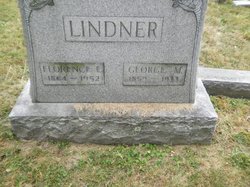
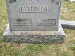
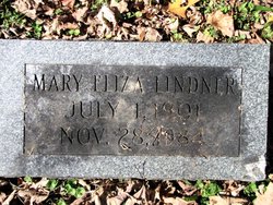
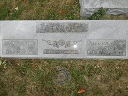
Florence Bramble Lindner
| Birth | : | 1864 |
| Death | : | 1952 |
| Burial | : | Ouderkerk aan den IJssel Nederlands Hervormde Kerk, Ouderkerk aan den IJssel, Krimpenerwaard Municipality, Netherlands |
| Coordinate | : | 51.9322220, 4.6361110 |
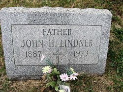
| Description | : | CUMBERLAND,MARYLAND —- Mrs. Florence Eliza Lindner, 87, died yesterday at her home, Nave's Crossroad. A native of Cumberland, she was a daughter of the late John T. and Eliza (Rice) Bramble. Mrs. Lindner was a member of SS. Peter and Paul Catholic Church. Surviving are five sons, John H., Charles W., Vincent J., Lawrence A. and Louis A. Lindner, all of this city; three daughters, Mrs. Frank Yockus and Miss Mary E. Lindner, both at home, and Mrs. Helen Stegmaier, city; a brother, George Bramble, city; a sister, Miss Mary Bramble, city; 35 grandchildren and 12 great- grandchildren. Five of... Read More |
frequently asked questions (FAQ):
-
Where is Florence Bramble Lindner's memorial?
Florence Bramble Lindner's memorial is located at: Ouderkerk aan den IJssel Nederlands Hervormde Kerk, Ouderkerk aan den IJssel, Krimpenerwaard Municipality, Netherlands.
-
When did Florence Bramble Lindner death?
Florence Bramble Lindner death on 1952 in
-
Where are the coordinates of the Florence Bramble Lindner's memorial?
Latitude: 51.9322220
Longitude: 4.6361110
Family Members:
Parent
Spouse
Siblings
Children
Flowers:
Nearby Cemetories:
1. Ouderkerk aan den IJssel Nederlands Hervormde Kerk
Ouderkerk aan den IJssel, Krimpenerwaard Municipality, Netherlands
Coordinate: 51.9322220, 4.6361110
2. Begraafplaats De essehof
Nieuwerkerk aan den IJssel, Zuidplas Municipality, Netherlands
Coordinate: 51.9599272, 4.6087006
3. Oude Begraafplaats Nieuwerkerk aan den IJssel
Nieuwerkerk aan den IJssel, Zuidplas Municipality, Netherlands
Coordinate: 51.9646128, 4.6186162
4. Oude Begraafplaats
Capelle aan den IJssel, Capelle aan den IJssel Municipality, Netherlands
Coordinate: 51.9166860, 4.5755210
5. Joodse Begraafplaats
Lekkerkerk, Krimpenerwaard Municipality, Netherlands
Coordinate: 51.9026200, 4.6836500
6. Algemene begraafplaats Lekkerkerk
Lekkerkerk, Krimpenerwaard Municipality, Netherlands
Coordinate: 51.8986600, 4.6967709
7. Oude Algemene Begraafplaats
Nieuw-Lekkerland, Molenwaard Municipality, Netherlands
Coordinate: 51.8921164, 4.6930499
8. Oud Kralingen Algemene Begraafplaats
Rotterdam, Rotterdam Municipality, Netherlands
Coordinate: 51.9320000, 4.5481900
9. Begraafplaats en Uitvaartcentrum IJsselmonde
IJsselmonde, Rotterdam Municipality, Netherlands
Coordinate: 51.9002288, 4.5558824
10. Joodse Begraafplaats Toepad
Rotterdam, Rotterdam Municipality, Netherlands
Coordinate: 51.9088890, 4.5322220
11. Begraafplaats Vredehof
Ridderkerk, Ridderkerk Municipality, Netherlands
Coordinate: 51.8683230, 4.5891290
12. Alblasserdam General Cemetery
Alblasserdam, Alblasserdam Municipality, Netherlands
Coordinate: 51.8620100, 4.6682900
13. Joodse begraafplaats Oostzeedijk
Rotterdam Municipality, Netherlands
Coordinate: 51.9219440, 4.5036110
14. Achterambacht Algemene Begraafplaats
Hendrik-Ido-Ambacht, Hendrik-Ido-Ambacht Municipality, Netherlands
Coordinate: 51.8489900, 4.6108200
15. Gouda Old Cemetery
Gouda, Gouda Municipality, Netherlands
Coordinate: 52.0064100, 4.7068900
16. Begraafplaats Sint Laurentius
Rotterdam, Rotterdam Municipality, Netherlands
Coordinate: 51.9342100, 4.4958500
17. Rotterdam Crooswijk General Cemetery
Rotterdam, Rotterdam Municipality, Netherlands
Coordinate: 51.9393500, 4.4911600
18. Protestantse Begraafplaats Hillegersberg
Hillegersberg-Schiebroek, Rotterdam Municipality, Netherlands
Coordinate: 51.9559332, 4.4934316
19. Joods begraafplaats Jan van Loonslaan
Rotterdam Municipality, Netherlands
Coordinate: 51.9252400, 4.4883000
20. Barendrecht General Cemetery
Barendrecht, Barendrecht Municipality, Netherlands
Coordinate: 51.8593700, 4.5382500
21. Gouda Ijsselhof Cemetery
Gouda, Gouda Municipality, Netherlands
Coordinate: 52.0095400, 4.7268000
22. Rotterdam Zuiderbegraafplaats
Rotterdam, Rotterdam Municipality, Netherlands
Coordinate: 51.8763300, 4.5045100
23. RK begraafplaats Gouda
Gouda, Gouda Municipality, Netherlands
Coordinate: 52.0174067, 4.7190455
24. Krimpen aan de Lek Cemetery
Krimpenerwaard Municipality, Netherlands
Coordinate: 51.9833330, 4.7833330

