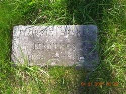
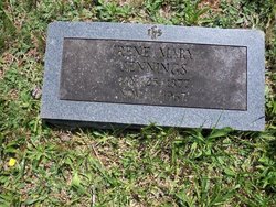
Florida Erskine “Florrie” Jennings
| Birth | : | 3 Mar 1868 Saint Louis, St. Louis City, Missouri, USA |
| Death | : | 6 Sep 1956 Winchester City, Virginia, USA |
| Burial | : | Riverside Cemetery, Plymouth, Grafton County, USA |
| Coordinate | : | 43.7736000, -71.6908100 |
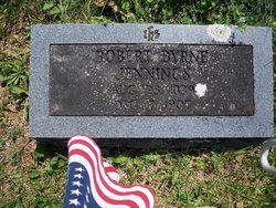
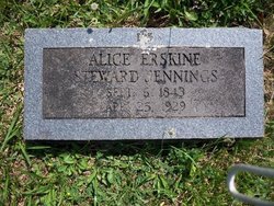
| Description | : | Florrie Erskine Jennings was born in 1868, the daughter of Robert B. Jennings and Alice E. Stewart. She was the granddaughter of James Erskine Stewart, a lawyer and judge in Page County, Virginia. Florrie never married. She spent part of her childhood in St. Louis, Missouri. As an adult, she lived with her good friend, Nelly Cook Kennerly, at "Greenway Court" in White Post, Clarke County, Virginia. Florrie died in 1956 at the age of 88. |
frequently asked questions (FAQ):
-
Where is Florida Erskine “Florrie” Jennings's memorial?
Florida Erskine “Florrie” Jennings's memorial is located at: Riverside Cemetery, Plymouth, Grafton County, USA.
-
When did Florida Erskine “Florrie” Jennings death?
Florida Erskine “Florrie” Jennings death on 6 Sep 1956 in Winchester City, Virginia, USA
-
Where are the coordinates of the Florida Erskine “Florrie” Jennings's memorial?
Latitude: 43.7736000
Longitude: -71.6908100
Family Members:
Parent
Siblings
Flowers:
Nearby Cemetories:
1. Riverside Cemetery
Plymouth, Grafton County, USA
Coordinate: 43.7736000, -71.6908100
2. Trinity Churchyard Cemetery
Holderness, Grafton County, USA
Coordinate: 43.7566000, -71.6696700
3. Dearborn Cemetery
Plymouth, Grafton County, USA
Coordinate: 43.7597220, -71.7213890
4. Beech Hill Burying Ground
Campton, Grafton County, USA
Coordinate: 43.8000620, -71.7119690
5. Pleasant Valley Cemetery
Plymouth, Grafton County, USA
Coordinate: 43.7741300, -71.7364600
6. Church Hill Cemetery
Ashland, Grafton County, USA
Coordinate: 43.7455560, -71.6522220
7. Spencer Cemetery
Grafton County, USA
Coordinate: 43.7720080, -71.7455500
8. Calvary Independent Baptist Church Cemetery
Plymouth, Grafton County, USA
Coordinate: 43.7639220, -71.7484290
9. Bartlett Cemetery
Plymouth, Grafton County, USA
Coordinate: 43.7542400, -71.7436200
10. Blair Cemetery
Campton, Grafton County, USA
Coordinate: 43.8111000, -71.6603012
11. Lower Intervale Cemetery
Plymouth, Grafton County, USA
Coordinate: 43.7316100, -71.6733800
12. Bog Road Cemetery
Campton, Grafton County, USA
Coordinate: 43.8152149, -71.6666793
13. Blaisdell Cemetery
Campton, Grafton County, USA
Coordinate: 43.8169440, -71.6555560
14. Turnpike Cemetery
Plymouth, Grafton County, USA
Coordinate: 43.7492700, -71.7532800
15. Shaw Cemetery
Holderness, Grafton County, USA
Coordinate: 43.7436110, -71.6225000
16. Owl Brook Cemetery
Ashland, Grafton County, USA
Coordinate: 43.7333200, -71.6300100
17. Campton Hollow Cemetery
Campton Hollow, Grafton County, USA
Coordinate: 43.8238150, -71.6409440
18. Hicks Hill Cemetery
Ashland, Grafton County, USA
Coordinate: 43.7277780, -71.6313890
19. Sanborn Cemetery
Holderness, Grafton County, USA
Coordinate: 43.7612800, -71.6050600
20. East Rumney
Rumney, Grafton County, USA
Coordinate: 43.8236110, -71.7483330
21. Union Cemetery
Bridgewater, Grafton County, USA
Coordinate: 43.7093500, -71.6763500
22. Mitchell Family Cemetery
Bridgewater, Grafton County, USA
Coordinate: 43.7052780, -71.6838890
23. Partridge Hill Cemetery
West Campton, Grafton County, USA
Coordinate: 43.8428700, -71.7046900
24. Eastern Corner Road Cemetery
Campton, Grafton County, USA
Coordinate: 43.8177540, -71.6045920

