

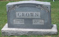
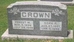
Forest Montgomery Crown
| Birth | : | 2 Mar 1896 |
| Death | : | 30 Jul 1948 |
| Burial | : | St. Andrew's Churchyard, Brinton, North Norfolk District, England |
| Coordinate | : | 52.8803690, 1.0274610 |
frequently asked questions (FAQ):
-
Where is Forest Montgomery Crown's memorial?
Forest Montgomery Crown's memorial is located at: St. Andrew's Churchyard, Brinton, North Norfolk District, England.
-
When did Forest Montgomery Crown death?
Forest Montgomery Crown death on 30 Jul 1948 in
-
Where are the coordinates of the Forest Montgomery Crown's memorial?
Latitude: 52.8803690
Longitude: 1.0274610
Family Members:
Parent

Spouse
Siblings
Children
Flowers:


Nearby Cemetories:
1. St. Andrew's Churchyard
Brinton, North Norfolk District, England
Coordinate: 52.8803690, 1.0274610
2. St Maurice Churchyard
Briningham, North Norfolk District, England
Coordinate: 52.8682680, 1.0271340
3. St Mary Churchyard Burgh Parva
Melton Constable, North Norfolk District, England
Coordinate: 52.8605700, 1.0337300
4. St Mary Churchyard
Gunthorpe, North Norfolk District, England
Coordinate: 52.8767720, 0.9883020
5. St Lawrence Churchyard
Hunworth, North Norfolk District, England
Coordinate: 52.8772530, 1.0673080
6. All Saints Churchyard
Bale, North Norfolk District, England
Coordinate: 52.8906290, 0.9871950
7. St Peter's Churchyard
Melton Constable, North Norfolk District, England
Coordinate: 52.8462900, 1.0247300
8. St. Andrews Churchyard
Letheringsett, North Norfolk District, England
Coordinate: 52.9081600, 1.0623490
9. All Saints Churchyard
Briston, North Norfolk District, England
Coordinate: 52.8511120, 1.0617870
10. St. Margaret's Churchyard
Saxlingham, North Norfolk District, England
Coordinate: 52.9155250, 1.0121410
11. Saint Andrew's Churchyard
Field Dalling, North Norfolk District, England
Coordinate: 52.9110600, 0.9832800
12. Methodist Memorial Gardens
Holt, North Norfolk District, England
Coordinate: 52.9067730, 1.0878360
13. Edgefield Old Churchyard
Edgefield, North Norfolk District, England
Coordinate: 52.8687300, 1.1001800
14. Holt Town Cemetery
Holt, North Norfolk District, England
Coordinate: 52.9117900, 1.0850400
15. St. Mary's Churchyard
Barney, North Norfolk District, England
Coordinate: 52.8555700, 0.9606080
16. Saint Andrew the Apostle
Holt, North Norfolk District, England
Coordinate: 52.9063400, 1.0933500
17. St. Martin's Churchyard
Hindringham, North Norfolk District, England
Coordinate: 52.8882000, 0.9477300
18. St. Martin's Churchyard, Glandford
Letheringsett, North Norfolk District, England
Coordinate: 52.9311970, 1.0396308
19. St. Peter and St. Paul's Churchyard
Edgefield, North Norfolk District, England
Coordinate: 52.8645320, 1.1089840
20. St Andrew and St Mary Churchyard
Langham, North Norfolk District, England
Coordinate: 52.9310020, 0.9855430
21. Old St. George Churchyard
Hindolveston, North Norfolk District, England
Coordinate: 52.8233900, 1.0136710
22. Christ Church Churchyard
Fulmodeston, North Norfolk District, England
Coordinate: 52.8385680, 0.9569670
23. St Andrew Churchyard
Hempstead, North Norfolk District, England
Coordinate: 52.8895750, 1.1270070
24. All Saints Churchyard
Hempstead, North Norfolk District, England
Coordinate: 52.8895200, 1.1274620