
| Birth | : | 15 Sep 1935 Wabash, Wabash County, Indiana, USA |
| Death | : | 3 Nov 1998 Lafayette, Tippecanoe County, Indiana, USA |
| Burial | : | South Lead Cemetery, Lead, Lawrence County, USA |
| Coordinate | : | 44.3478510, -103.7606260 |
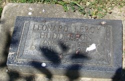
| Description | : | Chief Frances Ann Dunnagan First & Only Female Chief of the Miami Nation of Indiana 1994 – 1998 Former Vice-Chief 1998 She was married to Willis E. Dunnagan in Wabash on April 18, 1954, and he survives. She attended Roseburg Church of Christ in Marion, IN. She acted as Chief of the Miami Nation of Indians of the State of Indiana, Inc. for three years, until April 1998, at which time she was elected Vice Chief in the first general election. She served on the Miami Council for several years, and served on the Native American... Read More |
frequently asked questions (FAQ):
-
Where is Frances Ann “Pozequah” Huddleson Dunnagan's memorial?
Frances Ann “Pozequah” Huddleson Dunnagan's memorial is located at: South Lead Cemetery, Lead, Lawrence County, USA.
-
When did Frances Ann “Pozequah” Huddleson Dunnagan death?
Frances Ann “Pozequah” Huddleson Dunnagan death on 3 Nov 1998 in Lafayette, Tippecanoe County, Indiana, USA
-
Where are the coordinates of the Frances Ann “Pozequah” Huddleson Dunnagan's memorial?
Latitude: 44.3478510
Longitude: -103.7606260
Family Members:
Parent
Spouse

Children
Flowers:


Nearby Cemetories:
1. West Lead Cemetery
Lead, Lawrence County, USA
Coordinate: 44.3484001, -103.7779999
2. Mount Moriah Cemetery
Deadwood, Lawrence County, USA
Coordinate: 44.3760986, -103.7253036
3. Saint Ambrose Cemetery
Deadwood, Lawrence County, USA
Coordinate: 44.3821983, -103.7266998
4. Terry Cemetery
Terry, Lawrence County, USA
Coordinate: 44.3344290, -103.8165110
5. Oak Ridge Cemetery
Deadwood, Lawrence County, USA
Coordinate: 44.3891983, -103.6766968
6. Holy Cross Cemetery
Englewood, Lawrence County, USA
Coordinate: 44.2818985, -103.8047028
7. Mountain Lawn Cemetery
Englewood, Lawrence County, USA
Coordinate: 44.2818985, -103.8047028
8. Galena Cemetery
Galena, Lawrence County, USA
Coordinate: 44.3349220, -103.6438410
9. Preston Ghost Town Cemetery
Preston, Lawrence County, USA
Coordinate: 44.3577500, -103.8871670
10. Carbonate Cemetery
Maurice, Lawrence County, USA
Coordinate: 44.4000000, -103.8680500
11. Roubaix Cemetery
Roubaix, Lawrence County, USA
Coordinate: 44.2789380, -103.6656600
12. Dumont Cemetery
Lawrence County, USA
Coordinate: 44.2270000, -103.7860000
13. Carr Cemetery
Hanna, Lawrence County, USA
Coordinate: 44.2411003, -103.8606033
14. Crook City Cemetery
Crook City, Lawrence County, USA
Coordinate: 44.4432100, -103.6241500
15. Anderson Cemetery
Lawrence County, USA
Coordinate: 44.4747009, -103.6896973
16. Whitewood Cemetery
Whitewood, Lawrence County, USA
Coordinate: 44.4617820, -103.6330030
17. Rose Hill Cemetery
Spearfish, Lawrence County, USA
Coordinate: 44.4802180, -103.8509270
18. Mountain Meadow Cemetery
Lawrence County, USA
Coordinate: 44.2038994, -103.6557999
19. Saint Aloysius Cemetery
Sturgis, Meade County, USA
Coordinate: 44.4141340, -103.5193420
20. Little Dane Cemetery
Saint Onge, Lawrence County, USA
Coordinate: 44.5252500, -103.6705540
21. Gate of Heaven Cemetery
Saint Onge, Lawrence County, USA
Coordinate: 44.5353000, -103.7237000
22. Bear Gulch Cemetery
Lawrence County, USA
Coordinate: 44.3819008, -104.0325012
23. Bear Butte Cemetery
Sturgis, Meade County, USA
Coordinate: 44.4111595, -103.4947968
24. Black Hills National Cemetery
Sturgis, Meade County, USA
Coordinate: 44.3689003, -103.4753036