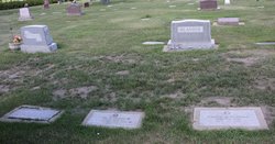
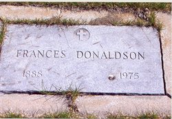
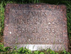
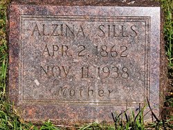
Frances “Frankie” Donaldson
| Birth | : | 3 Mar 1888 Kingsbury County, South Dakota, USA |
| Death | : | 15 Nov 1975 Aberdeen, Brown County, South Dakota, USA |
| Burial | : | Archer Street Cemetery, Masterton, Masterton District, New Zealand |
| Coordinate | : | -40.9538900, 175.6683800 |
| Plot | : | Block 88 Lot 2 grave F |
| Description | : | Obituary published in unknown newspaper (probably Aberdeen, South Dakota): Miss Frances Donaldson Funeral services for Frances Donaldson, 88, Aberdeen, have been set for 2 pm Tuesday at the Huebl Chapel with the Rev. Jerry Wickre officiating. Burial will be in Riverside Cemetery. Miss Donaldson died early Saturday morning at St. Luke's Hospital. Visitation will be at the Huebl Chapel from 7 pm Sunday until the time of service. Miss Donaldson was born in Kingsbury County near De Smet on March 5, 1887. She moved with her family to Aberdeen and attended Northern State College where she received a teaching certificate. She taught school at the Indian... Read More |
frequently asked questions (FAQ):
-
Where is Frances “Frankie” Donaldson's memorial?
Frances “Frankie” Donaldson's memorial is located at: Archer Street Cemetery, Masterton, Masterton District, New Zealand.
-
When did Frances “Frankie” Donaldson death?
Frances “Frankie” Donaldson death on 15 Nov 1975 in Aberdeen, Brown County, South Dakota, USA
-
Where are the coordinates of the Frances “Frankie” Donaldson's memorial?
Latitude: -40.9538900
Longitude: 175.6683800
Family Members:
Parent
Siblings
Flowers:
Nearby Cemetories:
1. Archer Street Cemetery
Masterton, Masterton District, New Zealand
Coordinate: -40.9538900, 175.6683800
2. Masterton War Memorial
Masterton, Masterton District, New Zealand
Coordinate: -40.9501290, 175.6648800
3. Riverside Cemetery
Masterton, Masterton District, New Zealand
Coordinate: -40.9621550, 175.6722690
4. Ahi pane pane Urupā
Masterton, Masterton District, New Zealand
Coordinate: -40.9524060, 175.6902370
5. Te Ahitainga Urupā
Masterton, Masterton District, New Zealand
Coordinate: -40.9393000, 175.7030750
6. Akura Urupā
Masterton, Masterton District, New Zealand
Coordinate: -40.9314120, 175.6349090
7. Hamuera Urupā
Masterton District, New Zealand
Coordinate: -41.0374980, 175.6611940
8. Clareville Cemetery
Clareville, Carterton District, New Zealand
Coordinate: -40.9981070, 175.5459540
9. Waipoapoa Urupa
Hastings, Hastings District, New Zealand
Coordinate: -41.0696050, 175.6604650
10. Waipopo Urupā
Masterton, Masterton District, New Zealand
Coordinate: -41.0696370, 175.6604430
11. Oates Family Cemetery
Carterton, Carterton District, New Zealand
Coordinate: -41.0453670, 175.5683580
12. Scandinavian Camp Cemetery
Kopuaranga, Masterton District, New Zealand
Coordinate: -40.8345650, 175.6643220
13. Hurunui-o-rangi
Masterton, Masterton District, New Zealand
Coordinate: -41.0709670, 175.6200720
14. Gladstone Church Cemetery
Gladstone, Carterton District, New Zealand
Coordinate: -41.0883600, 175.6432100
15. Te Uru o Tane Urupā
Greytown, South Wairarapa District, New Zealand
Coordinate: -41.0570790, 175.4947740
16. Church of St Francis of Assisi
Bideford, Masterton District, New Zealand
Coordinate: -40.8592400, 175.8714600
17. Mauriceville West Cemetery
Mauriceville West, Masterton District, New Zealand
Coordinate: -40.7670300, 175.6799680
18. Saint Francis Lutheran Churchyard
Mauriceville West, Masterton District, New Zealand
Coordinate: -40.7652900, 175.6834400
19. Papawai Urupā
Greytown, South Wairarapa District, New Zealand
Coordinate: -41.0985090, 175.4892270
20. Greytown Cemetery
Greytown, South Wairarapa District, New Zealand
Coordinate: -41.0920470, 175.4401160
21. Hastwell Cemetery
Eketahuna, Tararua District, New Zealand
Coordinate: -40.7191500, 175.7216100
22. David Leary Memorial
Eketahuna, Tararua District, New Zealand
Coordinate: -40.7079188, 175.5836626
23. Eketahuna Lawn Cemetery
Eketahuna, Tararua District, New Zealand
Coordinate: -40.6538700, 175.6883400
24. Martinborough Cemetery
Martinborough, South Wairarapa District, New Zealand
Coordinate: -41.2158720, 175.4722330

