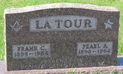
Frank C LaTour
| Birth | : | 29 Sep 1895 Oelwein, Fayette County, Iowa, USA |
| Death | : | 30 Sep 1964 Independence, Buchanan County, Iowa, USA |
| Burial | : | Rowley Cemetery, Rowley, Buchanan County, USA |
| Coordinate | : | 42.3716621, -91.8530655 |
| Plot | : | New Addition Lot 14 |
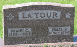
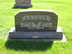
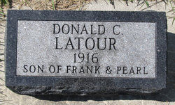
| Inscription | : | p/o Donald, Celesta & LaVonne |
frequently asked questions (FAQ):
-
Where is Frank C LaTour's memorial?
Frank C LaTour's memorial is located at: Rowley Cemetery, Rowley, Buchanan County, USA.
-
When did Frank C LaTour death?
Frank C LaTour death on 30 Sep 1964 in Independence, Buchanan County, Iowa, USA
-
Where are the coordinates of the Frank C LaTour's memorial?
Latitude: 42.3716621
Longitude: -91.8530655
Family Members:
Parent
Spouse
Siblings
Children
Flowers:
Nearby Cemetories:
1. Rowley Cemetery
Rowley, Buchanan County, USA
Coordinate: 42.3716621, -91.8530655
2. Pine Creek Cemetery
Quasqueton, Buchanan County, USA
Coordinate: 42.4172400, -91.7867200
3. Quasqueton Cemetery
Quasqueton, Buchanan County, USA
Coordinate: 42.3994370, -91.7621231
4. Cono Cemetery
Rowley, Buchanan County, USA
Coordinate: 42.3174170, -91.7769370
5. Spencers Grove Cemetery
Benton County, USA
Coordinate: 42.2841988, -91.8655014
6. Hickory Grove Cemetery
Quasqueton, Buchanan County, USA
Coordinate: 42.4207598, -91.7534684
7. Mount Hope Cemetery
Independence, Buchanan County, USA
Coordinate: 42.4571991, -91.8914032
8. State Hospital Cemetery
Independence, Buchanan County, USA
Coordinate: 42.4455986, -91.9253006
9. West Haven Cemetery
Independence, Buchanan County, USA
Coordinate: 42.4588678, -91.8986696
10. Wilson Cemetery
Independence, Buchanan County, USA
Coordinate: 42.4658012, -91.8516998
11. Sacred Heart Cemetery
Walker, Linn County, USA
Coordinate: 42.2938995, -91.7778015
12. Oakwood Cemetery
Independence, Buchanan County, USA
Coordinate: 42.4627991, -91.8927994
13. Walker Cemetery
Walker, Linn County, USA
Coordinate: 42.2840000, -91.7868000
14. Greenwood Cemetery
Brandon, Buchanan County, USA
Coordinate: 42.3123970, -91.9651640
15. Saint Marys Cemetery
Benton County, USA
Coordinate: 42.2616997, -91.8683014
16. Circle Grove Cemetery
Quasqueton, Buchanan County, USA
Coordinate: 42.3386002, -91.7061005
17. Saint Johns Catholic Cemetery
Independence, Buchanan County, USA
Coordinate: 42.4822006, -91.8957977
18. Buchanan County Poor Farm Cemetery
Independence, Buchanan County, USA
Coordinate: 42.4871560, -91.8647280
19. Jefferson Township Cemetery
Brandon, Buchanan County, USA
Coordinate: 42.3139000, -91.9931030
20. Brandon Cemetery
Brandon, Buchanan County, USA
Coordinate: 42.3156300, -91.9945200
21. Buchanan County Home Cemetery
Independence, Buchanan County, USA
Coordinate: 42.4903050, -91.8596350
22. Beachler Cemetery
Brandon, Buchanan County, USA
Coordinate: 42.3045000, -91.9908000
23. Fairview Cemetery
Winthrop, Buchanan County, USA
Coordinate: 42.4692001, -91.7407990
24. Saint Patricks Cemetery
Winthrop, Buchanan County, USA
Coordinate: 42.4653015, -91.7328033


