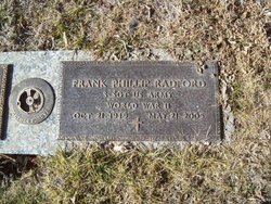
Frank Phillip Radford
| Birth | : | 21 Oct 1919 Haxtun, Phillips County, Colorado, USA |
| Death | : | 21 May 2005 Loveland, Larimer County, Colorado, USA |
| Burial | : | Grantsville Cemetery, Grantsville, Garrett County, USA |
| Coordinate | : | 39.6949997, -79.1641998 |
| Plot | : | Sacred Heart Garden Lot 46 |
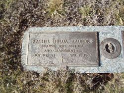
| Description | : | Haxtun-Fleming Herald, Haxtun, Colorado, May 25, 2005 Frank Phillip Radford passed away May 21 in Loveland at McKee Medical Center at the age of 85. Frank was born in Haxtun on October 21, 1919, to Harry and Anna Margaret (Cavanaugh) Radford. He graduated from Haxtun schools, attended the University of Colorado for two years and graduated from the California College of Mortuary Science in 1940. He was a licensed funeral director and embalmer in the state of Colorado. Frank married Rachel Hulda Schaffer on October 4, 1940. She died on April 29, 1969. On June 13, 1942,... Read More |
frequently asked questions (FAQ):
-
Where is Frank Phillip Radford's memorial?
Frank Phillip Radford's memorial is located at: Grantsville Cemetery, Grantsville, Garrett County, USA.
-
When did Frank Phillip Radford death?
Frank Phillip Radford death on 21 May 2005 in Loveland, Larimer County, Colorado, USA
-
Where are the coordinates of the Frank Phillip Radford's memorial?
Latitude: 39.6949997
Longitude: -79.1641998
Family Members:
Parent
Spouse
Flowers:
Nearby Cemetories:
1. Grantsville Cemetery
Grantsville, Garrett County, USA
Coordinate: 39.6949997, -79.1641998
2. Wiland Farm Cemetery
Grantsville, Garrett County, USA
Coordinate: 39.6855900, -79.1663600
3. Maple Glen Cemetery
Grantsville, Garrett County, USA
Coordinate: 39.7061005, -79.1511002
4. Otto Cemetery
Jennings, Garrett County, USA
Coordinate: 39.6772970, -79.1577550
5. Maple Grove Cemetery
Jennings, Garrett County, USA
Coordinate: 39.6737800, -79.1627000
6. Custer Cemetery
Garrett County, USA
Coordinate: 39.6720990, -79.1497030
7. Engle Cemetery
Grantsville, Garrett County, USA
Coordinate: 39.6656860, -79.1549920
8. Amos J. Yoder Old Burial Ground
Elk Lick Township, Somerset County, USA
Coordinate: 39.7256000, -79.1539000
9. Eli Ridgeley Amish Cemetery
Garrett County, USA
Coordinate: 39.6662800, -79.1861300
10. Oak Grove Mennonite Cemetery
Garrett County, USA
Coordinate: 39.7096550, -79.2110820
11. Beachy Grave Yard
Elk Lick Township, Somerset County, USA
Coordinate: 39.7283000, -79.1274000
12. Negro Mountain Cemetery
Garrett County, USA
Coordinate: 39.6697006, -79.2118988
13. Laughlin Church Cemetery
Grantsville, Garrett County, USA
Coordinate: 39.6702400, -79.2125900
14. Davies Family Cemetery
Grantsville, Garrett County, USA
Coordinate: 39.6770100, -79.1064200
15. Hershberger Graveyard
Elk Lick Township, Somerset County, USA
Coordinate: 39.7380680, -79.1311060
16. Niverton Amish Cemetery
Niverton, Somerset County, USA
Coordinate: 39.7368340, -79.1257480
17. Jesse Tomlinson Cemetery
Grantsville, Garrett County, USA
Coordinate: 39.6995620, -79.0961020
18. Ringer-Shoemaker Cemetery
Fort Hill, Somerset County, USA
Coordinate: 39.7418530, -79.2101170
19. Wilburn Cemetery
Jennings, Garrett County, USA
Coordinate: 39.6397200, -79.1937000
20. Christner Farm Cemetery
Elk Lick Township, Somerset County, USA
Coordinate: 39.7519440, -79.1202780
21. Mount Beulah Methodist Church Cemetery
Garrett County, USA
Coordinate: 39.6376200, -79.1058100
22. Trinity Cemetery
Grantsville, Garrett County, USA
Coordinate: 39.6380997, -79.1050034
23. New Germany Methodist Cemetery
Grantsville, Garrett County, USA
Coordinate: 39.6382600, -79.1044400
24. Old Peter Beachy Cemetery
Elk Lick Township, Somerset County, USA
Coordinate: 39.7493000, -79.0978000


