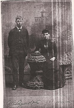
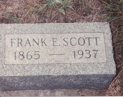
Franklin Elias “Frank” Scott
| Birth | : | 19 Apr 1865 Rockford, Winnebago County, Illinois, USA |
| Death | : | 24 Apr 1937 Des Moines, Polk County, Iowa, USA |
| Burial | : | All Saints Churchyard, West Markham, Bassetlaw District, England |
| Coordinate | : | 53.2462040, -0.9203580 |
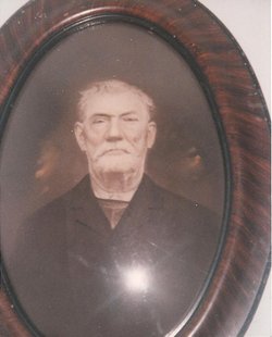
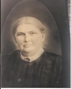
| Description | : | Frank is a son of Elias Franklin Scott and Fidelia (McCollister) Scott, and the husband first of Carrie Bell (Hoskins) Scott, second of Mary Etta (Maxwell) Scott, and third of Effie C. (Beckley) May Scott. Contributed by Nancy, from the Ames Milepost FRANK E. SCOTT The body of the late Frank E. Scott, 72, pioneer and longtime rural mail carrier out of the Cambridge post office, who died in Des Moines Saturday was laid to rest in the family lot in the Cambridge cemetery Monday after services at the Dahlstrom funeral home in Des Moines. He leaves beside the... Read More |
frequently asked questions (FAQ):
-
Where is Franklin Elias “Frank” Scott's memorial?
Franklin Elias “Frank” Scott's memorial is located at: All Saints Churchyard, West Markham, Bassetlaw District, England.
-
When did Franklin Elias “Frank” Scott death?
Franklin Elias “Frank” Scott death on 24 Apr 1937 in Des Moines, Polk County, Iowa, USA
-
Where are the coordinates of the Franklin Elias “Frank” Scott's memorial?
Latitude: 53.2462040
Longitude: -0.9203580
Family Members:
Parent
Spouse
Siblings
Children
Flowers:
Nearby Cemetories:
1. All Saints Churchyard
West Markham, Bassetlaw District, England
Coordinate: 53.2462040, -0.9203580
2. Church of All Saints Graveyard
West Markham, Bassetlaw District, England
Coordinate: 53.2463000, -0.9203000
3. Milton Mausoleum Churchyard
Newark and Sherwood District, England
Coordinate: 53.2492330, -0.9297590
4. St John the Baptist Churchyard
East Markham, Bassetlaw District, England
Coordinate: 53.2457870, -0.8877260
5. St Nicholas Churchyard
Tuxford, Bassetlaw District, England
Coordinate: 53.2312300, -0.8979000
6. St Paul's Churchyard
West Drayton, Bassetlaw District, England
Coordinate: 53.2649300, -0.9352100
7. Tuxford Cemetery
Tuxford, Bassetlaw District, England
Coordinate: 53.2271830, -0.8925790
8. St Nicholas Churchyard
Askham, Bassetlaw District, England
Coordinate: 53.2668010, -0.8922380
9. St. Peter's Churchyard
Gamston, Bassetlaw District, England
Coordinate: 53.2765100, -0.9385900
10. Holy Trinity Churchyard
Kirton, Newark and Sherwood District, England
Coordinate: 53.2170600, -0.9666600
11. All Saints Churchyard
Eaton, Bassetlaw District, England
Coordinate: 53.2939500, -0.9359600
12. St Michael the Archangel Churchyard
Laxton, Newark and Sherwood District, England
Coordinate: 53.1958110, -0.9208850
13. St Giles Churchyard
Darlton, Bassetlaw District, England
Coordinate: 53.2543300, -0.8339000
14. St. Peter's Churchyard
East Drayton, Bassetlaw District, England
Coordinate: 53.2691900, -0.8387700
15. St. Matthew Parish Churchyard
Boughton, Newark and Sherwood District, England
Coordinate: 53.2089100, -0.9855900
16. All Saints Churchyard
Weston, Newark and Sherwood District, England
Coordinate: 53.2035930, -0.8425490
17. Sherwood Forest Crematorium
Ollerton, Newark and Sherwood District, England
Coordinate: 53.2026140, -1.0005390
18. All Hallows Churchyard
Ordsall, Bassetlaw District, England
Coordinate: 53.3096650, -0.9443470
19. St. Peter's Churchyard
Stokeham, Bassetlaw District, England
Coordinate: 53.2835800, -0.8279800
20. St. John the Evangelist Churchyard
Perlethorpe, Newark and Sherwood District, England
Coordinate: 53.2317600, -1.0344800
21. St. John The Evangelist Church
Nottingham Unitary Authority, England
Coordinate: 53.2317530, -1.0345260
22. St Matthew's Churchyard
Normanton-on-Trent, Bassetlaw District, England
Coordinate: 53.2124500, -0.8172600
23. Ollerton Cemetery
Ollerton, Newark and Sherwood District, England
Coordinate: 53.2025700, -1.0139900
24. St Leonards Churchyard
Ragnall, Bassetlaw District, England
Coordinate: 53.2540200, -0.7993100

