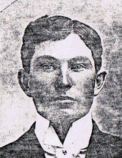
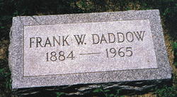
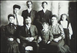
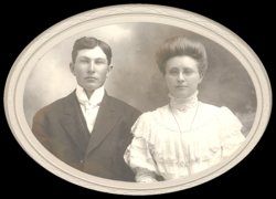
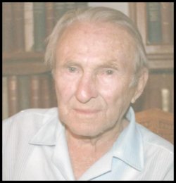
Franklin Wayne “Frank” Daddow
| Birth | : | 30 Jul 1884 Loup City, Sherman County, Nebraska, USA |
| Death | : | 5 Nov 1965 Loup City, Sherman County, Nebraska, USA |
| Burial | : | Thomaston Village Cemetery, Thomaston, Knox County, USA |
| Coordinate | : | 44.0833015, -69.1757965 |
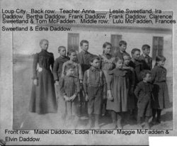
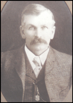
| Description | : | Services for Frank Daddow were held Monday, Nov. 8 at 2 p.m. at the Loup City Methodist Church by the Rev. Dwight Kemling. Burial was in the Evergreen Cemetery with Steele Funeral Home in charge. Pallbearers were Richard Rowe, Jerry Rowe, Bill Hancock, Louis Czaplewski, Paul Ritz, and Charles Lambert. Franklin Wayne Daddow was born July 30, 1884, on a farm near Loup City, the son of Samuel and Elvira Goodwin Daddow. He spent his entire life in the community where he received his education and carried on his occupation of farming. On March 6,... Read More |
frequently asked questions (FAQ):
-
Where is Franklin Wayne “Frank” Daddow's memorial?
Franklin Wayne “Frank” Daddow's memorial is located at: Thomaston Village Cemetery, Thomaston, Knox County, USA.
-
When did Franklin Wayne “Frank” Daddow death?
Franklin Wayne “Frank” Daddow death on 5 Nov 1965 in Loup City, Sherman County, Nebraska, USA
-
Where are the coordinates of the Franklin Wayne “Frank” Daddow's memorial?
Latitude: 44.0833015
Longitude: -69.1757965
Family Members:
Parent
Spouse
Siblings
Children
Flowers:
Nearby Cemetories:
1. Thomaston Village Cemetery
Thomaston, Knox County, USA
Coordinate: 44.0833015, -69.1757965
2. Elm Grove Cemetery
Thomaston, Knox County, USA
Coordinate: 44.0811880, -69.1761550
3. Saint Johns Cemetery
Thomaston, Knox County, USA
Coordinate: 44.0853004, -69.1781006
4. Thomaston State Prison Cemetery
Knox County, USA
Coordinate: 44.0757510, -69.1927230
5. Morse's Corner Cemetery
Thomaston, Knox County, USA
Coordinate: 44.0951490, -69.1569080
6. Anderson Cemetery
Knox County, USA
Coordinate: 44.0704382, -69.1567917
7. Westbrook Street Cemetery
South Thomaston, Knox County, USA
Coordinate: 44.0589880, -69.1581040
8. Butler Cemetery
South Thomaston, Knox County, USA
Coordinate: 44.0873196, -69.1359382
9. Robbins Cemetery
Thomaston, Knox County, USA
Coordinate: 44.1086280, -69.1505930
10. Ulmer Cemetery
Rockland, Knox County, USA
Coordinate: 44.1020630, -69.1372930
11. Old Settler Cemetery
Warren, Knox County, USA
Coordinate: 44.0916028, -69.2268444
12. Counce Cemetery
Warren, Knox County, USA
Coordinate: 44.0776050, -69.2277450
13. South Warren Cemetery
Knox County, USA
Coordinate: 44.0783005, -69.2283020
14. Farnsworth Cemetery
Rockland, Knox County, USA
Coordinate: 44.0974998, -69.1235962
15. Ingraham Cemetery
Owls Head, Knox County, USA
Coordinate: 44.0887740, -69.1130220
16. Leonard Cemetery
Warren, Knox County, USA
Coordinate: 44.1186350, -69.2205700
17. Fairview Cemetery
Warren, Knox County, USA
Coordinate: 44.1178017, -69.2219009
18. Newcomb Cemetery
Warren, Knox County, USA
Coordinate: 44.1180130, -69.2222830
19. Village Cemetery
South Thomaston, Knox County, USA
Coordinate: 44.0527573, -69.1213608
20. Robinson Yard
Cushing, Knox County, USA
Coordinate: 44.0391000, -69.2077730
21. Coughlin Memorial Cemetery
Rockland, Knox County, USA
Coordinate: 44.1141510, -69.1200390
22. Jewish Cemetery
Owls Head, Knox County, USA
Coordinate: 44.0798990, -69.1055150
23. Hall Cemetery
Owls Head, Knox County, USA
Coordinate: 44.0801180, -69.1054900
24. MacPhail Cemetery
Owls Head, Knox County, USA
Coordinate: 44.0805360, -69.1048570

