
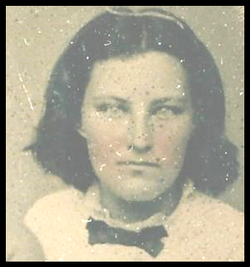
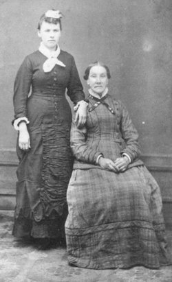

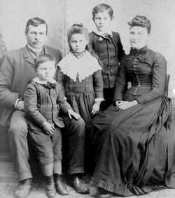
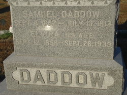
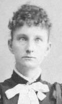
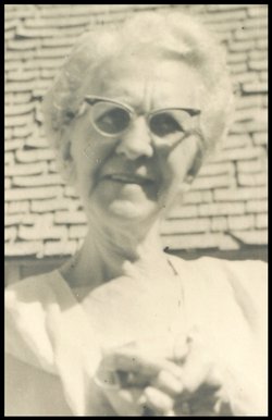
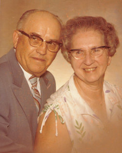
Roxie Elvira “Virie” Goodwin Daddow
| Birth | : | 12 Sep 1858 Horton, Bremer County, Iowa, USA |
| Death | : | 26 Sep 1939 Charles City, Floyd County, Iowa, USA |
| Burial | : | Bunhill Fields Burial Ground, London Borough of Islington, England |
| Coordinate | : | 51.5236015, -0.0888900 |
| Plot | : | In protestant section |
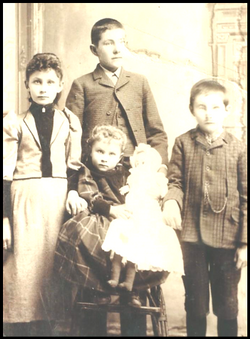
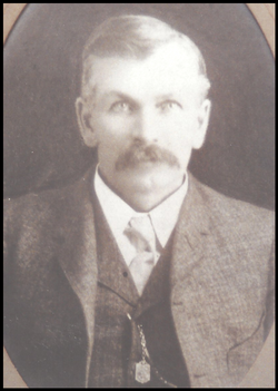
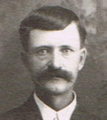
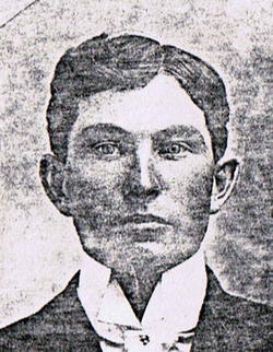
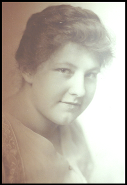
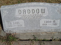
| Description | : | She was called "Virie." She is buried beside her husband Sam Daddow. She and her son Alfred Earl Daddow(called "Sliv"), and also Nellie - the new bride (of only five weeks) of Virie's son Franklin Wayne "Frank" Daddow, were all killed in an auto accident, while visiting relatives in Bremer County, Iowa. Sliv and Nellie were killed instantly; Virie died three days later. |
frequently asked questions (FAQ):
-
Where is Roxie Elvira “Virie” Goodwin Daddow's memorial?
Roxie Elvira “Virie” Goodwin Daddow's memorial is located at: Bunhill Fields Burial Ground, London Borough of Islington, England.
-
When did Roxie Elvira “Virie” Goodwin Daddow death?
Roxie Elvira “Virie” Goodwin Daddow death on 26 Sep 1939 in Charles City, Floyd County, Iowa, USA
-
Where are the coordinates of the Roxie Elvira “Virie” Goodwin Daddow's memorial?
Latitude: 51.5236015
Longitude: -0.0888900
Family Members:
Parent

Spouse
Siblings
Children
Flowers:


Nearby Cemetories:
1. Bunhill Fields Burial Ground
London Borough of Islington, England
Coordinate: 51.5236015, -0.0888900
2. Wesleys Chapel
London Borough of Islington, England
Coordinate: 51.5237140, -0.0865760
3. Quaker Gardens
London, City of London, England
Coordinate: 51.5239250, -0.0911890
4. Bunhill Fields Quaker Burying Ground
Islington, London Borough of Islington, England
Coordinate: 51.5239250, -0.0911890
5. St Luke Churchyard
St Luke's, London Borough of Islington, England
Coordinate: 51.5251312, -0.0941940
6. Old Church of St. Mary Moorfields (Defunct)
London, City of London, England
Coordinate: 51.5187890, -0.0857140
7. St. Giles Cripplegate Churchyard
London, City of London, England
Coordinate: 51.5187100, -0.0939510
8. St Mary's Moorfields Churchyard
London, City of London, England
Coordinate: 51.5177280, -0.0858980
9. Holywell Priory
Shoreditch, London Borough of Hackney, England
Coordinate: 51.5238050, -0.0785300
10. Plague Grave At Seward Street And Mount Mills
Clerkenwell, London Borough of Islington, England
Coordinate: 51.5259780, -0.0985880
11. Liverpool Street Station
London, City of London, England
Coordinate: 51.5187870, -0.0814920
12. Charthouse Chapel and Churchyard
City of London, England
Coordinate: 51.5209310, -0.0987080
13. Priory of St. Mary of Bethlehem Cemetery
Bishopsgate, City of London, England
Coordinate: 51.5183640, -0.0818180
14. St Clement with St Barnabas and St Matthew
Finsbury, London Borough of Islington, England
Coordinate: 51.5277700, -0.0977600
15. Charterhouse
London Borough of Islington, England
Coordinate: 51.5213890, -0.0997220
16. All Hallows on the Wall Churchyard
London, City of London, England
Coordinate: 51.5165990, -0.0843330
17. St Mary Aldermanbury Churchyard
London, City of London, England
Coordinate: 51.5164830, -0.0930720
18. St Albans Churchyard (Defunct)
London, City of London, England
Coordinate: 51.5166460, -0.0940880
19. St. Leonard Churchyard
Shoreditch, London Borough of Hackney, England
Coordinate: 51.5268230, -0.0773640
20. Guildhall
London, City of London, England
Coordinate: 51.5158200, -0.0911380
21. St Bartholomew the Great Churchyard
London, City of London, England
Coordinate: 51.5189300, -0.0995360
22. St Botolph Church
Bishopsgate, City of London, England
Coordinate: 51.5167080, -0.0816560
23. St. Botholph without Bishopsgate
Finsbury, London Borough of Islington, England
Coordinate: 51.5166840, -0.0815590
24. Austin Friars Churchyard
Broad Street, City of London, England
Coordinate: 51.5155030, -0.0854620