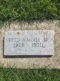
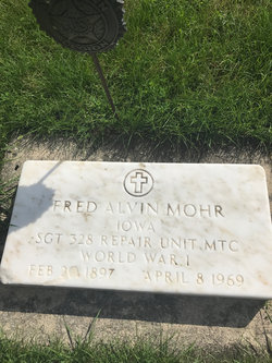
Fred A Mohr Jr.
| Birth | : | 23 Aug 1928 Terril, Dickinson County, Iowa, USA |
| Death | : | Aug 1930 Estherville, Emmet County, Iowa, USA |
| Burial | : | Fairview Cemetery, Terril, Dickinson County, USA |
| Coordinate | : | 43.2977982, -94.9349976 |
| Plot | : | 323-1 |
| Description | : | "On Thursday, August 23rd a 9 pound boy arrived at the home of Mr. and Mrs. Fred Mohr. He has been called Fred Alvin." *Published in the Spirit lake Beacon, Aug. 30, 1928. ----------- Fred Mohr, Jr. Funeral services were held last Saturday p. m. at the M. E. church for little Fred Mohr, son of Mr. and Mrs. Fred Mohr, who passed away at Estherville hospital Wednesday about noon. He had a severe case of cholera infantum. Every effort was put forth to save his life and all that human hands could do was done, but could not keep the little life here. Fred Mohr,... Read More |
frequently asked questions (FAQ):
-
Where is Fred A Mohr Jr.'s memorial?
Fred A Mohr Jr.'s memorial is located at: Fairview Cemetery, Terril, Dickinson County, USA.
-
When did Fred A Mohr Jr. death?
Fred A Mohr Jr. death on Aug 1930 in Estherville, Emmet County, Iowa, USA
-
Where are the coordinates of the Fred A Mohr Jr.'s memorial?
Latitude: 43.2977982
Longitude: -94.9349976
Family Members:
Parent
Flowers:
Nearby Cemetories:
1. Fairview Cemetery
Terril, Dickinson County, USA
Coordinate: 43.2977982, -94.9349976
2. Richland Township Cemetery
Terril, Dickinson County, USA
Coordinate: 43.3565323, -94.9927821
3. Saint Patricks Cemetery
Estherville, Emmet County, USA
Coordinate: 43.3843994, -94.8283005
4. Oak Hill Cemetery
Estherville, Emmet County, USA
Coordinate: 43.3986015, -94.8518982
5. Wallingford Lutheran Cemetery
Wallingford, Emmet County, USA
Coordinate: 43.3128014, -94.7731018
6. Lost Island Lutheran Cemetery
Lost Island Township, Palo Alto County, USA
Coordinate: 43.1980000, -94.8375000
7. Graettinger City Cemetery
Graettinger, Palo Alto County, USA
Coordinate: 43.2550011, -94.7722015
8. Saint Jacobs Cemetery
Graettinger, Palo Alto County, USA
Coordinate: 43.2546997, -94.7705994
9. East Side Cemetery
Estherville, Emmet County, USA
Coordinate: 43.4068985, -94.8264008
10. Superior Township Cemetery
Superior, Dickinson County, USA
Coordinate: 43.4399986, -94.9533005
11. Fairview Cemetery
Clay County, USA
Coordinate: 43.1899986, -95.0800018
12. East Side Memorial Cemetery
Estherville, Emmet County, USA
Coordinate: 43.4267750, -94.8265600
13. Norwegian Cemetery
Estherville, Emmet County, USA
Coordinate: 43.4291992, -94.8261032
14. Estherville Lutheran Cemetery
Estherville, Emmet County, USA
Coordinate: 43.4298000, -94.8263000
15. Saint Paul Lutheran Cemetery
Walnut Township, Palo Alto County, USA
Coordinate: 43.1866740, -94.7872050
16. Bedell Gravesite
Spirit Lake, Dickinson County, USA
Coordinate: 43.4128430, -95.0773690
17. Milford Cemetery
Milford, Dickinson County, USA
Coordinate: 43.3092003, -95.1481018
18. Okoboji Cemetery
Arnolds Park, Dickinson County, USA
Coordinate: 43.3649406, -95.1303558
19. Highland Cemetery
Highland Township, Palo Alto County, USA
Coordinate: 43.1497002, -94.8578033
20. Lakeview Gardens Cemetery
Spirit Lake, Dickinson County, USA
Coordinate: 43.3925000, -95.1119000
21. Rose Hill Cemetery (Defunct)
Spirit Lake, Dickinson County, USA
Coordinate: 43.4077600, -95.0976130
22. Pioneer Cemetery
Arnolds Park, Dickinson County, USA
Coordinate: 43.3655000, -95.1403000
23. Gardner Family Cemetery
Arnolds Park, Dickinson County, USA
Coordinate: 43.3654410, -95.1403480
24. Valley View Cemetery
Walnut Township, Palo Alto County, USA
Coordinate: 43.2428000, -94.7212000


