
| Memorials | : | 43 |
| Location | : | Estherville, Emmet County, USA |
| Coordinate | : | 43.4298000, -94.8263000 |
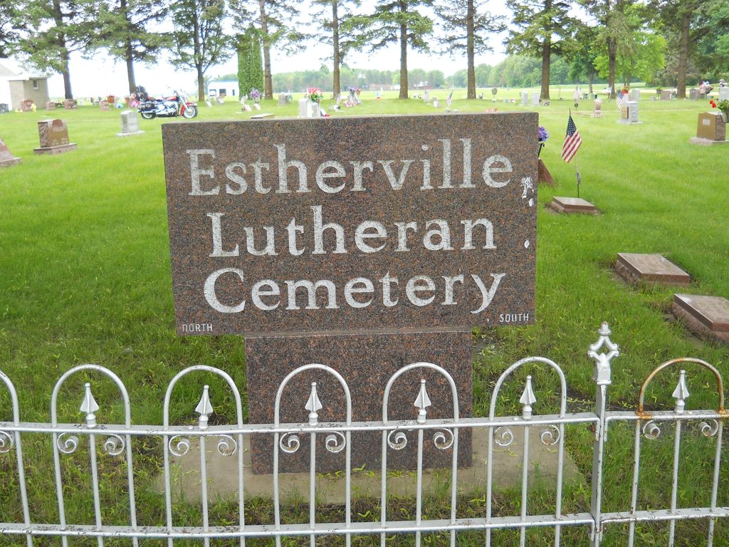
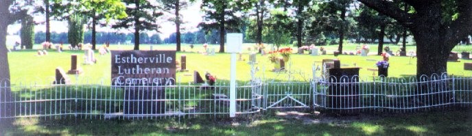
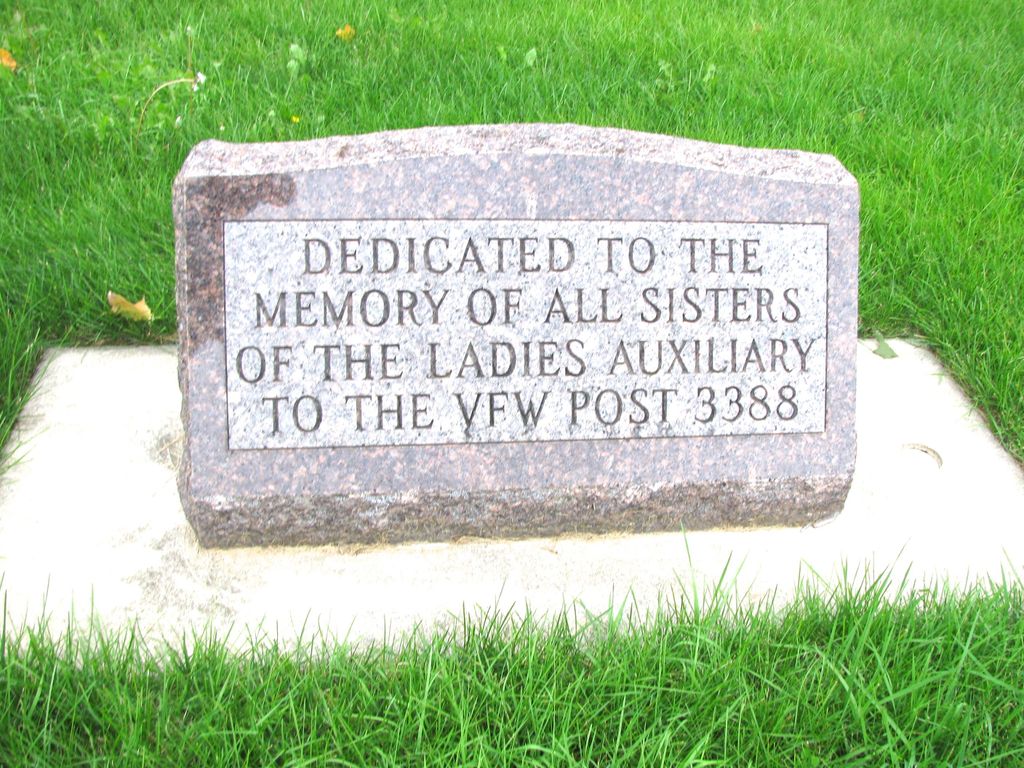
| Description | : | Estherville Lutheran Cemetery is located in Estherville Township; Estherville; Emmet County, Iowa. The Estherville Lutheran Cemetery (also known as the New Norwegian Cemetery) is located in Section 2 of Estherville Township, Emmet County, Iowa. OR About one mile north and 1/2 mile west of Estherville, Iowa on Highway 4. First Burial was in 1941, Esther Sunde. The books are kept by the Estherville Lutheran Church. The cemetery was recorded by walking from NW corner, north to south. A total of 25 Rows. In the 14th Row - The first monument is inscribed: "Dedicated to the Memory of all Sisters of the... Read More |
frequently asked questions (FAQ):
-
Where is Estherville Lutheran Cemetery?
Estherville Lutheran Cemetery is located at Estherville, Emmet County ,Iowa ,USA.
-
Estherville Lutheran Cemetery cemetery's updated grave count on graveviews.com?
43 memorials
-
Where are the coordinates of the Estherville Lutheran Cemetery?
Latitude: 43.4298000
Longitude: -94.8263000
Nearby Cemetories:
1. Norwegian Cemetery
Estherville, Emmet County, USA
Coordinate: 43.4291992, -94.8261032
2. East Side Memorial Cemetery
Estherville, Emmet County, USA
Coordinate: 43.4267750, -94.8265600
3. East Side Cemetery
Estherville, Emmet County, USA
Coordinate: 43.4068985, -94.8264008
4. Oak Hill Cemetery
Estherville, Emmet County, USA
Coordinate: 43.3986015, -94.8518982
5. Prosser Cemetery
Estherville, Emmet County, USA
Coordinate: 43.4422000, -94.7783000
6. Saint Patricks Cemetery
Estherville, Emmet County, USA
Coordinate: 43.3843994, -94.8283005
7. Union State Line Cemetery
Dickinson County, USA
Coordinate: 43.4928017, -94.9156036
8. Superior Township Cemetery
Superior, Dickinson County, USA
Coordinate: 43.4399986, -94.9533005
9. Ellsworth Cemetery
Emmet County, USA
Coordinate: 43.5005989, -94.7249985
10. Petersburg Cemetery
Jackson County, USA
Coordinate: 43.5224991, -94.9182968
11. Saint Johns Lutheran Cemetery
Petersburg, Jackson County, USA
Coordinate: 43.5442009, -94.8780975
12. Wallingford Lutheran Cemetery
Wallingford, Emmet County, USA
Coordinate: 43.3128014, -94.7731018
13. Center Township Cemetery
Emmet County, USA
Coordinate: 43.3608000, -94.6790000
14. Richland Township Cemetery
Terril, Dickinson County, USA
Coordinate: 43.3565323, -94.9927821
15. Swan Lake Township Cemetery
Maple Hill, Emmet County, USA
Coordinate: 43.3850746, -94.6381378
16. Lake Fremont Cemetery
Dunnell, Martin County, USA
Coordinate: 43.5691986, -94.7746964
17. Palestine Cemetery
Dolliver, Emmet County, USA
Coordinate: 43.4880000, -94.6408000
18. Lincoln Township Cemetery
Dolliver, Emmet County, USA
Coordinate: 43.4441986, -94.6204987
19. Lake Belt Cemetery
Ceylon, Martin County, USA
Coordinate: 43.5353012, -94.6742020
20. Fairview Cemetery
Terril, Dickinson County, USA
Coordinate: 43.2977982, -94.9349976
21. High Lake Jack Creek Cemetery
Wallingford, Emmet County, USA
Coordinate: 43.3006500, -94.7000620
22. Graettinger City Cemetery
Graettinger, Palo Alto County, USA
Coordinate: 43.2550011, -94.7722015
23. Saint Jacobs Cemetery
Graettinger, Palo Alto County, USA
Coordinate: 43.2546997, -94.7705994
24. Bedell Gravesite
Spirit Lake, Dickinson County, USA
Coordinate: 43.4128430, -95.0773690