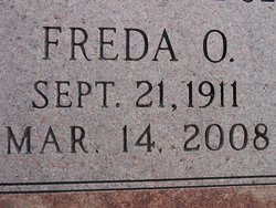
Freda Olive Williams Graham
| Birth | : | 21 Sep 1911 Lewiston, Pawnee County, Nebraska, USA |
| Death | : | 14 Mar 2008 Pawnee City, Pawnee County, Nebraska, USA |
| Burial | : | Burnham-on-Sea Cemetery, Burnham-on-Sea, Sedgemoor District, England |
| Coordinate | : | 51.2408600, -2.9933900 |
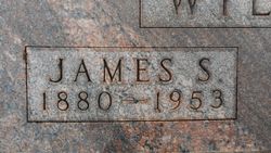
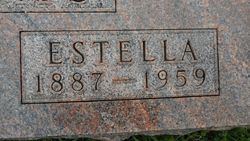
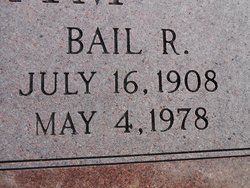
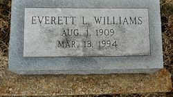
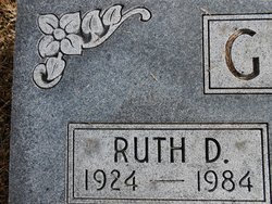
| Description | : | Parents: James and Ruth Estella (Swarts) Williams. She graduated from Pawnee High School. She married June 14, 1933 at the United Methodist Church in Pawnee City, NE. to Bail Robert Graham. They had 2 sons, Robert and Ronald. She was a nurse for Dr. Boyer in the 1930's and also worked as a nurse at the BSDC in Beatrice, NE. Preceding her in death were her parents, husband Bail, 2 brothers, Everet, James and one sister, Ruth. Survived by her son Ronald and wife Myra Graham of Tecumseh, NE. son, Robert and wife Jeannette Graham of Round Rock,... Read More |
frequently asked questions (FAQ):
-
Where is Freda Olive Williams Graham's memorial?
Freda Olive Williams Graham's memorial is located at: Burnham-on-Sea Cemetery, Burnham-on-Sea, Sedgemoor District, England.
-
When did Freda Olive Williams Graham death?
Freda Olive Williams Graham death on 14 Mar 2008 in Pawnee City, Pawnee County, Nebraska, USA
-
Where are the coordinates of the Freda Olive Williams Graham's memorial?
Latitude: 51.2408600
Longitude: -2.9933900
Family Members:
Parent
Spouse
Siblings
Flowers:
Nearby Cemetories:
1. Burnham-on-Sea Cemetery
Burnham-on-Sea, Sedgemoor District, England
Coordinate: 51.2408600, -2.9933900
2. St. Andrew's Churchyard
Burnham-on-Sea, Sedgemoor District, England
Coordinate: 51.2395800, -2.9977870
3. Convent of La Retraite
Burnham-on-Sea, Sedgemoor District, England
Coordinate: 51.2346309, -2.9926981
4. Highbridge Cemetery
Highbridge, Sedgemoor District, England
Coordinate: 51.2249430, -2.9741730
5. St Michael and All Angels Parish Churchyard
Brent Knoll, Sedgemoor District, England
Coordinate: 51.2520000, -2.9539000
6. Saint Mary Magdalene Churchyard
Berrow, Sedgemoor District, England
Coordinate: 51.2669160, -3.0136980
7. Saint Peter and All Hallows Churchyard
West Huntspill, Sedgemoor District, England
Coordinate: 51.2041900, -2.9966370
8. St. Mary the Virgin Churchyard
East Brent, Sedgemoor District, England
Coordinate: 51.2624370, -2.9418620
9. St Christopher's Churchyard
Lympsham, Sedgemoor District, England
Coordinate: 51.2826740, -2.9546028
10. Sedgemoor Crematorium
Sedgemoor District, England
Coordinate: 51.1909300, -3.0005180
11. All Saints Churchyard
East Huntspill, Sedgemoor District, England
Coordinate: 51.2015000, -2.9405700
12. Pawlett Methodist (Carter Memorial Wesleyan)
Pawlett, Sedgemoor District, England
Coordinate: 51.1845660, -3.0126480
13. Saint Bridget Churchyard
Brean, Sedgemoor District, England
Coordinate: 51.2983000, -3.0100000
14. St. John The Baptist Churchyard
Pawlett, Sedgemoor District, England
Coordinate: 51.1789100, -3.0012650
15. Holy Cross Churchyard
Mark, Sedgemoor District, England
Coordinate: 51.2269640, -2.8860140
16. Saint Michael and All Angels Churchyard
Puriton, Sedgemoor District, England
Coordinate: 51.1706000, -2.9735000
17. Saint Peter and St. Paul Churchyard
Bleadon, North Somerset Unitary Authority, England
Coordinate: 51.3074000, -2.9458300
18. St. John the Baptist Churchyard
Biddisham, Sedgemoor District, England
Coordinate: 51.2764090, -2.8878950
19. Otterhampton Extension Cemetery
Otterhampton, Sedgemoor District, England
Coordinate: 51.1828490, -3.0791630
20. All Saints Churchyard
Otterhampton, Sedgemoor District, England
Coordinate: 51.1829540, -3.0796420
21. Blessed Virgin Mary Churchyard
Woolavington, Sedgemoor District, England
Coordinate: 51.1704000, -2.9341000
22. Old St Nicholas Churchyard
Uphill, North Somerset Unitary Authority, England
Coordinate: 51.3203480, -2.9828110
23. Blessed Virgin Mary Extension Cemetery
Woolavington, Sedgemoor District, England
Coordinate: 51.1705660, -2.9329110
24. St.Mary Magdalene
Stockland Bristol, Sedgemoor District, England
Coordinate: 51.1867260, -3.0886950

