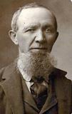
| Birth | : | 26 Feb 1848 Lower Saxony (Niedersachsen), Germany |
| Death | : | 31 Mar 1914 Platte County, Nebraska, USA |
| Burial | : | Sunnyside Cemetery, Sugar Hill, Grafton County, USA |
| Coordinate | : | 44.2130300, -71.8061600 |
| Description | : | Friederick was born to Gerd Dietrich Brunken and Gethe Margarete Haukenfrese in Westerstede, Germany. He first married Anna Marie Strodhoff. She was born 18 June 1851 in Burgforde, Germany and died in Westerstede Germany on 21 March 1886. From this union were born William and Marie. Friederick then married Helena Buhrs in Germany. From this union was born Henry. From the April 3, 1914 Columbus Telegram BRUNKEN--Fred Brunken died at his home at O'Kay Monday at 8:30 p.m. after a lingering illness. He was born in Germany February 21, 1848. There he... Read More |
frequently asked questions (FAQ):
-
Where is Friederick Brunken's memorial?
Friederick Brunken's memorial is located at: Sunnyside Cemetery, Sugar Hill, Grafton County, USA.
-
When did Friederick Brunken death?
Friederick Brunken death on 31 Mar 1914 in Platte County, Nebraska, USA
-
Where are the coordinates of the Friederick Brunken's memorial?
Latitude: 44.2130300
Longitude: -71.8061600
Family Members:
Parent
Spouse
Siblings
Children
Flowers:
Nearby Cemetories:
1. Sunnyside Cemetery
Sugar Hill, Grafton County, USA
Coordinate: 44.2130300, -71.8061600
2. Noyes Cemetery
Landaff, Grafton County, USA
Coordinate: 44.1830560, -71.8286110
3. Willow Cemetery
Franconia, Grafton County, USA
Coordinate: 44.1968994, -71.7530975
4. Elmwood Cemetery
Franconia, Grafton County, USA
Coordinate: 44.2219009, -71.7474976
5. Salmon Hole Cemetery
Lisbon, Grafton County, USA
Coordinate: 44.2359600, -71.8848200
6. Landaff Center Cemetery
Landaff, Grafton County, USA
Coordinate: 44.1739860, -71.8847040
7. Grove Hill Cemetery
Lisbon, Grafton County, USA
Coordinate: 44.2108002, -71.9094009
8. Kinsman Cemetery
Easton, Grafton County, USA
Coordinate: 44.1374900, -71.7808700
9. Easton Cemetery
Easton, Grafton County, USA
Coordinate: 44.1375000, -71.7805560
10. Ammonoosuc Meadows Cemetery
Littleton, Grafton County, USA
Coordinate: 44.3013992, -71.8043976
11. Eli Wallace Horse Cemetery
Littleton, Grafton County, USA
Coordinate: 44.2981300, -71.7714081
12. Pond Cemetery
Lyman, Grafton County, USA
Coordinate: 44.2671800, -71.9093700
13. Saint Rose of Lima Cemetery
Bethlehem, Grafton County, USA
Coordinate: 44.2950200, -71.7391700
14. Glenwood Cemetery
Littleton, Grafton County, USA
Coordinate: 44.3116100, -71.7901400
15. Saint Rose of Lima New Catholic Cemetery
Littleton, Grafton County, USA
Coordinate: 44.3130989, -71.7949982
16. Mount Washington Cemetery
Bethlehem, Grafton County, USA
Coordinate: 44.2797620, -71.6944050
17. Bethlehem Cemetery
Bethlehem, Grafton County, USA
Coordinate: 44.2803870, -71.6945420
18. Adams-Pfaelzer Cemetery
Littleton, Grafton County, USA
Coordinate: 44.3185210, -71.8283880
19. Center Cemetery
Lyman, Grafton County, USA
Coordinate: 44.2672200, -71.9381400
20. Parker Hill Cemetery
Lyman, Grafton County, USA
Coordinate: 44.2582400, -71.9458800
21. Pettyboro District Cemetery
Pettyboro, Grafton County, USA
Coordinate: 44.2038310, -71.9620880
22. Maple Street Cemetery
Bethlehem, Grafton County, USA
Coordinate: 44.2858370, -71.6846050
23. Bath Village Cemetery
Bath, Grafton County, USA
Coordinate: 44.1693500, -71.9617800
24. Pattenville Cemetery (Defunct)
Littleton, Grafton County, USA
Coordinate: 44.3310320, -71.8624310


