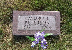
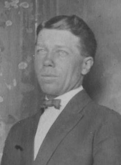
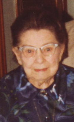
Gaylord R. Peterson
| Birth | : | 8 May 1917 Ogden, Boone County, Iowa, USA |
| Death | : | 14 Oct 1984 Boone, Boone County, Iowa, USA |
| Burial | : | Wrentham Municipal Cemetery, Wrentham, Waveney District, England |
| Coordinate | : | 52.4020520, 1.6676040 |
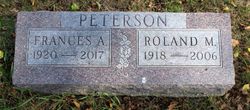
| Description | : | Gaylord R. Peterson, 67, Cedar Falls, died October 14, 1984, at Boone County Hospital. He was born May 8, 1917, in Ogden the son of Anton and Evelyn Peterson. Peterson was a former construction worker. Survivors include one brother, Roland, of Adel. Funeral services will be held at 10:30 a.m. Thursday at the Carson Funeral Home in Ogden. Burial will be in the Swede Valley Cemetery. Friends may call at Carson's until 9 p.m. Wednesday and on Thursday from 9 a.m. until time of the services. |
frequently asked questions (FAQ):
-
Where is Gaylord R. Peterson's memorial?
Gaylord R. Peterson's memorial is located at: Wrentham Municipal Cemetery, Wrentham, Waveney District, England.
-
When did Gaylord R. Peterson death?
Gaylord R. Peterson death on 14 Oct 1984 in Boone, Boone County, Iowa, USA
-
Where are the coordinates of the Gaylord R. Peterson's memorial?
Latitude: 52.4020520
Longitude: 1.6676040
Family Members:
Parent
Siblings
Flowers:
Nearby Cemetories:
1. Wrentham Municipal Cemetery
Wrentham, Waveney District, England
Coordinate: 52.4020520, 1.6676040
2. St. Michael's Churchyard
Benacre, Waveney District, England
Coordinate: 52.4003900, 1.6907680
3. Wrentham New Cemetery
Wrentham, Waveney District, England
Coordinate: 52.3894110, 1.6561480
4. St. Nicholas' Churchyard
Wrentham, Waveney District, England
Coordinate: 52.3885730, 1.6565260
5. St Mary Churchyard
Henstead, Waveney District, England
Coordinate: 52.4159800, 1.6577200
6. All Saints Churchyard
Frostenden, Waveney District, England
Coordinate: 52.3767750, 1.6430333
7. St. Michael's Churchyard
Rushmere, Waveney District, England
Coordinate: 52.4332200, 1.6688300
8. St Edmund Churchyard
Kessingland, Waveney District, England
Coordinate: 52.4158970, 1.7157750
9. St. Lawrence's Churchyard
South Cove, Waveney District, England
Coordinate: 52.3689060, 1.6708800
10. Saint Margaret's Churchyard
Sotterley, Waveney District, England
Coordinate: 52.4098151, 1.6144616
11. St. Andrew's Churchyard
Covehithe, Waveney District, England
Coordinate: 52.3761800, 1.7056300
12. Memorial Chapel Cemetery
Sotterley, Waveney District, England
Coordinate: 52.4022499, 1.6070140
13. St. Andrew's Churchyard
Mutford, Waveney District, England
Coordinate: 52.4387060, 1.6566540
14. Holy Trinity Churchyard
Gisleham, Waveney District, England
Coordinate: 52.4372320, 1.6975344
15. Waveney Memorial Park and Crematorium
Ellough, Waveney District, England
Coordinate: 52.4314090, 1.6151750
16. Saint John the Baptist Churchyard
Barnby, Waveney District, England
Coordinate: 52.4510410, 1.6494740
17. St. Margaret's Churchyard
Stoven, Waveney District, England
Coordinate: 52.3777910, 1.5951750
18. All Saints Churchyard
Ellough, Waveney District, England
Coordinate: 52.4233040, 1.5915220
19. St Peter's Churchyard
Carlton Colville, Waveney District, England
Coordinate: 52.4514530, 1.6929030
20. St Mary Churchyard
Uggeshall, Waveney District, England
Coordinate: 52.3665630, 1.6054470
21. St. Botolph Churchyard
North Cove, Waveney District, England
Coordinate: 52.4474411, 1.6227847
22. St Peter's New Churchyard
Carlton Colville, Waveney District, England
Coordinate: 52.4528500, 1.6953250
23. Saint John the Baptist Churchyard
Shadingfield, Waveney District, England
Coordinate: 52.3979837, 1.5777654
24. Ss Peter and Paul Churchyard
Wangford, Waveney District, England
Coordinate: 52.3546610, 1.6197460


