
| Memorials | : | 46 |
| Location | : | Carlton Colville, Waveney District, England |
| Coordinate | : | 52.4514530, 1.6929030 |
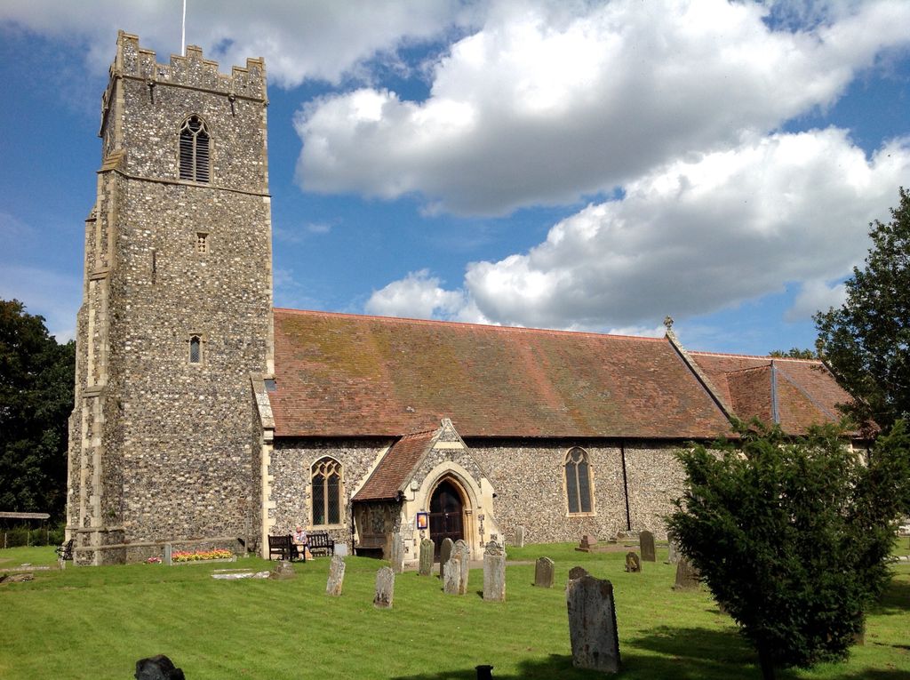
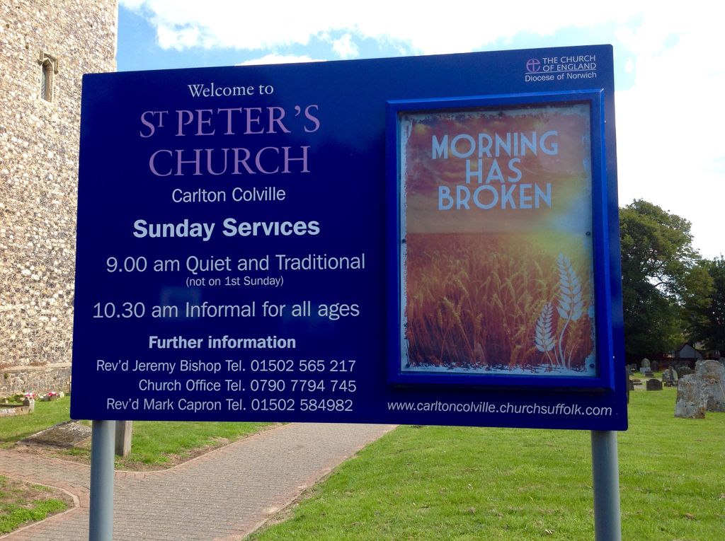
| Description | : | St. Peter's Church is the Anglican parish church in the village of Carlton Colville, near Lowestoft in Suffolk, England. It is a small church with 13th-century origins, the oldest recorded building in the village. It is a Grade II listed building. The church as it stands today is largely Victorian, rebuilt in the style of a medieval church in the 1880s – the church had a wealthy rector, who had the church almost completely rebuilt at his own expense. The tower is original 13th century, restored rather than replaced, but the rest is mainly 19th century work. Several of the old... Read More |
frequently asked questions (FAQ):
-
Where is St Peter's Churchyard?
St Peter's Churchyard is located at Carlton Colville, Waveney District ,Suffolk ,England.
-
St Peter's Churchyard cemetery's updated grave count on graveviews.com?
45 memorials
-
Where are the coordinates of the St Peter's Churchyard?
Latitude: 52.4514530
Longitude: 1.6929030
Nearby Cemetories:
1. St Peter's New Churchyard
Carlton Colville, Waveney District, England
Coordinate: 52.4528500, 1.6953250
2. Holy Trinity Churchyard
Gisleham, Waveney District, England
Coordinate: 52.4372320, 1.6975344
3. St. Michael's Churchyard
Rushmere, Waveney District, England
Coordinate: 52.4332200, 1.6688300
4. All Saints & St Margaret Churchyard
Pakefield, Waveney District, England
Coordinate: 52.4533520, 1.7344150
5. St. Andrew's Churchyard
Mutford, Waveney District, England
Coordinate: 52.4387060, 1.6566540
6. Saint John the Baptist Churchyard
Barnby, Waveney District, England
Coordinate: 52.4510410, 1.6494740
7. Kirkley Cemetery
Lowestoft, Waveney District, England
Coordinate: 52.4583260, 1.7353110
8. St. Peter and St. John Churchyard
Kirkley, Waveney District, England
Coordinate: 52.4628290, 1.7384010
9. St. Michael's Churchyard
Oulton, Waveney District, England
Coordinate: 52.4823570, 1.6952900
10. St Mary's Churchyard
Burgh St Peter, South Norfolk District, England
Coordinate: 52.4840860, 1.6710830
11. St Edmund Churchyard
Kessingland, Waveney District, England
Coordinate: 52.4158970, 1.7157750
12. St Mary Churchyard
Henstead, Waveney District, England
Coordinate: 52.4159800, 1.6577200
13. Lowestoft Cemetery
Lowestoft, Waveney District, England
Coordinate: 52.4814390, 1.7404560
14. St. Botolph Churchyard
North Cove, Waveney District, England
Coordinate: 52.4474411, 1.6227847
15. St Margaret Churchyard
Lowestoft, Waveney District, England
Coordinate: 52.4860970, 1.7402750
16. St. Michael's Churchyard
Benacre, Waveney District, England
Coordinate: 52.4003900, 1.6907680
17. Waveney Memorial Park and Crematorium
Ellough, Waveney District, England
Coordinate: 52.4314090, 1.6151750
18. Wrentham Municipal Cemetery
Wrentham, Waveney District, England
Coordinate: 52.4020520, 1.6676040
19. Lowestoft Naval Memorial
Lowestoft, Waveney District, England
Coordinate: 52.4883730, 1.7554520
20. RNPS Belle Vue Park Cemetery
Lowestoft, Waveney District, England
Coordinate: 52.4901740, 1.7559862
21. St. Peter's Churchyard
Gunton, Waveney District, England
Coordinate: 52.5003000, 1.7444000
22. All Saints Churchyard
Worlingham, Waveney District, England
Coordinate: 52.4517300, 1.5969000
23. Gunton Woodland Burial Park
Lowestoft, Waveney District, England
Coordinate: 52.5010260, 1.7461380
24. St Mary the Virgin Churchyard
Aldeby, South Norfolk District, England
Coordinate: 52.4826360, 1.6075660