
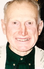
Gerald Vincent Rosenquist
| Birth | : | 27 Jan 1927 Burnside, Webster County, Iowa, USA |
| Death | : | 22 Dec 2015 Dayton, Webster County, Iowa, USA |
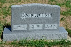
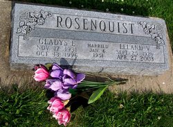
| Burial | : | McGuire Bend Cemetery, Dayton, Webster County, USA |
| Coordinate | : | 42.3410000, -93.9880000 |
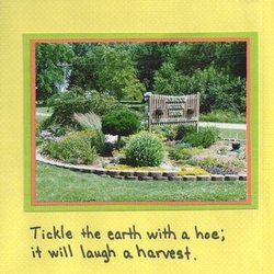
| Description | : | Gerald Rosenquist, 88 of Dayton passed away peacefully at his Meadow Creek Farm home on December 22, 2015. He was surrounded by his family. Outside his perennial gardens and farm fields were at rest. Gerald deeded his body to the University of Iowa Carver College of Medicine. A Celebration of Life service will be held next summer at 1:30 p.m., Saturday, June 25, 2016 at the McGuire Bend United Brethren Church in rural Dayton. Gerald Vincent Rosenquist was born on the family farm near Burnside, Iowa on January 27, 1927 to Reuben and Lillie Rosenquist. He attended Burnside High School... Read More |
frequently asked questions (FAQ):
-
Where is Gerald Vincent Rosenquist's memorial?
Gerald Vincent Rosenquist's memorial is located at: McGuire Bend Cemetery, Dayton, Webster County, USA.
-
When did Gerald Vincent Rosenquist death?
Gerald Vincent Rosenquist death on 22 Dec 2015 in Dayton, Webster County, Iowa, USA
-
Where are the coordinates of the Gerald Vincent Rosenquist's memorial?
Latitude: 42.3410000
Longitude: -93.9880000
Family Members:
Parent

Spouse
Siblings

Flowers:


Nearby Cemetories:
1. McGuire Bend Cemetery
Dayton, Webster County, USA
Coordinate: 42.3410000, -93.9880000
2. Hartman Cemetery
Lehigh, Webster County, USA
Coordinate: 42.3666397, -93.9835627
3. Vegors Cemetery
Webster County, USA
Coordinate: 42.3177986, -93.9421997
4. Ober and Scott Cemetery
Duncombe, Webster County, USA
Coordinate: 42.3841390, -93.9982856
5. Oak Grove Cemetery
Lehigh, Webster County, USA
Coordinate: 42.3438988, -94.0475006
6. Bass Cemetery
Dayton, Webster County, USA
Coordinate: 42.2966995, -94.0149994
7. Blanchard Cemetery
Webster County, USA
Coordinate: 42.4021988, -93.9997025
8. West Lawn Cemetery
Lehigh, Webster County, USA
Coordinate: 42.3616982, -94.0678024
9. Homer Cemetery
Homer, Hamilton County, USA
Coordinate: 42.3680992, -93.9088974
10. Border Plains Cemetery
Border Plains, Webster County, USA
Coordinate: 42.3917000, -94.0448000
11. Hooks Point Cemetery
Hamilton County, USA
Coordinate: 42.2944530, -93.9199090
12. Oakwood Cemetery
Stratford, Hamilton County, USA
Coordinate: 42.2942009, -93.9182968
13. Neese Cemetery
Homer, Hamilton County, USA
Coordinate: 42.3250000, -93.8935000
14. Nesse Cemetery
Hamilton County, USA
Coordinate: 42.3250008, -93.8933029
15. Washington Cemetery
Duncombe, Webster County, USA
Coordinate: 42.4277992, -93.9916992
16. Dayton Cemetery
Dayton, Webster County, USA
Coordinate: 42.2675000, -94.0755000
17. Hardin Township Cemetery
Hardin Township, Webster County, USA
Coordinate: 42.2411003, -93.9708023
18. Christ the King Catholic Cemetery
Dayton, Webster County, USA
Coordinate: 42.2601929, -94.0727539
19. Otho Cemetery
Otho, Webster County, USA
Coordinate: 42.4025002, -94.1153030
20. Saratoga Cemetery
Stanhope, Hamilton County, USA
Coordinate: 42.3539009, -93.8167038
21. Holaday Creek Cemetery
Webster County, USA
Coordinate: 42.4472008, -94.0886002
22. Washington Township Cemetery
Duncombe, Webster County, USA
Coordinate: 42.4707900, -94.0002000
23. Linn Cemetery
Pilot Mound, Boone County, USA
Coordinate: 42.2045330, -93.9970230
24. South Marion Cemetery
Stratford, Hamilton County, USA
Coordinate: 42.2327995, -93.8735962