| Birth | : | 18 Feb 1886 Vermillion, Clay County, South Dakota, USA |
| Death | : | 9 Aug 1901 Vermillion, Clay County, South Dakota, USA |
| Burial | : | Bluff View Cemetery, Vermillion, Clay County, USA |
| Coordinate | : | 42.7714000, -96.9056000 |
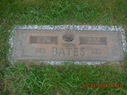
| Inscription | : | In Loving Memory Gertie Mae Wife of Joseph Lupton Coverdale Died Aug 9, 1907 "Blessed are they who die in the Lord" |
| Description | : | Mrs. Joseph (Gertrude May Washburn) Coverdale At intervals in the lives of people a happy event is sometimes followed by intense sorrow. The birth of a child brings happiness to the parents but the death of the mother immediately afterward casts a shadow of gloom over all. Such is the case in the death of Mrs. Coverdale, which occurred in this city last Thursday night. On Tuesday morning she gave birth to twins, and soon afterwards went into convulsions. She continued to suffer severely under these visitations and the best of medical aid was summoned to try... Read More |
frequently asked questions (FAQ):
-
Where is Gertrude Mae “Gertie” Washburn Coverdale's memorial?
Gertrude Mae “Gertie” Washburn Coverdale's memorial is located at: Bluff View Cemetery, Vermillion, Clay County, USA.
-
When did Gertrude Mae “Gertie” Washburn Coverdale death?
Gertrude Mae “Gertie” Washburn Coverdale death on 9 Aug 1901 in Vermillion, Clay County, South Dakota, USA
-
Where are the coordinates of the Gertrude Mae “Gertie” Washburn Coverdale's memorial?
Latitude: 42.7714000
Longitude: -96.9056000
Family Members:
Parent
Spouse
Siblings
Children
Flowers:
Nearby Cemetories:
1. Bluff View Cemetery
Vermillion, Clay County, USA
Coordinate: 42.7714000, -96.9056000
2. Saint Agnes Calvary Cemetery
Vermillion, Clay County, USA
Coordinate: 42.7715900, -96.9072100
3. Saint Agnes Cemetery
Vermillion, Clay County, USA
Coordinate: 42.7872009, -96.8499985
4. Dowlin Cemetery
Burbank, Clay County, USA
Coordinate: 42.7789001, -96.8107986
5. Gibb's Cemetery
Newcastle, Dixon County, USA
Coordinate: 42.6985100, -96.8518400
6. Saint Peter Greenfield Cemetery
Vermillion, Clay County, USA
Coordinate: 42.8608017, -96.8644028
7. Clay Creek Cemetery
Clay County, USA
Coordinate: 42.8516998, -96.9788971
8. Ionia Cemetery
Newcastle, Dixon County, USA
Coordinate: 42.6893997, -96.8300018
9. Maskell Cemetery
Maskell, Dixon County, USA
Coordinate: 42.6878014, -96.9916992
10. Halverson Cemetery
Maskell, Dixon County, USA
Coordinate: 42.6908600, -97.0013500
11. Ahlsborg Lutheran Cemetery
Union County, USA
Coordinate: 42.8228000, -96.7612000
12. Saint Mary Cemetery
Union County, USA
Coordinate: 42.8520584, -96.7877502
13. Newcastle Cemetery
Newcastle, Dixon County, USA
Coordinate: 42.6550500, -96.8708700
14. Saint Peters Calvary Cemetery
Newcastle, Dixon County, USA
Coordinate: 42.6533800, -96.8744700
15. Spirit Mound Cemetery
Clay County, USA
Coordinate: 42.8885994, -96.9424973
16. Clay Point Cemetery
Prairie Center Township, Clay County, USA
Coordinate: 42.8987700, -96.9065600
17. Lime Grove Cemetery
Maskell, Dixon County, USA
Coordinate: 42.6632400, -96.9990500
18. Lime Creek Cemetery
Maskell, Dixon County, USA
Coordinate: 42.6569600, -97.0004700
19. Obert Cemetery
Obert, Cedar County, USA
Coordinate: 42.6702995, -97.0289001
20. Evergreen Cemetery
Meckling, Clay County, USA
Coordinate: 42.7896996, -97.0903015
21. Brule Creek Cemetery
Spink Township, Union County, USA
Coordinate: 42.8346510, -96.7324350
22. Taylor Cemetery
Clay County, USA
Coordinate: 42.8372002, -97.0785980
23. Union County Poor Farm Cemetery
Union County, USA
Coordinate: 42.7649210, -96.7077580
24. Saint Paul Cemetery
Elk Point, Union County, USA
Coordinate: 42.7641983, -96.7061005


