
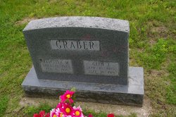
Glen J Graber
| Birth | : | 10 Apr 1905 Henry County, Iowa, USA |
| Death | : | 30 Sep 1976 Mount Pleasant, Henry County, Iowa, USA |
| Burial | : | Stambaugh Cemetery, Iron River, Iron County, USA |
| Coordinate | : | 46.0774994, -88.6286011 |
| Plot | : | Section 4, Row 23 |
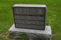
| Description | : | Mount Pleasant (IA) News Friday, 1 October 1976 Glen Graber Glen J. Graber, 71, 507 W. Madison, Mt. Pleasant, Iowa, died Thursday, Sept. 30, 1976 at 2:30 p.m. at Henry County Memorial Hospital, Mt. Pleasant. He was born in Henry County April 10, 1905 the son of Jacob E. and Barbara Roth Graber. Mr. Graber was a retired farmer. He was a lifelong resident of the Trenton and Mt. Pleasant communities. He was a member of the Wayland Mennonite Church. On Dec. 19, 1931, he was married to Marcella Hinkle at Wayland. He is survived by his widow, three sons, Donald Graber and Roger D. Graber, Mt. Pleasant... Read More |
frequently asked questions (FAQ):
-
Where is Glen J Graber's memorial?
Glen J Graber's memorial is located at: Stambaugh Cemetery, Iron River, Iron County, USA.
-
When did Glen J Graber death?
Glen J Graber death on 30 Sep 1976 in Mount Pleasant, Henry County, Iowa, USA
-
Where are the coordinates of the Glen J Graber's memorial?
Latitude: 46.0774994
Longitude: -88.6286011
Family Members:
Parent


Spouse

Siblings

Children

Flowers:


Nearby Cemetories:
1. Stambaugh Cemetery
Iron River, Iron County, USA
Coordinate: 46.0774994, -88.6286011
2. Iron River Cemetery
Iron River, Iron County, USA
Coordinate: 46.1027985, -88.6358032
3. Stambaugh Cemetery
Stambaugh, Iron County, USA
Coordinate: 46.0492670, -88.6409150
4. Resthaven Cemetery
Iron River, Iron County, USA
Coordinate: 46.0964012, -88.6772003
5. Bates Township Cemetery
Mapleton, Iron County, USA
Coordinate: 46.1201629, -88.5664721
6. Indian Cemetery
Crystal Falls, Iron County, USA
Coordinate: 46.0389230, -88.5104410
7. Rosehill Cemetery
Beechwood, Iron County, USA
Coordinate: 46.1568985, -88.7617035
8. Martin Cemetery
Tipler, Florence County, USA
Coordinate: 45.9502983, -88.6549988
9. Tipler Cemetery
Tipler, Florence County, USA
Coordinate: 45.9252100, -88.6334000
10. Lakeview Cemetery
Alvin, Forest County, USA
Coordinate: 45.9831009, -88.8341980
11. Hematite Cemetery
Amasa, Iron County, USA
Coordinate: 46.2356520, -88.4636600
12. Evergreen Memorial Cemetery
Crystal Falls, Iron County, USA
Coordinate: 46.1005620, -88.3124540
13. Long Lake Cemetery
Long Lake, Florence County, USA
Coordinate: 45.8532982, -88.6575012
14. Mansfield Mine Memorial
Mansfield, Iron County, USA
Coordinate: 46.1134700, -88.2178200
15. Commonwealth Cemetery
Commonwealth, Florence County, USA
Coordinate: 45.9144000, -88.2494000
16. Phelps Cemetery
Phelps, Vilas County, USA
Coordinate: 46.0646000, -89.0795000
17. Woodlawn Cemetery
Florence, Florence County, USA
Coordinate: 45.9235992, -88.2343979
18. Volkmann Cemetery
Phelps, Vilas County, USA
Coordinate: 46.0544900, -89.0928900
19. Katakikon Indian Village Cemetery
Watersmeet, Gogebic County, USA
Coordinate: 46.1513889, -89.0850000
20. Forest Home Cemetery
Newald, Forest County, USA
Coordinate: 45.7520800, -88.6962000
21. Schuett Burial Site
Fence, Florence County, USA
Coordinate: 45.7655000, -88.4400100
22. Rosehill East Cemetery
Mansfield, Iron County, USA
Coordinate: 46.0735589, -88.1243176
23. Hillside Cemetery
Fence, Florence County, USA
Coordinate: 45.7366982, -88.4246979
24. Channing Cemetery
Channing, Dickinson County, USA
Coordinate: 46.1302986, -88.0839005