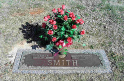
Glenn Thomas “Buck” Smith
| Birth | : | 11 Jan 1924 Randolph County, North Carolina, USA |
| Death | : | 21 Aug 1991 Siler City, Chatham County, North Carolina, USA |
| Burial | : | Sunset Memorial Park, Forest City, Rutherford County, USA |
| Coordinate | : | 35.3200800, -81.9088050 |
| Description | : | Glenn was the son of Robert Glenn and Floy Adeline (Vestal) Smith. He married Hazel Louise Black and they had three children: Brenda Carol, Glenda Jean and Thomas 'Tommy'. Greensboro News & Record, NC August 23, 1991 LIBERTY - Glenn T. "Buck" Smith, 67, of 521 S. Greensboro St. died Wednesday at Chatham Hospital in Siler City. Funeral will be at 11 a.m. Saturday at Loflin Funeral Home. Burial will be in Fairview Cemetery. A native of Randolph County, he was a poultry farmer, an Army veteran of World War II and a member of American Legion Post 81 in Liberty. Surviving are wife, Mrs. Hazel... Read More |
frequently asked questions (FAQ):
-
Where is Glenn Thomas “Buck” Smith's memorial?
Glenn Thomas “Buck” Smith's memorial is located at: Sunset Memorial Park, Forest City, Rutherford County, USA.
-
When did Glenn Thomas “Buck” Smith death?
Glenn Thomas “Buck” Smith death on 21 Aug 1991 in Siler City, Chatham County, North Carolina, USA
-
Where are the coordinates of the Glenn Thomas “Buck” Smith's memorial?
Latitude: 35.3200800
Longitude: -81.9088050
Family Members:
Parent
Spouse
Siblings
Nearby Cemetories:
1. Sunset Memorial Park
Forest City, Rutherford County, USA
Coordinate: 35.3200800, -81.9088050
2. Restoration Church Cemetery
Forest City, Rutherford County, USA
Coordinate: 35.3328200, -81.9228500
3. Adaville Baptist Church Cemetery
Spindale, Rutherford County, USA
Coordinate: 35.3356680, -81.9201110
4. Little Huntley Church Cemetery
Rutherford County, USA
Coordinate: 35.3229870, -81.9340790
5. Bethany Baptist Church Cemetery
Forest City, Rutherford County, USA
Coordinate: 35.3029200, -81.8933260
6. McDonald Family Cemetery
Forest City, Rutherford County, USA
Coordinate: 35.3075850, -81.8876240
7. David Huntley Family Cemetery
Rutherfordton, Rutherford County, USA
Coordinate: 35.3255330, -81.9347790
8. Danieltown Baptist Church Cemetery
Danieltown, Rutherford County, USA
Coordinate: 35.2977100, -81.9127880
9. Oak Grove Missionary Baptist Church
Forest City, Rutherford County, USA
Coordinate: 35.3296300, -81.8782300
10. Saint Paul AME Zion Cemetery
Forest City, Rutherford County, USA
Coordinate: 35.3407600, -81.8863900
11. Word of Faith Fellowship Cemetery
Spindale, Rutherford County, USA
Coordinate: 35.2931390, -81.9189950
12. Tanners Grove United Methodist Cemetery
Rutherford County, USA
Coordinate: 35.2905410, -81.9049720
13. Wells Springs UMC Cemetery
Forest City, Rutherford County, USA
Coordinate: 35.3485413, -81.8906326
14. Spindale Cemetery
Spindale, Rutherford County, USA
Coordinate: 35.3507996, -81.9218979
15. Pleasant Grove United Methodist Church Cemetery
Forest City, Rutherford County, USA
Coordinate: 35.3490000, -81.8845000
16. Shiloh Baptist Cemetery
Shiloh, Rutherford County, USA
Coordinate: 35.2975160, -81.9424070
17. Sulphur Springs Holiness Cemetery
Danieltown, Rutherford County, USA
Coordinate: 35.2844250, -81.9004050
18. Cool Springs Cemetery
Forest City, Rutherford County, USA
Coordinate: 35.3396988, -81.8711014
19. Morning Star Baptist Cemetery
Forest City, Rutherford County, USA
Coordinate: 35.2851830, -81.8952620
20. Doggett Cemetery
Forest City, Rutherford County, USA
Coordinate: 35.2932710, -81.8780670
21. Old Cool Springs Baptist Cemetery
Rutherford County, USA
Coordinate: 35.3420280, -81.8712940
22. Saint Luke F.B.H. Church Cemetery
Forest City, Rutherford County, USA
Coordinate: 35.3405390, -81.8697340
23. Russell Tabernacle CME Church Memorial Garden
Spindale, Rutherford County, USA
Coordinate: 35.3587510, -81.9164120
24. Whiteside Cemetery
Spindale, Rutherford County, USA
Coordinate: 35.3605400, -81.9118200


