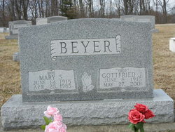
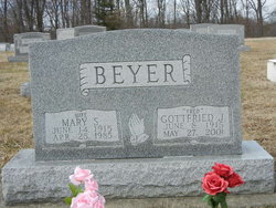
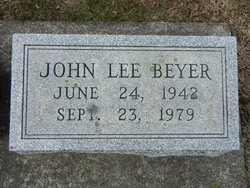
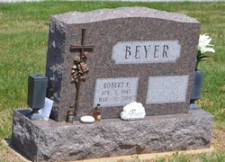
Gottfried John “Fred” Beyer
| Birth | : | 8 Jun 1915 Baltimore City, Maryland, USA |
| Death | : | 27 May 2001 Carroll County, Maryland, USA |
| Burial | : | Allendale Township Cemetery, Allendale, Ottawa County, USA |
| Coordinate | : | 42.9987700, -85.9353590 |
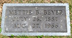
| Description | : | Gottfried John "Fred" Beyer, son of William H Beyer and Mettie Basler, married Mary A Siegman, daughter of Clayton Monroe Siegman and Ruth Virginia Schaeffer, about 1940 in probably Carroll County, Maryland. They had three sons. 1940 census Carroll County, Maryland Old Tawery Road Gottfried J Beger, 24 [name mispelled] ...2 yrs of high school, income in 1939, ...$936.00, worked as Foreman @steel company Mary A, 24 Gottfried "Fred" J. Beyer Carroll County Times, May 27, 2001 "85 of Westminster Gottfried "Fred" John Beyer, 85, of Westminster, died Sunday, May 27, 2001, at Carroll County General... Read More |
frequently asked questions (FAQ):
-
Where is Gottfried John “Fred” Beyer's memorial?
Gottfried John “Fred” Beyer's memorial is located at: Allendale Township Cemetery, Allendale, Ottawa County, USA.
-
When did Gottfried John “Fred” Beyer death?
Gottfried John “Fred” Beyer death on 27 May 2001 in Carroll County, Maryland, USA
-
Where are the coordinates of the Gottfried John “Fred” Beyer's memorial?
Latitude: 42.9987700
Longitude: -85.9353590
Family Members:
Parent
Spouse
Children
Flowers:
Nearby Cemetories:
1. Allendale Township Cemetery
Allendale, Ottawa County, USA
Coordinate: 42.9987700, -85.9353590
2. Maplewood Cemetery
Lamont, Ottawa County, USA
Coordinate: 43.0111008, -85.9072037
3. Eastmanville Cemetery
Eastmanville, Ottawa County, USA
Coordinate: 43.0176780, -85.9580400
4. Elmwood Cemetery
Lamont, Ottawa County, USA
Coordinate: 43.0047330, -85.8910510
5. Poor Farm Cemetery
Eastmanville, Ottawa County, USA
Coordinate: 43.0146660, -85.9832100
6. Ottawa Center Cemetery
Coopersville, Ottawa County, USA
Coordinate: 43.0279007, -86.0129929
7. Rusk Cemetery
Allendale, Ottawa County, USA
Coordinate: 42.9546400, -86.0125530
8. Jacob Aman Burial Ground
Grand Rapids, Kent County, USA
Coordinate: 42.9755510, -85.8361050
9. Church Cemetery
Tallmadge, Ottawa County, USA
Coordinate: 42.9529750, -85.8506440
10. Advent Cemetery
Coopersville, Ottawa County, USA
Coordinate: 43.0677280, -85.8875570
11. Coopersville-Polkton Cemetery
Coopersville, Ottawa County, USA
Coordinate: 43.0766900, -85.9411600
12. Saint Marys Cemetery
Marne, Ottawa County, USA
Coordinate: 43.0446410, -85.8432300
13. Marne Cemetery
Marne, Ottawa County, USA
Coordinate: 43.0309810, -85.8238630
14. Robinson Township Cemetery
Grand Haven, Ottawa County, USA
Coordinate: 43.0335210, -86.0559510
15. Haire Cemetery
Jenison, Ottawa County, USA
Coordinate: 42.9363260, -85.8374910
16. Saint Michaels Catholic Cemetery
Coopersville, Ottawa County, USA
Coordinate: 43.0806280, -86.0073710
17. Lowing Cemetery
Jenison, Ottawa County, USA
Coordinate: 42.9219444, -85.8525000
18. Blendon Township Cemetery
Hudsonville, Ottawa County, USA
Coordinate: 42.8992004, -85.9107971
19. Wells Cemetery
Wright Township, Ottawa County, USA
Coordinate: 43.0736008, -85.8266983
20. Rosedale Memorial Park
Tallmadge Township, Ottawa County, USA
Coordinate: 42.9721160, -85.7876870
21. Georgetown Township Cemetery
Hudsonville, Ottawa County, USA
Coordinate: 42.8941710, -85.8519780
22. Olive Township Cemetery
West Olive, Ottawa County, USA
Coordinate: 42.9285100, -86.0716900
23. Borculo Cemetery
Borculo, Ottawa County, USA
Coordinate: 42.8810190, -86.0208890
24. River Bend Cemetery
Walker, Kent County, USA
Coordinate: 42.9352989, -85.7750015

