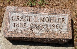
Grace Eugenia Mohler
| Birth | : | 8 Jun 1882 Carroll County, Iowa, USA |
| Death | : | 25 Oct 1960 Carroll, Carroll County, Iowa, USA |
| Burial | : | Louis B Hazelton Memorial Cemetery, Buckeye, Maricopa County, USA |
| Coordinate | : | 33.4077988, -112.5460968 |
| Plot | : | Section 1 |
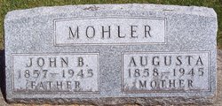
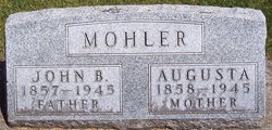
| Description | : | Grace was the daughter of John Mohler and Augusta Kasdorf. Oct 26, 1960 - Carroll Daily Times - Grace E. Mohler, 78, member of a pioneer Carroll County family, died as a result of a cerebral hemorrhage at 5:15 p.m. Tuesday, Oct. 25, at St. Anthony Hospital, where she had been taken at 12:30 p.m. Tuesday. She had been in failing health for several years. Funeral services will be at the Huffman Funeral Home at 11 a.m. Friday, Oct. 28, with the Rev. Ivan C. Bys of the First Methodist Church officiating. Burial will be in the Carroll City Cemetery. Friends... Read More |
frequently asked questions (FAQ):
-
Where is Grace Eugenia Mohler's memorial?
Grace Eugenia Mohler's memorial is located at: Louis B Hazelton Memorial Cemetery, Buckeye, Maricopa County, USA.
-
When did Grace Eugenia Mohler death?
Grace Eugenia Mohler death on 25 Oct 1960 in Carroll, Carroll County, Iowa, USA
-
Where are the coordinates of the Grace Eugenia Mohler's memorial?
Latitude: 33.4077988
Longitude: -112.5460968
Family Members:
Parent
Siblings
Flowers:
Nearby Cemetories:
1. Louis B Hazelton Memorial Cemetery
Buckeye, Maricopa County, USA
Coordinate: 33.4077988, -112.5460968
2. Liberty Cemetery
Liberty, Maricopa County, USA
Coordinate: 33.3732986, -112.4938965
3. Christ Presbyterian Church Columbarium
Goodyear, Maricopa County, USA
Coordinate: 33.4563280, -112.4083690
4. Palo Verde Baptist Church Cemetery
Palo Verde, Maricopa County, USA
Coordinate: 33.3494400, -112.6854530
5. White Tanks Cemetery
Goodyear, Maricopa County, USA
Coordinate: 33.5117280, -112.4022230
6. Church at Litchfield Park Garden of Memories
Litchfield Park, Maricopa County, USA
Coordinate: 33.4964000, -112.3586000
7. Goodyear Farms Historic Cemetery
Litchfield Park, Maricopa County, USA
Coordinate: 33.4901490, -112.3329520
8. Holy Cross Cemetery
Avondale, Maricopa County, USA
Coordinate: 33.4767890, -112.2775830
9. Shepherd of the Desert Lutheran Church Columbarium
Sun City, Maricopa County, USA
Coordinate: 33.5842890, -112.2981500
10. First United Methodist Church Columbarium
Sun City, Maricopa County, USA
Coordinate: 33.5740210, -112.2861820
11. Maricopa Cemetery
Laveen, Maricopa County, USA
Coordinate: 33.3633003, -112.2219009
12. Our Savior Lutheran Church Columbarium
Sun City, Maricopa County, USA
Coordinate: 33.5734230, -112.2804520
13. Sunwest Cemetery
El Mirage, Maricopa County, USA
Coordinate: 33.6222140, -112.3304200
14. Saint Christopher Episcopal Church Memorial Garden
Sun City, Maricopa County, USA
Coordinate: 33.5796000, -112.2809000
15. Camino del Sol Mortuary Columbarium
Sun City West, Maricopa County, USA
Coordinate: 33.6554000, -112.3585000
16. Garden of Memories Columbarium and Garden
Peoria, Maricopa County, USA
Coordinate: 33.5814000, -112.2623000
17. Crown of Life Lutheran Church Memorial Garden
Sun City West, Maricopa County, USA
Coordinate: 33.6467070, -112.3409990
18. Church of the Advent Memorial Garden
Sun City West, Maricopa County, USA
Coordinate: 33.6468000, -112.3411000
19. Lakeview United Methodist Church Columbarium
Sun City, Maricopa County, USA
Coordinate: 33.6057549, -112.2797546
20. Church of the Palms UCC Memorial Garden
Sun City, Maricopa County, USA
Coordinate: 33.5974998, -112.2711105
21. Russian Molokan Cemetery
Maricopa County, USA
Coordinate: 33.5307999, -112.2189026
22. Lord of Life Lutheran Church Memorial Columbarium
Sun City West, Maricopa County, USA
Coordinate: 33.6633000, -112.3587000
23. Shepherd of the Hills United Methodist Columbarium
Sun City West, Maricopa County, USA
Coordinate: 33.6659000, -112.3577000
24. Desert Garden United Church Columbarium
Sun City West, Maricopa County, USA
Coordinate: 33.6530000, -112.3342000

