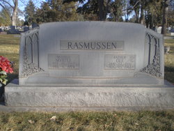
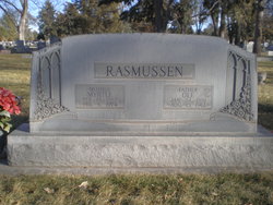
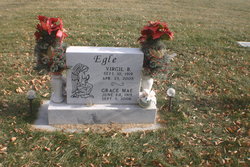
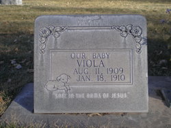
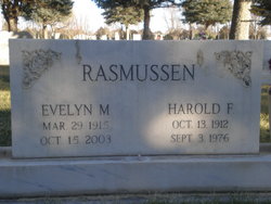
Grace Mae Rasmussen Egle
| Birth | : | 2 Jun 1919 North Platte, Lincoln County, Nebraska, USA |
| Death | : | 5 Sep 2006 North Platte, Lincoln County, Nebraska, USA |
| Burial | : | Archer Street Cemetery, Masterton, Masterton District, New Zealand |
| Coordinate | : | -40.9538900, 175.6683800 |
| Description | : | Buried Sept 23,2006 Lot 1019D Space- 2 Grace M.Egle June 2,1919-Sept 5,2006 Grace Mae Egle, 87, of North Platte, Neb., died at her home on Sept. 5, 2006. On June 24, 1919, a baby girl was born to Ole and Myrtle Rasmussen in North Platte. Grace Mae was raised and spent her entire life in North Platte and graduated from NPHS in 1938. While attending the School of Commerce in North Platte, she fell in love with Virgil Egle from Palisade, Neb. They married on June 23, 1940. To this union two daughters, Shannon and Cindy, were born. For many years Grace Mae enjoyed... Read More |
frequently asked questions (FAQ):
-
Where is Grace Mae Rasmussen Egle's memorial?
Grace Mae Rasmussen Egle's memorial is located at: Archer Street Cemetery, Masterton, Masterton District, New Zealand.
-
When did Grace Mae Rasmussen Egle death?
Grace Mae Rasmussen Egle death on 5 Sep 2006 in North Platte, Lincoln County, Nebraska, USA
-
Where are the coordinates of the Grace Mae Rasmussen Egle's memorial?
Latitude: -40.9538900
Longitude: 175.6683800
Family Members:
Parent
Spouse
Siblings
Children
Flowers:
Nearby Cemetories:
1. Archer Street Cemetery
Masterton, Masterton District, New Zealand
Coordinate: -40.9538900, 175.6683800
2. Masterton War Memorial
Masterton, Masterton District, New Zealand
Coordinate: -40.9501290, 175.6648800
3. Riverside Cemetery
Masterton, Masterton District, New Zealand
Coordinate: -40.9621550, 175.6722690
4. Ahi pane pane Urupā
Masterton, Masterton District, New Zealand
Coordinate: -40.9524060, 175.6902370
5. Te Ahitainga Urupā
Masterton, Masterton District, New Zealand
Coordinate: -40.9393000, 175.7030750
6. Akura Urupā
Masterton, Masterton District, New Zealand
Coordinate: -40.9314120, 175.6349090
7. Hamuera Urupā
Masterton District, New Zealand
Coordinate: -41.0374980, 175.6611940
8. Clareville Cemetery
Clareville, Carterton District, New Zealand
Coordinate: -40.9981070, 175.5459540
9. Waipoapoa Urupa
Hastings, Hastings District, New Zealand
Coordinate: -41.0696050, 175.6604650
10. Waipopo Urupā
Masterton, Masterton District, New Zealand
Coordinate: -41.0696370, 175.6604430
11. Oates Family Cemetery
Carterton, Carterton District, New Zealand
Coordinate: -41.0453670, 175.5683580
12. Scandinavian Camp Cemetery
Kopuaranga, Masterton District, New Zealand
Coordinate: -40.8345650, 175.6643220
13. Hurunui-o-rangi
Masterton, Masterton District, New Zealand
Coordinate: -41.0709670, 175.6200720
14. Gladstone Church Cemetery
Gladstone, Carterton District, New Zealand
Coordinate: -41.0883600, 175.6432100
15. Te Uru o Tane Urupā
Greytown, South Wairarapa District, New Zealand
Coordinate: -41.0570790, 175.4947740
16. Church of St Francis of Assisi
Bideford, Masterton District, New Zealand
Coordinate: -40.8592400, 175.8714600
17. Mauriceville West Cemetery
Mauriceville West, Masterton District, New Zealand
Coordinate: -40.7670300, 175.6799680
18. Saint Francis Lutheran Churchyard
Mauriceville West, Masterton District, New Zealand
Coordinate: -40.7652900, 175.6834400
19. Papawai Urupā
Greytown, South Wairarapa District, New Zealand
Coordinate: -41.0985090, 175.4892270
20. Greytown Cemetery
Greytown, South Wairarapa District, New Zealand
Coordinate: -41.0920470, 175.4401160
21. Hastwell Cemetery
Eketahuna, Tararua District, New Zealand
Coordinate: -40.7191500, 175.7216100
22. David Leary Memorial
Eketahuna, Tararua District, New Zealand
Coordinate: -40.7079188, 175.5836626
23. Eketahuna Lawn Cemetery
Eketahuna, Tararua District, New Zealand
Coordinate: -40.6538700, 175.6883400
24. Martinborough Cemetery
Martinborough, South Wairarapa District, New Zealand
Coordinate: -41.2158720, 175.4722330


