Hannah Zabriskie Blauvelt
| Birth | : | 30 Jul 1807 Paramus, Bergen County, New Jersey, USA |
| Death | : | 3 May 1842 Paramus, Bergen County, New Jersey, USA |
| Burial | : | Kershaw City Cemetery, Kershaw, Lancaster County, USA |
| Coordinate | : | 34.5539610, -80.5723390 |
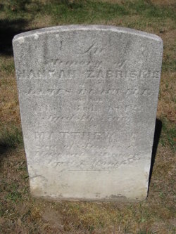
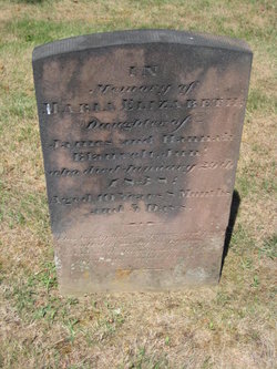
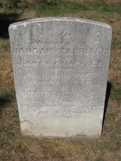
| Inscription | : | In Memory of Hannah Zabriskie wife of James Blauvelt who died May 3, 1842 Aged 36 Years James M. Son of James and Hannah Blauvelt Oct. 16, 1842 On the day Hannah died she was 35 years o |
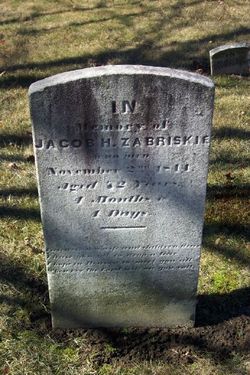
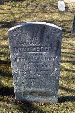
| Description | : | Hannah Zabriskie, dau. of Jacob Zabriskie and Antje "Anne" Hopper, bapt. Aug. 16, 1807 at the Paramus Reformed Dutch Church, in Paramus, NJ. She d. May 3, 1842 likely from complications following the birth of her 10th child and was interred at the Old Paramus Reformed Dutch Churchyard in Paramus. On Sept. 26, 1824 at the Saddle River Dutch Church, Hannah m. as his 1st wife, Jacobus "James" Blauvelt, s. of Isaac Blauvelt and Sarah Johnson, b. May 24 (bapt. June 29), 1800 in Paramus, NJ. They had ten child: Sarah Ann, Maria Elizabeth (d.y.), Isaac, Phebe, Jacob, Abraham, James, Mary... Read More |
frequently asked questions (FAQ):
-
Where is Hannah Zabriskie Blauvelt's memorial?
Hannah Zabriskie Blauvelt's memorial is located at: Kershaw City Cemetery, Kershaw, Lancaster County, USA.
-
When did Hannah Zabriskie Blauvelt death?
Hannah Zabriskie Blauvelt death on 3 May 1842 in Paramus, Bergen County, New Jersey, USA
-
Where are the coordinates of the Hannah Zabriskie Blauvelt's memorial?
Latitude: 34.5539610
Longitude: -80.5723390
Family Members:
Parent
Spouse
Siblings
Children
Flowers:
Nearby Cemetories:
1. Belk Cemetery
Kershaw, Lancaster County, USA
Coordinate: 34.5605870, -80.5831860
2. Center Grove Baptist Church Cemetery
Kershaw, Lancaster County, USA
Coordinate: 34.5677000, -80.5862300
3. Highland Heights Cemetery
Kershaw, Lancaster County, USA
Coordinate: 34.5691300, -80.5838490
4. Laurel Hill Baptist Church Cemetery
Kershaw, Lancaster County, USA
Coordinate: 34.5686600, -80.5860700
5. Church In The Lord Jesus Christ Of The Apostolic F
Kershaw, Lancaster County, USA
Coordinate: 34.5765870, -80.5845710
6. Hanging Rock Presbyterian Church Cemetery
Lancaster, Lancaster County, USA
Coordinate: 34.5569050, -80.6298410
7. Hanging Rock United Methodist Church Cemetery
Lancaster County, USA
Coordinate: 34.5236015, -80.6200027
8. Prodigal Freewill Baptist Church Cemetery
Kershaw County, USA
Coordinate: 34.5600530, -80.5095960
9. Oakhurst Baptist Church Cemetery
Heath Springs, Lancaster County, USA
Coordinate: 34.5856140, -80.6305160
10. Potter's House Independent Baptist Church Cemetery
Kershaw, Lancaster County, USA
Coordinate: 34.5122450, -80.6205540
11. Sand Hill Baptist Church Cemetery
Kershaw, Lancaster County, USA
Coordinate: 34.6116710, -80.5648690
12. Haile Gold Mine Baptist Church Cemetery
Kershaw, Lancaster County, USA
Coordinate: 34.5839800, -80.5087390
13. Pineview Baptist Church Cemetery
Kershaw, Lancaster County, USA
Coordinate: 34.5000050, -80.6109170
14. Oak Ridge Baptist Church Cemetery
Kershaw, Lancaster County, USA
Coordinate: 34.4933300, -80.5478870
15. Oak Ridge Baptist Church Cemetery
Kershaw County, USA
Coordinate: 34.4934182, -80.5432949
16. Beaver Creek Presbyterian Cemetery
Lancaster County, USA
Coordinate: 34.5219002, -80.6430969
17. Sam Roberts Cemetery
Kershaw County, USA
Coordinate: 34.5549430, -80.4910710
18. Buffalo Baptist Church Cemetery
Mount Pisgah, Kershaw County, USA
Coordinate: 34.5528720, -80.4903030
19. Pleasant Plains Baptist Church Cemetery
Kershaw, Lancaster County, USA
Coordinate: 34.6218030, -80.5652560
20. Pleasant Plain Baptist Church Cemetery
Pleasant Plain, Lancaster County, USA
Coordinate: 34.6218600, -80.5653360
21. Pleasant Grove #2 AME Zion Cemetery
Kershaw, Lancaster County, USA
Coordinate: 34.5087360, -80.6361030
22. Second Calvary Baptist Church Cemetery
Heath Springs, Lancaster County, USA
Coordinate: 34.5330480, -80.6592850
23. Connors Family Cemetery
Lancaster, Lancaster County, USA
Coordinate: 34.6074600, -80.6360790
24. Mount Zion Baptist Church Cemetery
Heath Springs, Lancaster County, USA
Coordinate: 34.5514820, -80.6652250

