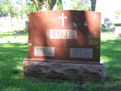
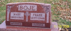
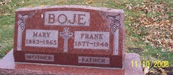
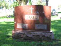
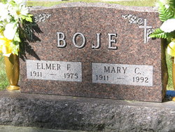
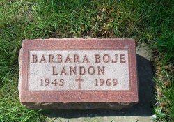
Harold Christof Boje
| Birth | : | 26 May 1914 Carroll, Carroll County, Iowa, USA |
| Death | : | 13 Dec 1989 Harlan, Shelby County, Iowa, USA |
| Burial | : | Junee Cemetery, Junee, Junee Shire, Australia |
| Coordinate | : | -34.8792860, 147.6090210 |
| Plot | : | Lot 200, Space 7 |
| Description | : | Husband of Mary (Dinan) Boje Son of Frank & Mary (Strangle) Boje ---------- Harold Boje, 75 HARLAN - Harold Christof Boje, the son of Frank and Mary(Strangle)Boje was born May 26, 1914, at Carroll. He attended St. Lawrence Grade School and graduated from Carroll High School. After school he worked with the Civilian Conservation Corps on the Alaskan Highway. Nov. 30,1939, he married Mary Dinan at St. Lawrence Church in Carroll. Five children were born to this union. After their marriage, he owned and operated Boje Construction at Carroll. He retired in 1970, and they moved to Colorado Springs, CO. In 1985, they returned... Read More |
frequently asked questions (FAQ):
-
Where is Harold Christof Boje's memorial?
Harold Christof Boje's memorial is located at: Junee Cemetery, Junee, Junee Shire, Australia.
-
When did Harold Christof Boje death?
Harold Christof Boje death on 13 Dec 1989 in Harlan, Shelby County, Iowa, USA
-
Where are the coordinates of the Harold Christof Boje's memorial?
Latitude: -34.8792860
Longitude: 147.6090210
Family Members:
Parent
Spouse
Siblings
Children
Flowers:
Nearby Cemetories:
1. Junee Cemetery
Junee, Junee Shire, Australia
Coordinate: -34.8792860, 147.6090210
2. Junee Pioneer Cemetery
Junee, Junee Shire, Australia
Coordinate: -34.8250950, 147.5234380
3. Old Junee Cemetery
Old Junee, Junee Shire, Australia
Coordinate: -34.8288640, 147.5153160
4. Marrar Cemetery
Marrar, Coolamon Shire, Australia
Coordinate: -34.8320350, 147.3804120
5. Wantabadgery Cemetery
Wantabadgery, Junee Shire, Australia
Coordinate: -35.0548700, 147.7141440
6. Mitta Mitta Anglican Cemetery
Mitta Mitta, Junee Shire, Australia
Coordinate: -34.8917820, 147.8526410
7. Cooba Cemetery
Cooba, Cootamundra-Gundagai Regional Council, Australia
Coordinate: -34.9499900, 147.8498100
8. Bethungra Cemetery
Bethungra, Junee Shire, Australia
Coordinate: -34.7631900, 147.8387300
9. Mundarlo Cemetery
Mundarlo, Cootamundra-Gundagai Regional Council, Australia
Coordinate: -35.0930800, 147.8169500
10. Nangus General Cemetery
Nangus, Cootamundra-Gundagai Regional Council, Australia
Coordinate: -35.0531510, 147.9029060
11. North Berry Jerry Cemetery
Coolamon, Coolamon Shire, Australia
Coordinate: -34.7388290, 147.2756180
12. Coolamon Cemetery
Coolamon, Coolamon Shire, Australia
Coordinate: -34.8099100, 147.1893200
13. Tumblong Cemetery
Tumblong, Cootamundra-Gundagai Regional Council, Australia
Coordinate: -35.1551470, 147.9999310
14. Muttama Cemetery
Muttama, Cootamundra-Gundagai Regional Council, Australia
Coordinate: -34.8178460, 148.1230180
15. Cootamundra General Cemetery
Cootamundra, Cootamundra-Gundagai Regional Council, Australia
Coordinate: -34.6331280, 148.0435500
16. North Gundagai Cemetery
Gundagai, Cootamundra-Gundagai Regional Council, Australia
Coordinate: -35.0513900, 148.1119400
17. Stockinbingal Cemetery
Stockinbingal, Cootamundra-Gundagai Regional Council, Australia
Coordinate: -34.4900260, 147.8755720
18. Gundagai Lawn Cemetery and Columbarium Wall
Gundagai, Cootamundra-Gundagai Regional Council, Australia
Coordinate: -35.0505070, 148.1134450
19. South Gundagai Cemetery
Gundagai, Cootamundra-Gundagai Regional Council, Australia
Coordinate: -35.0964700, 148.0922890
20. Coolac Cemetery
Coolac, Cootamundra-Gundagai Regional Council, Australia
Coordinate: -34.9316600, 148.1664400
21. Ganmain Cemetery
Ganmain, Coolamon Shire, Australia
Coordinate: -34.8022460, 147.0469160
22. Wagragobilly Cemetery
Darbalara, Cootamundra-Gundagai Regional Council, Australia
Coordinate: -35.0875240, 148.2117960
23. Menz Family Gravesite
The Rock, Lockhart Shire, Australia
Coordinate: -35.2795980, 147.1279510
24. The Rock Cemetery
The Rock, Lockhart Shire, Australia
Coordinate: -35.2787600, 147.1225520

