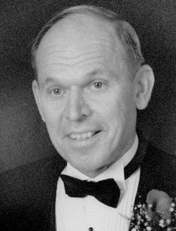
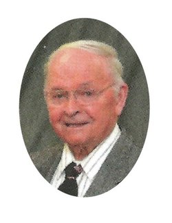
Harold Edward “Shorty” Matt
| Birth | : | 24 Nov 1924 Saint Olaf, Clayton County, Iowa, USA |
| Death | : | 21 Mar 2015 West Des Moines, Polk County, Iowa, USA |
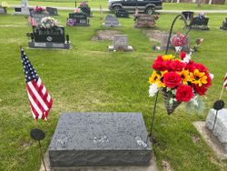
| Burial | : | Saint Josephs Cemetery, Elkader, Clayton County, USA |
| Coordinate | : | 42.8488998, -91.4021988 |
| Description | : | Suggested edit: Lifetime resident of the Elkader area, Harold Edward Matt, fondly known as "Shorty", died at the age of 90 with amazing grace on March 21 at the Mercy Medical Center in West Des Moines after a battle with leukemia. He was born November 24, 1924 in the rural St. Olaf, Iowa area to Leo and Rose (Gebhart) Matt. He attended the Garnavillo St. Joseph's Catholic School through tenth grade and graduated from the Garnavillo High School in 1942. He worked on the family farm to help his widowed mother until 1957. For the next 30 years... Read More |
frequently asked questions (FAQ):
-
Where is Harold Edward “Shorty” Matt's memorial?
Harold Edward “Shorty” Matt's memorial is located at: Saint Josephs Cemetery, Elkader, Clayton County, USA.
-
When did Harold Edward “Shorty” Matt death?
Harold Edward “Shorty” Matt death on 21 Mar 2015 in West Des Moines, Polk County, Iowa, USA
-
Where are the coordinates of the Harold Edward “Shorty” Matt's memorial?
Latitude: 42.8488998
Longitude: -91.4021988
Family Members:
Parent
Siblings
Flowers:
Nearby Cemetories:
1. Saint Josephs Cemetery
Elkader, Clayton County, USA
Coordinate: 42.8488998, -91.4021988
2. Elkader Cemetery
Elkader, Clayton County, USA
Coordinate: 42.8541718, -91.4000015
3. Hartman Cemetery
Cox Creek Township, Clayton County, USA
Coordinate: 42.8155360, -91.3880840
4. Colony Catholic Cemetery (Defunct)
Read Township, Clayton County, USA
Coordinate: 42.8830000, -91.3580000
5. Dohrer Cemetery
Osborne, Clayton County, USA
Coordinate: 42.8124846, -91.4584734
6. County Home Cemetery
Clayton Center, Clayton County, USA
Coordinate: 42.8916702, -91.3499985
7. Cords Cemetery
Osborne, Clayton County, USA
Coordinate: 42.7973308, -91.4377662
8. Meenan Cemetery
Communia, Clayton County, USA
Coordinate: 42.7999862, -91.3584693
9. Zion Lutheran Cemetery
Clayton Center, Clayton County, USA
Coordinate: 42.8841705, -91.3249969
10. Clayton Center Cemetery
Clayton Center, Clayton County, USA
Coordinate: 42.8841705, -91.3225021
11. Communia Cemetery
Volga Township, Clayton County, USA
Coordinate: 42.7868996, -91.3630981
12. Watkins Cemetery
Osborne, Clayton County, USA
Coordinate: 42.7833180, -91.4584733
13. Patterson Pioneer Cemetery
Saint Olaf, Clayton County, USA
Coordinate: 42.9216000, -91.4489000
14. Mederville Cemetery
Elkader, Clayton County, USA
Coordinate: 42.7638893, -91.4194412
15. Clark Family Cemetery
Beulah, Clayton County, USA
Coordinate: 42.9166505, -91.4751415
16. Norway Lutheran Church Cemetery
Saint Olaf, Clayton County, USA
Coordinate: 42.9352798, -91.4302826
17. Weymouth Cemetery
Saint Olaf, Clayton County, USA
Coordinate: 42.9278799, -91.4583559
18. Krumm Cemetery
Garber, Clayton County, USA
Coordinate: 42.7913760, -91.3023559
19. Blanchaine Cemetery
Volga, Clayton County, USA
Coordinate: 42.7676210, -91.3389040
20. Eberhard Cemetery
Littleport, Clayton County, USA
Coordinate: 42.7583201, -91.3418020
21. Farmersburg-Wagner Cemetery
Farmersburg, Clayton County, USA
Coordinate: 42.9481010, -91.3700027
22. Cook Family Cemetery
Elkader, Clayton County, USA
Coordinate: 42.9209880, -91.5091230
23. Highland Lutheran Cemetery
Highland Township, Clayton County, USA
Coordinate: 42.8987000, -91.5330000
24. Sacred Heart Cemetery
Littleport, Clayton County, USA
Coordinate: 42.7425003, -91.3747025


