Harold Gene Gillespie
| Birth | : | 22 Nov 1929 Charles City, Floyd County, Iowa, USA |
| Death | : | 7 Feb 2007 Colwell, Floyd County, Iowa, USA |
| Burial | : | Warren Village Cemetery, Warren, Grafton County, USA |
| Coordinate | : | 43.9326200, -71.8917600 |
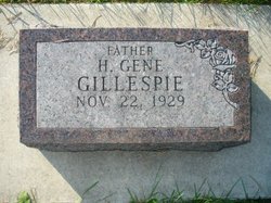
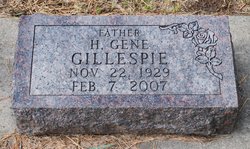
| Inscription | : | Father |
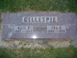
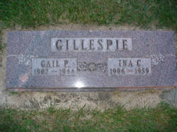
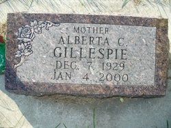
| Description | : | COLWELL — Harold G. Gillespie, 77, of Colwell, died on Wednesday, Feb. 7, at his home. He was born Nov. 22, 1929, in Charles City, the son of Gail and Ina Schultz Gillespie. He married Alberta Zappa on Oct. 13, 1947, in Minneapolis. She preceded him in death on Jan. 4, 2000. Mr. Gillespie drove a truck for Berger Van Lines in Minneapolis for many years. He then drove for Sperry Transportation in Charles City before becoming a self-employed owner-operator. He drove trucks for more than 50 years. He is survived by: two sons, Bruce (Janine)... Read More |
frequently asked questions (FAQ):
-
Where is Harold Gene Gillespie's memorial?
Harold Gene Gillespie's memorial is located at: Warren Village Cemetery, Warren, Grafton County, USA.
-
When did Harold Gene Gillespie death?
Harold Gene Gillespie death on 7 Feb 2007 in Colwell, Floyd County, Iowa, USA
-
Where are the coordinates of the Harold Gene Gillespie's memorial?
Latitude: 43.9326200
Longitude: -71.8917600
Family Members:
Parent
Spouse
Siblings
Children
Flowers:
Nearby Cemetories:
1. Warren Village Cemetery
Warren, Grafton County, USA
Coordinate: 43.9326200, -71.8917600
2. Pine Hill Cemetery
Warren, Grafton County, USA
Coordinate: 43.9370003, -71.8929977
3. Clough Cemetery
Warren, Grafton County, USA
Coordinate: 43.9090200, -71.8878800
4. East Side Cemetery
Wentworth, Grafton County, USA
Coordinate: 43.8837000, -71.9002200
5. High Street Cemetery
Glencliff, Grafton County, USA
Coordinate: 43.9851100, -71.8913900
6. East Piermont Cemetery
Piermont, Grafton County, USA
Coordinate: 43.9438890, -71.9689890
7. Foster Cemetery
Wentworth, Grafton County, USA
Coordinate: 43.8708100, -71.9127800
8. Wentworth Village Cemetery
Wentworth, Grafton County, USA
Coordinate: 43.8707280, -71.9128410
9. Oliverian Road Cemetery
Benton, Grafton County, USA
Coordinate: 43.9978145, -71.9209265
10. Lund Cemetery
Warren, Grafton County, USA
Coordinate: 43.9882800, -71.9589200
11. East Orford Cemetery
Orford, Grafton County, USA
Coordinate: 43.9096900, -72.0032600
12. Blake Cemetery
Stinson Lake, Grafton County, USA
Coordinate: 43.8827780, -71.7975000
13. Rodimon-Cross Cemetery
Piermont, Grafton County, USA
Coordinate: 43.9901100, -71.9924500
14. Clay Hollow Cemetery
Piermont, Grafton County, USA
Coordinate: 43.9597220, -72.0333330
15. Number 6 Cemetery
East Haverhill, Grafton County, USA
Coordinate: 44.0326400, -71.9518600
16. Pleasant View Cemetery
Rumney, Grafton County, USA
Coordinate: 43.8194008, -71.8814011
17. Avery Cemetery
Ellsworth, Grafton County, USA
Coordinate: 43.8805600, -71.7511200
18. East Haverhill Cemetery
East Haverhill, Grafton County, USA
Coordinate: 44.0289688, -71.9889297
19. Old Baptist Church Cemetery
Ellsworth, Grafton County, USA
Coordinate: 43.8738890, -71.7430560
20. Pease Cemetery
Ellsworth, Grafton County, USA
Coordinate: 43.8741100, -71.7382000
21. Cheever Cemetery
Dorchester, Grafton County, USA
Coordinate: 43.8015200, -71.9238400
22. South Lawn Cemetery
Piermont, Grafton County, USA
Coordinate: 43.9667600, -72.0812500
23. North Dorchester Cemetery
Dorchester, Grafton County, USA
Coordinate: 43.8033330, -71.9730560
24. Cedar Grove Cemetery
Piermont, Grafton County, USA
Coordinate: 43.9720300, -72.0813400

