
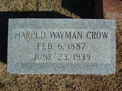

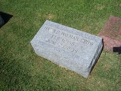
Harold Wayman Crow
| Birth | : | 8 Feb 1887 |
| Death | : | 23 Jun 1939 Libertyville, St. Francois County, Missouri, USA |
| Burial | : | Evergreen Home Cemetery, Beatrice, Gage County, USA |
| Coordinate | : | 40.2677994, -96.7052994 |
| Description | : | The entire community was shocked and grieved last Friday afternoon to learn that Harold W. Crow, respected farmer of the Libertyville Community had ended his life on that day by shooting himself in the head with a revolver. No reason was given for the act and it is presumed that he did while in a spell of despondency. Harold W. Crow, of near Libertyville, MO died at his home there Friday June 23, 1939 at the age of 52 years, 4 months and 17 days. Funeral services were held at his residence Sunday afternoon, June 25, 1939 at 2:30... Read More |
frequently asked questions (FAQ):
-
Where is Harold Wayman Crow's memorial?
Harold Wayman Crow's memorial is located at: Evergreen Home Cemetery, Beatrice, Gage County, USA.
-
When did Harold Wayman Crow death?
Harold Wayman Crow death on 23 Jun 1939 in Libertyville, St. Francois County, Missouri, USA
-
Where are the coordinates of the Harold Wayman Crow's memorial?
Latitude: 40.2677994
Longitude: -96.7052994
Family Members:
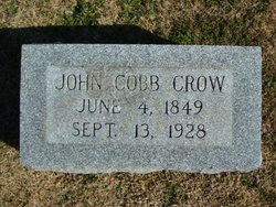
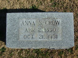
Parent
Spouse
Children
Flowers:


Nearby Cemetories:
1. Evergreen Home Cemetery
Beatrice, Gage County, USA
Coordinate: 40.2677994, -96.7052994
2. Beatrice Cemetery
Beatrice, Gage County, USA
Coordinate: 40.2625970, -96.7332670
3. Walnut Grove Pet Cemetery
Beatrice, Gage County, USA
Coordinate: 40.2613200, -96.7605920
4. Emmanuel Lutheran Cemetery
Beatrice, Gage County, USA
Coordinate: 40.2934100, -96.6521900
5. Saint Joseph Cemetery
Beatrice, Gage County, USA
Coordinate: 40.3054700, -96.7460700
6. Austin Creek Cemetery
Beatrice, Gage County, USA
Coordinate: 40.3282280, -96.7233020
7. Brethren Cemetery
Holmesville, Gage County, USA
Coordinate: 40.2125015, -96.6331024
8. Pleasant View Cemetery
Pickrell, Gage County, USA
Coordinate: 40.3493240, -96.7101000
9. First Mennonite Church Cemetery
Beatrice, Gage County, USA
Coordinate: 40.2856800, -96.8120500
10. Stark Cemetery
Holmesville, Gage County, USA
Coordinate: 40.2122002, -96.6147003
11. Homestead National Historical Park
Beatrice, Gage County, USA
Coordinate: 40.2864800, -96.8271100
12. Zion Evangelical Lutheran Cemetery
Pickrell, Gage County, USA
Coordinate: 40.3456001, -96.6147003
13. Freeman Cemetery
Beatrice, Gage County, USA
Coordinate: 40.2966933, -96.8435666
14. Blue Springs Cemetery
Blue Springs, Gage County, USA
Coordinate: 40.1526800, -96.6627000
15. Dolen Cemetery
Gage County, USA
Coordinate: 40.3494950, -96.8225930
16. Saint Marys Cemetery
Blue Springs, Gage County, USA
Coordinate: 40.1464005, -96.6806030
17. Filley Cemetery
Filley, Gage County, USA
Coordinate: 40.2761002, -96.5306015
18. First Trinity Lutheran Cemetery
Beatrice, Gage County, USA
Coordinate: 40.3053600, -96.8794400
19. Ellis Cemetery
Beatrice, Gage County, USA
Coordinate: 40.2260017, -96.8785019
20. Anyon Cemetery
Beatrice, Gage County, USA
Coordinate: 40.1548600, -96.8128800
21. Christ Lutheran Church Cemetery
Pickrell, Gage County, USA
Coordinate: 40.4079410, -96.6848370
22. Wymore Cemetery
Wymore, Gage County, USA
Coordinate: 40.1241989, -96.6917038
23. Calvary Cemetery
Wymore, Gage County, USA
Coordinate: 40.1225014, -96.6917038
24. Sparks Cemetery
Beatrice, Gage County, USA
Coordinate: 40.2485180, -96.8984970