
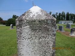
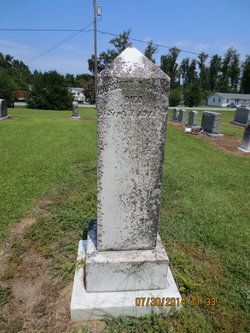
Harriet Ann Davis Swain
| Birth | : | 1855 |
| Death | : | 3 Sep 1911 |
| Burial | : | High Shoal Baptist Cemetery, Henrietta, Rutherford County, USA |
| Coordinate | : | 35.2659800, -81.7777450 |
frequently asked questions (FAQ):
-
Where is Harriet Ann Davis Swain's memorial?
Harriet Ann Davis Swain's memorial is located at: High Shoal Baptist Cemetery, Henrietta, Rutherford County, USA.
-
When did Harriet Ann Davis Swain death?
Harriet Ann Davis Swain death on 3 Sep 1911 in
-
Where are the coordinates of the Harriet Ann Davis Swain's memorial?
Latitude: 35.2659800
Longitude: -81.7777450
Family Members:
Spouse
Children

Flowers:


Nearby Cemetories:
1. High Shoal Baptist Cemetery
Henrietta, Rutherford County, USA
Coordinate: 35.2659800, -81.7777450
2. Caroleen Avondale Henrietta Cemetery
Avondale, Rutherford County, USA
Coordinate: 35.2753940, -81.7925690
3. Haynes Grove Cemetery
Cliffside, Rutherford County, USA
Coordinate: 35.2471930, -81.7735250
4. New Zion Baptist Cemetery
Rutherford County, USA
Coordinate: 35.2595770, -81.8014850
5. Cliffside Cemetery
Cliffside, Rutherford County, USA
Coordinate: 35.2460220, -81.7651250
6. Goodes Grove Baptist Cemetery
Mooresboro, Cleveland County, USA
Coordinate: 35.2562027, -81.7421036
7. Goode Graveyard
Six Points, Rutherford County, USA
Coordinate: 35.2796440, -81.7439270
8. John Matheny Family Cemetery
Mooresboro, Cleveland County, USA
Coordinate: 35.2492500, -81.7438310
9. Scruggs Cemetery
Rutherford County, USA
Coordinate: 35.2325800, -81.7814220
10. Race Path Baptist Church Cemetery
Ellenboro, Rutherford County, USA
Coordinate: 35.2944250, -81.7507420
11. Calvary Baptist Cemetery
Cliffside, Rutherford County, USA
Coordinate: 35.2383995, -81.8110657
12. Victory Baptist Church Cemetery
Ellenboro, Rutherford County, USA
Coordinate: 35.3042000, -81.7884980
13. Scruggs Cemetery
Cliffside, Rutherford County, USA
Coordinate: 35.2264000, -81.7639000
14. Gantts Grove Baptist Church Cemetery
Mooresboro, Cleveland County, USA
Coordinate: 35.2767067, -81.7276077
15. Providence United Methodist Church Cemetery
Forest City, Rutherford County, USA
Coordinate: 35.2633018, -81.8305969
16. Plain View Baptist Cemetery
Ellenboro, Rutherford County, USA
Coordinate: 35.2988750, -81.7410280
17. Baxter Family Cemetery
Caroleen, Rutherford County, USA
Coordinate: 35.3028590, -81.8087310
18. Goodes Creek Baptist Cemetery
Cliffside, Rutherford County, USA
Coordinate: 35.2307710, -81.8152780
19. Bridges Family Cemetery
Mooresboro, Cleveland County, USA
Coordinate: 35.2622200, -81.7194000
20. Oak Grove United Methodist Church Cemetery
Ellenboro, Rutherford County, USA
Coordinate: 35.3131840, -81.7884070
21. Jonas Rollins Cemetery
Mooresboro, Cleveland County, USA
Coordinate: 35.2699210, -81.7180040
22. Liberty Baptist Cemetery
Ellenboro, Rutherford County, USA
Coordinate: 35.3034477, -81.7356873
23. Trinity Baptist Church Cemetery
Mooresboro, Cleveland County, USA
Coordinate: 35.2601280, -81.7133865
24. Mount Pleasant Baptist Church Cemetery
Mooresboro, Cleveland County, USA
Coordinate: 35.2320100, -81.7280800