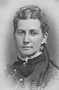
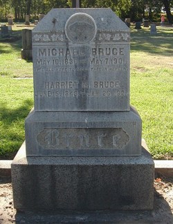
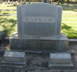
Harriet May Moyle Bruce
| Birth | : | 15 Jun 1843 Bere Ferrers, West Devon Borough, Devon, England |
| Death | : | 26 Jan 1921 Chico, Butte County, California, USA |
| Burial | : | Orchard Street Cemetery, Dover, Morris County, USA |
| Coordinate | : | 40.8814011, -74.5618973 |
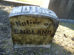
| Description | : | The Chico Enterprise, Thursday Evening January 27, 1921: "Mrs. Harriet Bruce Is Called By Death. Complications which set in following an accident in which she suffered a broken hip, proved fatal yesterday afternoon to Mrs. Harriet Moyle Bruce, pioneer resident of this city. Death came at her home, 4628 Fourth Street. Deceased came to America from Bear-Austin, England, with her parents, Mr. and Mrs. William Moyle when she was but 5 years old. She was married to Michael Bruce on July 2, 1859, at Hazelgreen, [Jo Daviess County] Ill., and one year later came to California, Sutter county and later... Read More |
frequently asked questions (FAQ):
-
Where is Harriet May Moyle Bruce's memorial?
Harriet May Moyle Bruce's memorial is located at: Orchard Street Cemetery, Dover, Morris County, USA.
-
When did Harriet May Moyle Bruce death?
Harriet May Moyle Bruce death on 26 Jan 1921 in Chico, Butte County, California, USA
-
Where are the coordinates of the Harriet May Moyle Bruce's memorial?
Latitude: 40.8814011
Longitude: -74.5618973
Family Members:
Spouse
Children
Flowers:
Nearby Cemetories:
1. Orchard Street Cemetery
Dover, Morris County, USA
Coordinate: 40.8814011, -74.5618973
2. Mount Sinai Cemetery
Randolph, Morris County, USA
Coordinate: 40.8713989, -74.5594025
3. Locust Hill Cemetery
Dover, Morris County, USA
Coordinate: 40.8913994, -74.5580978
4. Saint Marys Catholic Church Cemetery
Dover, Morris County, USA
Coordinate: 40.8821983, -74.5785980
5. Old Saint Marys Graveyard
Dover, Morris County, USA
Coordinate: 40.8858650, -74.5778860
6. Saints Peter and Paul Orthodox Cemetery
Dover, Morris County, USA
Coordinate: 40.8659897, -74.5628204
7. Pleasant Hill Cemetery
Randolph, Morris County, USA
Coordinate: 40.8653984, -74.5618820
8. Friends Cemetery
Randolph, Morris County, USA
Coordinate: 40.8649788, -74.5632477
9. Millbrook Methodist Cemetery
Randolph, Morris County, USA
Coordinate: 40.8636017, -74.5573730
10. Saint Cecilia Cemetery
Rockaway, Morris County, USA
Coordinate: 40.9077988, -74.5160980
11. First Presbyterian Church Cemetery
Rockaway, Morris County, USA
Coordinate: 40.9034805, -74.5121765
12. Hill Family Cemetery
Franklin, Morris County, USA
Coordinate: 40.8698616, -74.5055542
13. Walnut Grove Baptist Cemetery
Randolph, Morris County, USA
Coordinate: 40.8282585, -74.5649567
14. Walnut Grove Methodist Episcopal Church Cemetery
Randolph, Morris County, USA
Coordinate: 40.8279190, -74.5656891
15. Walton Family Burial Ground
Rockaway, Morris County, USA
Coordinate: 40.9351100, -74.5530500
16. First Presbyterian Church of Berkshire Valley Ceme
Wharton, Morris County, USA
Coordinate: 40.9311256, -74.5927963
17. Mount Freedom Cemetery
Randolph, Morris County, USA
Coordinate: 40.8272743, -74.5823669
18. Trowbridge Family Farm Cemetery
Morris Township, Morris County, USA
Coordinate: 40.8331630, -74.5232620
19. United Methodist Church Cemetery
Succasunna, Morris County, USA
Coordinate: 40.8683281, -74.6374207
20. Denville Cemetery
Denville, Morris County, USA
Coordinate: 40.8986092, -74.4874344
21. First Presbyterian Church Cemetery
Succasunna, Morris County, USA
Coordinate: 40.8682213, -74.6379700
22. Saint Francis Cemetery
Denville, Morris County, USA
Coordinate: 40.8960991, -74.4703522
23. Mount Freedom Hebrew Cemetery
Mount Freedom, Morris County, USA
Coordinate: 40.8194008, -74.6164017
24. Long-Gordon Burial Ground
Morris County, USA
Coordinate: 40.9463800, -74.6140700

