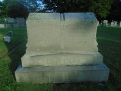
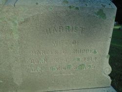
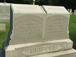
Harriet Rahama Dawley Shippee
| Birth | : | 28 Sep 1819 Exeter, Washington County, Rhode Island, USA |
| Death | : | 5 Mar 1895 East Greenwich, Kent County, Rhode Island, USA |
| Burial | : | Rose Hill Cemetery, Oxford, City of Oxford, England |
| Coordinate | : | 51.7320960, -1.2254070 |
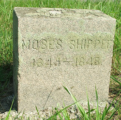
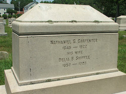
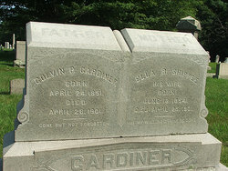
| Description | : | Mancer C. Shippee married Harriet Rahama Dawley, who died March 5, 1895, three days prior to the death of her husband, their funeral services being held on the same day. Their children were: Sarah, born in 1840, married James Holland, a contractor and builder in East Greenwich; Moses, died in childhood; Mary E., married Charles Tarbox; Aaron, married Mary Eliza Nicholas, of Coventry, R. I.; Amanda, married David Vaughn, and moved to California; Delia B., married Nathaniel G. Carpenter, of East Greenwich, R. I.; Ella R., married Colvin Gardner; Henry Mancer, of further mention; Moses E., a real estate dealer... Read More |
frequently asked questions (FAQ):
-
Where is Harriet Rahama Dawley Shippee's memorial?
Harriet Rahama Dawley Shippee's memorial is located at: Rose Hill Cemetery, Oxford, City of Oxford, England.
-
When did Harriet Rahama Dawley Shippee death?
Harriet Rahama Dawley Shippee death on 5 Mar 1895 in East Greenwich, Kent County, Rhode Island, USA
-
Where are the coordinates of the Harriet Rahama Dawley Shippee's memorial?
Latitude: 51.7320960
Longitude: -1.2254070
Family Members:
Parent
Spouse
Siblings
Children
Flowers:
Nearby Cemetories:
1. Rose Hill Cemetery
Oxford, City of Oxford, England
Coordinate: 51.7320960, -1.2254070
2. St. James Churchyard
Cowley, City of Oxford, England
Coordinate: 51.7305878, -1.2202638
3. St Mary the Virgin Churchyard
Iffley, City of Oxford, England
Coordinate: 51.7273590, -1.2381680
4. St Mary and St Nicholas Churchyard
Littlemore, City of Oxford, England
Coordinate: 51.7210753, -1.2232272
5. Littlemore Chapel
Littlemore, City of Oxford, England
Coordinate: 51.7208320, -1.2270330
6. St Mary and St John Church
Oxford, City of Oxford, England
Coordinate: 51.7452501, -1.2314021
7. Greyfriars
Oxford, City of Oxford, England
Coordinate: 51.7437920, -1.2401460
8. St. Aldate's Churchyard
Oxford, City of Oxford, England
Coordinate: 51.7497900, -1.2118500
9. St. Andrew's Churchyard
Sandford-on-Thames, South Oxfordshire District, England
Coordinate: 51.7121430, -1.2289060
10. St Ignatius’ Chapel
Oxford, City of Oxford, England
Coordinate: 51.7503160, -1.2396720
11. St. Clements Churchyard
Oxford, City of Oxford, England
Coordinate: 51.7527790, -1.2369920
12. St Laurence Churchyard
South Hinksey, Vale of White Horse District, England
Coordinate: 51.7319218, -1.2635270
13. St Matthews Church
Oxford, City of Oxford, England
Coordinate: 51.7442200, -1.2585480
14. Magdalen College Chapel
Oxford, City of Oxford, England
Coordinate: 51.7519830, -1.2469820
15. Merton College chapel
Oxford, City of Oxford, England
Coordinate: 51.7510500, -1.2526620
16. Corpus Christi College Chapel
Oxford, City of Oxford, England
Coordinate: 51.7507010, -1.2534236
17. Christ Church Cathedral
Oxford, City of Oxford, England
Coordinate: 51.7500620, -1.2547160
18. Oriel College Ante-Chapel
Oxford, City of Oxford, England
Coordinate: 51.7512420, -1.2531940
19. University College Chapel
Oxford, City of Oxford, England
Coordinate: 51.7522100, -1.2521700
20. Queens College Chapel
Oxford, City of Oxford, England
Coordinate: 51.7532340, -1.2506990
21. St Peter-in-the-East Churchyard
Oxford, City of Oxford, England
Coordinate: 51.7536111, -1.2500000
22. New College
Oxford, City of Oxford, England
Coordinate: 51.7543090, -1.2515310
23. St. Cross Churchyard
Holywell, City of Oxford, England
Coordinate: 51.7558380, -1.2479690
24. University Church of St Mary the Virgin
Oxford, City of Oxford, England
Coordinate: 51.7523990, -1.2556000

