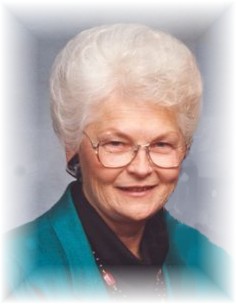
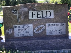
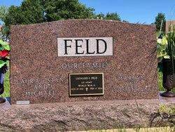
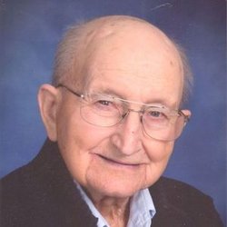
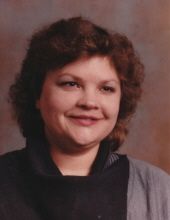
Harriett Gail Powers Feld
| Birth | : | 2 Jan 1927 Calhoun County, Iowa, USA |
| Death | : | 18 Jul 2006 Afton, Union County, Iowa, USA |
| Burial | : | Tremont Cemetery, Dixon, Solano County, USA |
| Coordinate | : | 38.4940987, -121.7043991 |
| Description | : | Harriett Gail Feld, 79, of Afton, died Tues. July 18, 2006 at the Afton Care Center in Afton. Harriett Gail Feld was born Jan. 2, 1927 in Calhoun County, Iowa to Michael Earl Powers and Adell Frizzell Maquire. Gail graduated from Rockwell High School in 1944 and studied at the Conservatory of Music in Chicago. On January 12, 1948 Gail was united in marriage to Leonard Leo Feld in Fort Dodge, Iowa. They settled in Piper, Iowa until 1952 when they moved to Pomeroy, Iowa. In the fall of 1958, they moved to Rockwell City where they farmed and started... Read More |
frequently asked questions (FAQ):
-
Where is Harriett Gail Powers Feld's memorial?
Harriett Gail Powers Feld's memorial is located at: Tremont Cemetery, Dixon, Solano County, USA.
-
When did Harriett Gail Powers Feld death?
Harriett Gail Powers Feld death on 18 Jul 2006 in Afton, Union County, Iowa, USA
-
Where are the coordinates of the Harriett Gail Powers Feld's memorial?
Latitude: 38.4940987
Longitude: -121.7043991
Family Members:
Parent
Spouse
Siblings
Children
Flowers:
Nearby Cemetories:
1. Tremont Cemetery
Dixon, Solano County, USA
Coordinate: 38.4940987, -121.7043991
2. Davis Cemetery
Davis, Yolo County, USA
Coordinate: 38.5550003, -121.7260971
3. Episcopal Church of Saint Martin Columbarium
Davis, Yolo County, USA
Coordinate: 38.5488870, -121.7611850
4. Dixon Cemetery
Dixon, Solano County, USA
Coordinate: 38.4354553, -121.8227005
5. Sacramento Valley National Cemetery
Dixon, Solano County, USA
Coordinate: 38.4167800, -121.8754000
6. Sunset Hill Cemetery
Sacramento, Sacramento County, USA
Coordinate: 38.5608000, -121.5037300
7. Masonic Lawn Cemetery
Sacramento, Sacramento County, USA
Coordinate: 38.5604720, -121.5032600
8. Binghampton Cemetery
Solano County, USA
Coordinate: 38.3510550, -121.8244220
9. Odd Fellows Lawn Cemetery and Mausoleum
Sacramento, Sacramento County, USA
Coordinate: 38.5585000, -121.5011000
10. Sacramento City Cemetery
Sacramento, Sacramento County, USA
Coordinate: 38.5636864, -121.5009537
11. Buddhist Church of Sacramento Nokotsudo
Sacramento, Sacramento County, USA
Coordinate: 38.5639300, -121.4978400
12. National Shrine of Our Lady of Guadalupe Crypt
Sacramento, Sacramento County, USA
Coordinate: 38.5704800, -121.5014400
13. Pho Minh Temple Columbarium
Sacramento, Sacramento County, USA
Coordinate: 38.5340100, -121.4769000
14. Saint Joseph Cemetery
Sacramento, Sacramento County, USA
Coordinate: 38.5574989, -121.4835968
15. California State Capitol
Sacramento, Sacramento County, USA
Coordinate: 38.5760994, -121.4931488
16. Saint Joseph Cemetery
Woodland, Yolo County, USA
Coordinate: 38.6694400, -121.7842120
17. Saint Rose Cemetery (Defunct)
Sacramento, Sacramento County, USA
Coordinate: 38.5208015, -121.4672012
18. Woodland Cemetery
Woodland, Yolo County, USA
Coordinate: 38.6711006, -121.7846985
19. Holy Ascension Russian Orthodox Cemetery
Sacramento, Sacramento County, USA
Coordinate: 38.5846212, -121.4936736
20. Trinity Episcopal Cathedral Columbarium
Sacramento, Sacramento County, USA
Coordinate: 38.5705500, -121.4723770
21. New Helvetia Cemetery (Defunct)
Sacramento, Sacramento County, USA
Coordinate: 38.5731600, -121.4639900
22. Home of Peace Cemetery
Sacramento, Sacramento County, USA
Coordinate: 38.5137558, -121.4382782
23. Sacramento Memorial Lawn Cemetery
Sacramento, Sacramento County, USA
Coordinate: 38.5146484, -121.4380341
24. East Lawn Memorial Park
Sacramento, Sacramento County, USA
Coordinate: 38.5612960, -121.4492760

