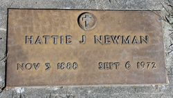
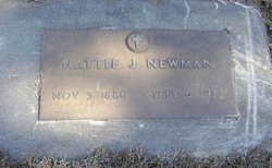
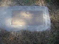
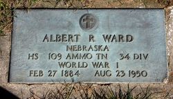
Hattie Jane Ward Newman
| Birth | : | 3 Nov 1888 Nebraska, USA |
| Death | : | 3 Sep 1972 Mapleton, Monona County, Iowa, USA |
| Burial | : | Green Point Cemetery, Bluff, Invercargill City, New Zealand |
| Coordinate | : | -46.5739350, 168.3006450 |
| Plot | : | Block 4, Lot 6 |
| Description | : | Hattie Jane Newman, daughter of Alonzo and Mary (Linderman) Ward, was born November 3, 1888 in Indiana and died Wednesday, September 6, 1972 at the home of a daughter at Pisgah, Iowa. She had reached the age of 83 years, 10 months and 3 days. Mrs. Newman moved to Decatur, Nebraska with her parents when she was a child. She married Harry Newman in 1906 at Castana, Iowa and they farmed in the Castana, Oto and Smithland community. In 1934 Hattie moved to Mapleton where she was employed as a cook at the R&R Café and the Home Café until her... Read More |
frequently asked questions (FAQ):
-
Where is Hattie Jane Ward Newman's memorial?
Hattie Jane Ward Newman's memorial is located at: Green Point Cemetery, Bluff, Invercargill City, New Zealand.
-
When did Hattie Jane Ward Newman death?
Hattie Jane Ward Newman death on 3 Sep 1972 in Mapleton, Monona County, Iowa, USA
-
Where are the coordinates of the Hattie Jane Ward Newman's memorial?
Latitude: -46.5739350
Longitude: 168.3006450
Family Members:
Parent
Spouse
Siblings
Children
Flowers:
Nearby Cemetories:
1. Green Point Cemetery
Bluff, Invercargill City, New Zealand
Coordinate: -46.5739350, 168.3006450
2. Bluff Cemetery
Bluff, Invercargill City, New Zealand
Coordinate: -46.6017310, 168.3248670
3. Captain Stirling Grave
Bluff, Invercargill City, New Zealand
Coordinate: -46.6016466, 168.3691108
4. Te Hau Mutunga Urupā
Invercargill, Invercargill City, New Zealand
Coordinate: -46.4288704, 168.4148361
5. Southland Crematorium
Invercargill, Invercargill City, New Zealand
Coordinate: -46.4109100, 168.3961330
6. Eastern Cemetery
Invercargill, Invercargill City, New Zealand
Coordinate: -46.4070770, 168.3961480
7. Holy Trinity Anglican Church
Invercargill, Invercargill City, New Zealand
Coordinate: -46.3984736, 168.3660057
8. All Saints Anglican Church
Invercargill, Invercargill City, New Zealand
Coordinate: -46.3906042, 168.3476728
9. Saint Johns Cemetery
Invercargill, Invercargill City, New Zealand
Coordinate: -46.3748600, 168.3431480
10. Wallacetown New Cemetery
Wallacetown, Southland District, New Zealand
Coordinate: -46.3374900, 168.2835700
11. Wallacetown Old Cemetery
Wallacetown, Southland District, New Zealand
Coordinate: -46.3321840, 168.2861670
12. Ruapuke Island Cemetery
Southland District, New Zealand
Coordinate: -46.7881040, 168.5048690
13. Woodlands Cemetery
Woodlands, Southland District, New Zealand
Coordinate: -46.3568800, 168.5463770
14. Ryal Bush
Ryal Bush, Southland District, New Zealand
Coordinate: -46.2836700, 168.3256000
15. Riverton Cemetery
Riverton, Southland District, New Zealand
Coordinate: -46.3316900, 168.0215500
16. Horseshoe Bay Cemetery
Stewart Island, Southland District, New Zealand
Coordinate: -46.8814467, 168.1334396
17. Braggs Bay Cemetery
Stewart Island, Southland District, New Zealand
Coordinate: -46.8896680, 168.1397690
18. Halfmoon Bay Cemetery
Stewart Island, Southland District, New Zealand
Coordinate: -46.8947480, 168.1248950
19. Fortrose Cemetery
Fortrose, Southland District, New Zealand
Coordinate: -46.5694400, 168.8088500
20. Colac Bay Cemetery
Colac Bay, Southland District, New Zealand
Coordinate: -46.3679806, 167.8798528
21. The Neck
Stewart Island, Southland District, New Zealand
Coordinate: -46.9249600, 168.1922400
22. Forest Hill Cemetery
Southland District, New Zealand
Coordinate: -46.2049720, 168.3969970
23. Calcium Cemetery
Isla Bank, Southland District, New Zealand
Coordinate: -46.2035710, 168.1279070
24. Wakapatu Cemetery
Wakapatu, Southland District, New Zealand
Coordinate: -46.3806050, 167.8060970

