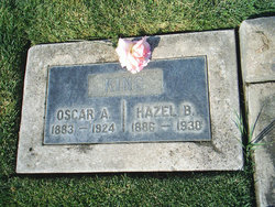
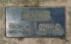
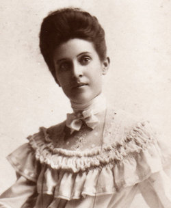
Hazel Bertha Kennedy King-Kroeger
| Birth | : | 2 Oct 1886 Florin, Sacramento County, California, USA |
| Death | : | 18 Aug 1930 Sacramento, Sacramento County, California, USA |
| Burial | : | Franklin Cemetery, Franklin, Sacramento County, USA |
| Coordinate | : | 38.3761749, -121.4558029 |
| Plot | : | Row 1, Plot L Southeast Corner |
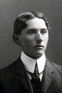
| Description | : | Hazel grew up on the family's farm near Elk Grove. On Oct. 23, 1907 in Sacramento, she married Oscar Aaron King. They made their home in Franklin where Oscar worked as a stock herder and farmer. Widowed in 1926, 10 months later Hazel married John J. Kroeger on Nov. 25, 1926 in Sacramento. They made their home in San Joaquin Twp. where John was a rancher. At age 43 Hazel died in a Sacramento hospital after a short illness. Cause of death was a fractured leg when she stumbled while walking up the stairs at the hospital. A contributing factor... Read More |
frequently asked questions (FAQ):
-
Where is Hazel Bertha Kennedy King-Kroeger's memorial?
Hazel Bertha Kennedy King-Kroeger's memorial is located at: Franklin Cemetery, Franklin, Sacramento County, USA.
-
When did Hazel Bertha Kennedy King-Kroeger death?
Hazel Bertha Kennedy King-Kroeger death on 18 Aug 1930 in Sacramento, Sacramento County, California, USA
-
Where are the coordinates of the Hazel Bertha Kennedy King-Kroeger's memorial?
Latitude: 38.3761749
Longitude: -121.4558029
Family Members:
Parent
Spouse
Siblings
Children
Flowers:
Nearby Cemetories:
1. Franklin Cemetery
Franklin, Sacramento County, USA
Coordinate: 38.3761749, -121.4558029
2. Point Pleasant Cemetery
Point Pleasant, Sacramento County, USA
Coordinate: 38.3308525, -121.4638290
3. Elk Grove Cosumnes-Cemetery
Elk Grove, Sacramento County, USA
Coordinate: 38.4088593, -121.3875504
4. East Lawn Elk Grove Memorial Park
Elk Grove, Sacramento County, USA
Coordinate: 38.4282608, -121.3969955
5. San Joaquin Cemetery
Sacramento, Sacramento County, USA
Coordinate: 38.4387665, -121.4034653
6. Hilltop Cemetery
Elk Grove, Sacramento County, USA
Coordinate: 38.4156490, -121.3534950
7. Hicksville Cemetery
Hicksville, Sacramento County, USA
Coordinate: 38.3257942, -121.3190765
8. Chua Phuoc Thien Temple Columbarium
Sacramento, Sacramento County, USA
Coordinate: 38.4555400, -121.3345500
9. Pleasant Grove Cemetery
Elk Grove, Sacramento County, USA
Coordinate: 38.4302220, -121.3107670
10. Home of Peace Cemetery
Sacramento, Sacramento County, USA
Coordinate: 38.5137558, -121.4382782
11. Elder Creek Cemetery
Florin, Sacramento County, USA
Coordinate: 38.5111008, -121.4169006
12. Sacramento Pet Cemetery
Sacramento, Sacramento County, USA
Coordinate: 38.4815870, -121.3402080
13. Sacramento Memorial Lawn Cemetery
Sacramento, Sacramento County, USA
Coordinate: 38.5146484, -121.4380341
14. Saint Rose Cemetery (Defunct)
Sacramento, Sacramento County, USA
Coordinate: 38.5208015, -121.4672012
15. Tinh Xa Ngoc An Temple Columbarium
Sacramento, Sacramento County, USA
Coordinate: 38.5190200, -121.4159500
16. Sharp Family Cemetery
Walnut Grove, Sacramento County, USA
Coordinate: 38.2351900, -121.5135800
17. Sacramento County Veterans Memorial Cemetery
Sacramento, Sacramento County, USA
Coordinate: 38.5252838, -121.4239120
18. Russian Orthodox Cemetery
Sacramento, Sacramento County, USA
Coordinate: 38.5268800, -121.4244300
19. Sacramento County Cemetery
Sacramento County, USA
Coordinate: 38.5267900, -121.4233700
20. Sacramento County Hospital Cemetery
Sacramento, Sacramento County, USA
Coordinate: 38.5289300, -121.4239100
21. Saint Mary's Catholic Cemetery and Mausoleum
Sacramento, Sacramento County, USA
Coordinate: 38.5298900, -121.4261200
22. Pho Minh Temple Columbarium
Sacramento, Sacramento County, USA
Coordinate: 38.5340100, -121.4769000
23. Union Cemetery
Sacramento County, USA
Coordinate: 38.4477997, -121.2619019
24. Quiet Haven Memorial Park Cemetery
Sacramento, Sacramento County, USA
Coordinate: 38.5109711, -121.3245621


