
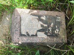
| Birth | : | 17 May 1929 Liberty, Gage County, Nebraska, USA |
| Death | : | 14 Feb 2014 Holdrege, Phelps County, Nebraska, USA |
| Burial | : | Taruheru Cemetery, Gisborne, Gisborne District, New Zealand |
| Coordinate | : | -38.6428900, 177.9802300 |
| Plot | : | F-13 |
| Inscription | : | Married on June 24, 1947 |
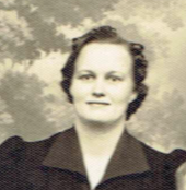
| Description | : | H. Joan "Joan" Hunt was born May 17, 1929 at Liberty, Nebraska, the fifth of six children of Benton Roy "Roy" and Leona M. (Hallett) Ellison. Joan, passed away on Friday, February 14, 2014 at the Christian Homes Care Community, Holdrege, Nebraska. Joan received her education in several schools in southeast Nebraska. Following her education, Joan began to be courted by her future husband, Dean Gilbert Hunt from Orleans, Nebraska. On June 24, 1947, Joan was united in marriage to Dean Gilbert Hunt at Norton, Kansas. To this union four children were born: Danny, Eugene, Jonell and Keith. Dean and... Read More |
frequently asked questions (FAQ):
-
Where is Hazel Joan Ellison Hunt's memorial?
Hazel Joan Ellison Hunt's memorial is located at: Taruheru Cemetery, Gisborne, Gisborne District, New Zealand.
-
When did Hazel Joan Ellison Hunt death?
Hazel Joan Ellison Hunt death on 14 Feb 2014 in Holdrege, Phelps County, Nebraska, USA
-
Where are the coordinates of the Hazel Joan Ellison Hunt's memorial?
Latitude: -38.6428900
Longitude: 177.9802300
Family Members:
Parent
Spouse

Siblings
Children
Flowers:


Nearby Cemetories:
1. Taruheru Cemetery
Gisborne, Gisborne District, New Zealand
Coordinate: -38.6428900, 177.9802300
2. Makaraka Cemetery
Gisborne, Gisborne District, New Zealand
Coordinate: -38.6482600, 177.9803200
3. Waerenga a hika Urupā
Gisborne, Gisborne District, New Zealand
Coordinate: -38.5954100, 177.9263500
4. Opou Tuarakena Cemetery
Manutuke, Gisborne District, New Zealand
Coordinate: -38.6744759, 177.9095277
5. Opou Station Cemetery
Manutuke, Gisborne District, New Zealand
Coordinate: -38.6779310, 177.9084450
6. Paramanihi Waihirere Cemetery
Gisborne, Gisborne District, New Zealand
Coordinate: -38.5791250, 177.9488450
7. Manutuke Churchyard Urupā
Manutuke, Gisborne District, New Zealand
Coordinate: -38.6815360, 177.9080180
8. Patutahi Cemetery
Gisborne, Gisborne District, New Zealand
Coordinate: -38.6199300, 177.8955600
9. Manutuke Whakato Urupā
Manutuke, Gisborne District, New Zealand
Coordinate: -38.6843390, 177.9073690
10. Wainui
Gisborne District, New Zealand
Coordinate: -38.6950000, 178.0707400
11. Ormond Cemetery
Ormond, Gisborne District, New Zealand
Coordinate: -38.5526480, 177.9279330
12. Pouawa Urupā
Whangara, Gisborne District, New Zealand
Coordinate: -38.6085500, 178.1825900
13. Whangara Urupā
Whangara, Gisborne District, New Zealand
Coordinate: -38.5716800, 178.2310400
14. Tapuae o te Rangi Urupā
Whatatutu, Gisborne District, New Zealand
Coordinate: -38.3791200, 177.8134180
15. Kohimarama Urupā
Tolaga Bay, Gisborne District, New Zealand
Coordinate: -38.3791770, 178.3007610
16. Nuhaka North Cemetery
Morere, Wairoa District, New Zealand
Coordinate: -38.9797100, 177.7944300
17. Tolaga Bay Cemetery
Tolaga Bay, Gisborne District, New Zealand
Coordinate: -38.3643370, 178.3045240
18. Tolaga Bay Urupā
Tolaga Bay, Gisborne District, New Zealand
Coordinate: -38.3629400, 178.3050080
19. Rakauroa Cemetery
Matawai, Gisborne District, New Zealand
Coordinate: -38.4358900, 177.5711400
20. Okuri Marea Urupa
Tolaga Bay, Gisborne District, New Zealand
Coordinate: -38.3055250, 178.2704340
21. Arataiha Urupā
Nuhaka, Wairoa District, New Zealand
Coordinate: -39.0201020, 177.7361770
22. Opoutama Cemetery
Mahia, Wairoa District, New Zealand
Coordinate: -39.0550780, 177.8405420
23. Manawarakau Urupā
Nuhaka, Wairoa District, New Zealand
Coordinate: -39.0371870, 177.7262650
24. Kaiuku Marae Urupā
Mahia, Wairoa District, New Zealand
Coordinate: -39.0823112, 177.9086516