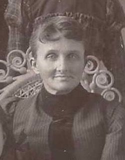
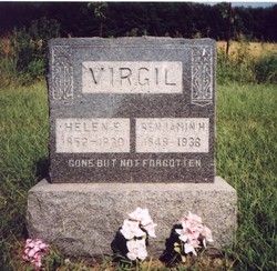
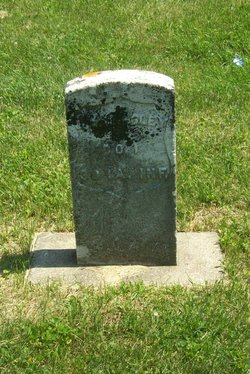
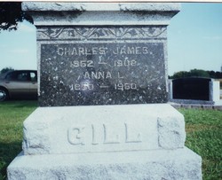
Helen Eliza Kingsley Virgil
| Birth | : | 22 Aug 1852 Castleton, Rutland County, Vermont, USA |
| Death | : | 13 Jan 1930 Collins, St. Clair County, Missouri, USA |
| Burial | : | Flaybrick Memorial Gardens, Birkenhead, Metropolitan Borough of Wirral, England |
| Coordinate | : | 53.3968130, -3.0633240 |
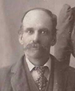
| Description | : | Obit: Helen was the daughter of Amos Weeks and Cornelia A/Emeline Brown Kingsley. She was born at Castleton Corners, Vermont, August 22, 1852, and passed away at the home near Collins, MO, January 13, 1930, at the age of 77 years, 4 months and 21 days. She went to Iowa with her parents as a child and spent most of her girlhood days at Chester, Iowa. She married Benjamin Henry Virgil in Fort Dodge, Webster Co, Iowa on 20 November 1871. They had eleven children: Clara Etta (Mrs James M Learmont) of Humboldt, Iowa, Milton Eugene of Ayrshire, Iowa, Florence... Read More |
frequently asked questions (FAQ):
-
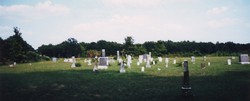
Where is Helen Eliza Kingsley Virgil's memorial?
Helen Eliza Kingsley Virgil's memorial is located at: Flaybrick Memorial Gardens, Birkenhead, Metropolitan Borough of Wirral, England.
-
When did Helen Eliza Kingsley Virgil death?
Helen Eliza Kingsley Virgil death on 13 Jan 1930 in Collins, St. Clair County, Missouri, USA
-
Where are the coordinates of the Helen Eliza Kingsley Virgil's memorial?
Latitude: 53.3968130
Longitude: -3.0633240
Family Members:
Parent
Spouse
Siblings
Children
Nearby Cemetories:
1. Flaybrick Memorial Gardens
Birkenhead, Metropolitan Borough of Wirral, England
Coordinate: 53.3968130, -3.0633240
2. St Oswald's Churchyard
Bidston, Metropolitan Borough of Wirral, England
Coordinate: 53.4043400, -3.0791000
3. Salacre Lane Cemetery
Upton, Metropolitan Borough of Wirral, England
Coordinate: 53.3824050, -3.0919920
4. Saint Mary's Churchyard
Upton, Metropolitan Borough of Wirral, England
Coordinate: 53.3847010, -3.0961600
5. St Alban's Catholic Church
Wallasey, Metropolitan Borough of Wirral, England
Coordinate: 53.4181339, -3.0445808
6. St Hilary Churchyard
Wallasey, Metropolitan Borough of Wirral, England
Coordinate: 53.4216480, -3.0601780
7. St. Werburgh & St. Laurence Catholic Churchyard
Birkenhead, Metropolitan Borough of Wirral, England
Coordinate: 53.3894910, -3.0217530
8. St. John the Evangelist Churchyard
Egremont, Metropolitan Borough of Wirral, England
Coordinate: 53.4163500, -3.0329700
9. Holy Cross Churchyard
Woodchurch, Metropolitan Borough of Wirral, England
Coordinate: 53.3731900, -3.0899400
10. Christ Church Churchyard
Moreton, Metropolitan Borough of Wirral, England
Coordinate: 53.3999580, -3.1112310
11. Rake Lane Cemetery
Wallasey, Metropolitan Borough of Wirral, England
Coordinate: 53.4256120, -3.0437320
12. St. Mary's Churchyard
Birkenhead, Metropolitan Borough of Wirral, England
Coordinate: 53.3895930, -3.0112520
13. Landican Cemetery and Crematorium
Woodchurch, Metropolitan Borough of Wirral, England
Coordinate: 53.3654000, -3.0887510
14. St Paul's
Tranmere, Metropolitan Borough of Wirral, England
Coordinate: 53.3740000, -3.0154600
15. Liverpool Naval Memorial
Liverpool, Metropolitan Borough of Liverpool, England
Coordinate: 53.4061220, -2.9981050
16. St. Nicholas' Churchyard
Liverpool, Metropolitan Borough of Liverpool, England
Coordinate: 53.4069350, -2.9951480
17. St. George's Churchyard
Liverpool, Metropolitan Borough of Liverpool, England
Coordinate: 53.4049700, -2.9901030
18. Christ Church
Bebington, Metropolitan Borough of Wirral, England
Coordinate: 53.3584460, -3.0254810
19. St. Paul's Churchyard
Liverpool, Metropolitan Borough of Liverpool, England
Coordinate: 53.4099460, -2.9919370
20. St. Peter's Churchyard
Bebington, Metropolitan Borough of Wirral, England
Coordinate: 53.3692500, -3.0021020
21. St. Thomas Churchyard
Liverpool, Metropolitan Borough of Liverpool, England
Coordinate: 53.4010330, -2.9861190
22. Bebington Cemetery
Bebington, Metropolitan Borough of Wirral, England
Coordinate: 53.3588030, -3.0165370
23. St. John the Divine
Frankby, Metropolitan Borough of Wirral, England
Coordinate: 53.3744200, -3.1330200
24. St. Peter's Churchyard
Liverpool, Metropolitan Borough of Liverpool, England
Coordinate: 53.4051290, -2.9844200

