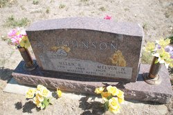
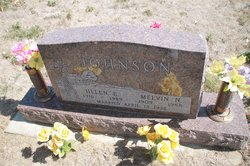
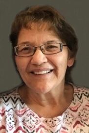
Helen Esther Utke Johnson
| Birth | : | 9 Sep 1916 Yankton County, South Dakota, USA |
| Death | : | 23 Nov 1989 Irene, Clay County, South Dakota, USA |
| Burial | : | North Bethlehem Cemetery, Yankton County, USA |
| Coordinate | : | 43.1403700, -97.4388700 |
| Description | : | Helen E. Johnson, 73, of Irene, died Thursday, Nov. 23, 1989, at Sunset Manor Nursing Home, Irene. Funeral services will be Monday at 2 p.m. at Our Redeemer Lutheran Church, rural Irene. Burial will be at North Bethelhem Cemetery. Visitation will be Sunday from 2 to 9 p.m. at the Hansen Funeral Homme, Irene. Mrs. Johnson was born Sept. 9, 1916, in Yankton County. She was baptized and confirmed at Martinus Lutheran Church, rural Lesterville. She married Melvin Johnson April 8, 1936, at the Midway parsonage. Survivors include five daughters, Sharon (Robert) Rempp of Scottsdale, Ariz., Connie (Jerome) Jensen of Irene, Bonnie, (Dean) Nielsen... Read More |
frequently asked questions (FAQ):
-
Where is Helen Esther Utke Johnson's memorial?
Helen Esther Utke Johnson's memorial is located at: North Bethlehem Cemetery, Yankton County, USA.
-
When did Helen Esther Utke Johnson death?
Helen Esther Utke Johnson death on 23 Nov 1989 in Irene, Clay County, South Dakota, USA
-
Where are the coordinates of the Helen Esther Utke Johnson's memorial?
Latitude: 43.1403700
Longitude: -97.4388700
Family Members:
Parent
Spouse
Siblings
Children
Flowers:
Nearby Cemetories:
1. New Bethlehem Cemetery
Yankton, Yankton County, USA
Coordinate: 43.1263400, -97.4389800
2. Saron Reformed Cemetery
Yankton County, USA
Coordinate: 43.1537500, -97.4686700
3. Zion Oswald Congregational Cemetery
Menno, Hutchinson County, USA
Coordinate: 43.1839240, -97.4204710
4. Zion EUB Cemetery
Molan Township, Hutchinson County, USA
Coordinate: 43.1840200, -97.4204610
5. Jamesville Colony Cemetery
Jamesville Township, Yankton County, USA
Coordinate: 43.1037170, -97.4787730
6. Zion Cemetery
Hutchinson County, USA
Coordinate: 43.1842003, -97.4030991
7. Elim Cemetery
Yankton County, USA
Coordinate: 43.1511002, -97.3574982
8. Zion Evangelical Lutheran Congregation Cemetery
Hutchinson County, USA
Coordinate: 43.1842003, -97.4972000
9. Pleasant Hill Cemetery
Vedin Corner, Yankton County, USA
Coordinate: 43.0752000, -97.4092400
10. Braunesreuther Family Cemetery
Utica, Yankton County, USA
Coordinate: 43.0629400, -97.4762600
11. Our Savior's East Cemetery
Yankton County, USA
Coordinate: 43.1475900, -97.5561600
12. Ebenezer Reformed Cemetery
Hutchinson County, USA
Coordinate: 43.2121200, -97.5135130
13. Bang Cemetery
Turner County, USA
Coordinate: 43.1997500, -97.3392000
14. Voll Cemetery
Yankton County, USA
Coordinate: 43.0567017, -97.3768997
15. Saint Columba Catholic Cemetery
Mayfield, Yankton County, USA
Coordinate: 43.0967000, -97.3192000
16. Carlson Cemetery
Turner County, USA
Coordinate: 43.1843987, -97.3174973
17. Hoffnung Cemetery
Lesterville, Yankton County, USA
Coordinate: 43.0902600, -97.5580600
18. Sigel Cemetery
Utica, Yankton County, USA
Coordinate: 43.0390400, -97.4216000
19. Salem Community Cemetery
Turner County, USA
Coordinate: 43.2433500, -97.3995200
20. Mueller Cemetery
Yankton County, USA
Coordinate: 43.0489006, -97.5160980
21. Our Savior's West Cemetery
Yankton County, USA
Coordinate: 43.1637300, -97.5947900
22. Ogstad Cemetery
Yankton County, USA
Coordinate: 43.1549988, -97.2794037
23. Odessa Lutheran Cemetery
Lesterville, Yankton County, USA
Coordinate: 43.0985985, -97.5911026
24. Saint Boniface Cemetery
Turkey Ridge, Turner County, USA
Coordinate: 43.2271100, -97.3189800


