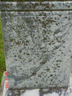
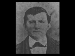
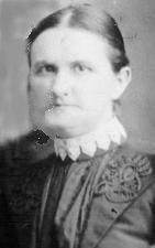
Henrietta Luebke Hackstein
| Birth | : | 11 Apr 1842 Germany |
| Death | : | 18 Jan 1898 Worden, Douglas County, Kansas, USA |
| Burial | : | St Lawrence Churchyard, Wootton St Lawrence, Basingstoke and Deane Borough, England |
| Coordinate | : | 51.2751600, -1.1522800 |
| Description | : | According to Franklin County, Kansas Register of Deaths, Henrietta died of consumption. |
frequently asked questions (FAQ):
-
Where is Henrietta Luebke Hackstein's memorial?
Henrietta Luebke Hackstein's memorial is located at: St Lawrence Churchyard, Wootton St Lawrence, Basingstoke and Deane Borough, England.
-
When did Henrietta Luebke Hackstein death?
Henrietta Luebke Hackstein death on 18 Jan 1898 in Worden, Douglas County, Kansas, USA
-
Where are the coordinates of the Henrietta Luebke Hackstein's memorial?
Latitude: 51.2751600
Longitude: -1.1522800
Family Members:
Spouse
Children
Flowers:
Nearby Cemetories:
1. St Lawrence Churchyard
Wootton St Lawrence, Basingstoke and Deane Borough, England
Coordinate: 51.2751600, -1.1522800
2. St. Thomas of Canterbury Churchyard
Worting, Basingstoke and Deane Borough, England
Coordinate: 51.2621430, -1.1405070
3. All Saints Churchyard
Monk Sherborne, Basingstoke and Deane Borough, England
Coordinate: 51.2981040, -1.1288260
4. St John Churchyard and Garden of Remembrance
Oakley, Basingstoke and Deane Borough, England
Coordinate: 51.2468300, -1.1689700
5. St. John's Churchyard
Wootton St Lawrence, Basingstoke and Deane Borough, England
Coordinate: 51.2467406, -1.1687444
6. Worting Road Cemetery
Basingstoke, Basingstoke and Deane Borough, England
Coordinate: 51.2623970, -1.1049700
7. St. Leonard's Churchyard
Oakley, Basingstoke and Deane Borough, England
Coordinate: 51.2498700, -1.1882700
8. St Andrew Churchyard
Sherborne St John, Basingstoke and Deane Borough, England
Coordinate: 51.2955000, -1.1069200
9. Christ Church Churchyard
Ramsdell, Basingstoke and Deane Borough, England
Coordinate: 51.3131100, -1.1558500
10. South View Cemetery
Basingstoke, Basingstoke and Deane Borough, England
Coordinate: 51.2693510, -1.0911620
11. St. Michael's Churchyard
Basingstoke, Basingstoke and Deane Borough, England
Coordinate: 51.2652400, -1.0885200
12. St Mary Churchyard
Basingstoke, Basingstoke and Deane Borough, England
Coordinate: 51.2652010, -1.0818960
13. St. Mary and St. John the Baptist Churchyard
Pamber, Basingstoke and Deane Borough, England
Coordinate: 51.3194500, -1.1279200
14. All Saints Churchyard
Deane, Basingstoke and Deane Borough, England
Coordinate: 51.2486030, -1.2191660
15. All Saints Churchyard
Hannington, Basingstoke and Deane Borough, England
Coordinate: 51.2956100, -1.2285200
16. St. Leonard's Churchyard
Cliddesden, Basingstoke and Deane Borough, England
Coordinate: 51.2373200, -1.0948700
17. St. Andrew's Churchyard
Farleigh Wallop, Basingstoke and Deane Borough, England
Coordinate: 51.2234400, -1.1064200
18. Holy Trinity and St. Andrew's Churchyard
Ashe, Basingstoke and Deane Borough, England
Coordinate: 51.2472000, -1.2375000
19. St Catherine Churchyard
Wolverton, Basingstoke and Deane Borough, England
Coordinate: 51.3236500, -1.2097700
20. Tadley Cemetery
Tadley, Basingstoke and Deane Borough, England
Coordinate: 51.3356900, -1.1435800
21. St Stephen Churchyard
Baughurst, Basingstoke and Deane Borough, England
Coordinate: 51.3354800, -1.1657100
22. St Peter Churchyard
Tadley, Basingstoke and Deane Borough, England
Coordinate: 51.3359400, -1.1433300
23. All Saints Churchyard
Dummer, Basingstoke and Deane Borough, England
Coordinate: 51.2103290, -1.1588850
24. St Nicholas Churchyard
Steventon, Basingstoke and Deane Borough, England
Coordinate: 51.2214000, -1.2123600


