
| Birth | : | 29 Oct 1896 Iowa, USA |
| Death | : | 29 Aug 1987 Lemmon, Perkins County, South Dakota, USA |
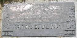
| Burial | : | St Michael and All Angels Churchyard, North Otterington, Hambleton District, England |
| Coordinate | : | 54.3017300, -1.4438700 |
| Plot | : | Block3 Lot 10 Grave 6 |
| Description | : | Siblings: John F. Ploog, Helena (Ploog) Taylor, William M. Ploog, Gretchen Ploog. Frieda Ploog, Andrew H. Ploog. Linda Ploog, Hugo D. Ploog, Rosa Ploog, Frances Ploog, Albert PLOOG Parents: Henry Ploog, Sr. and Christina (Gernns) Married: Mayme RUZICKA 19 JUL 1919 Children: Kenneth Richard Ploog, Winfred Ploog, Helen Ploog |
frequently asked questions (FAQ):
-
Where is Henry David Ploog Jr.'s memorial?
Henry David Ploog Jr.'s memorial is located at: St Michael and All Angels Churchyard, North Otterington, Hambleton District, England.
-
When did Henry David Ploog Jr. death?
Henry David Ploog Jr. death on 29 Aug 1987 in Lemmon, Perkins County, South Dakota, USA
-
Where are the coordinates of the Henry David Ploog Jr.'s memorial?
Latitude: 54.3017300
Longitude: -1.4438700
Family Members:
Parent

Spouse
Siblings
Children
Flowers:


Nearby Cemetories:
1. St Michael and All Angels Churchyard
North Otterington, Hambleton District, England
Coordinate: 54.3017300, -1.4438700
2. St Andrew Churchyard
South Otterington, Hambleton District, England
Coordinate: 54.2823100, -1.4311300
3. St. Barnabas Church Cemetery
Thornton-le-Moor, Hambleton District, England
Coordinate: 54.2874720, -1.4011833
4. Thornton-le-Beans Chapelyard
Thornton-le-Beans, Hambleton District, England
Coordinate: 54.3074250, -1.3934900
5. St. Michael and All Angels Churchyard
Maunby, Hambleton District, England
Coordinate: 54.2725530, -1.4606140
6. St James Churchyard
Romanby, Hambleton District, England
Coordinate: 54.3331660, -1.4474010
7. St. Helen's Churchyard
Ainderby Steeple, Hambleton District, England
Coordinate: 54.3232200, -1.4870680
8. Northallerton Cemetery
Northallerton, Hambleton District, England
Coordinate: 54.3410870, -1.4380120
9. All Saints Churchyard
Northallerton, Hambleton District, England
Coordinate: 54.3420430, -1.4366340
10. St John the Baptist Churchyard
Kirby Wiske, Hambleton District, England
Coordinate: 54.2576320, -1.4238510
11. All Saints Churchyard
Yafforth, Hambleton District, England
Coordinate: 54.3447400, -1.4720100
12. St Leonard Churchyard
Thornton-le-Street, Hambleton District, England
Coordinate: 54.2700040, -1.3653200
13. All Saints Churchyard
Pickhill, Hambleton District, England
Coordinate: 54.2470500, -1.4700700
14. St. Thomas Churchyard
Brompton, Hambleton District, England
Coordinate: 54.3613700, -1.4263900
15. St Radegund Churchyard
Scruton, Hambleton District, England
Coordinate: 54.3275320, -1.5398210
16. St John the Baptist Churchyard
Leeming, Hambleton District, England
Coordinate: 54.2990400, -1.5497100
17. Brompton Cemetery
Northallerton, Hambleton District, England
Coordinate: 54.3614100, -1.4140900
18. St Mary the Virgin Churchyard
Leake, Hambleton District, England
Coordinate: 54.3094180, -1.3357310
19. St Lambert Churchyard
Burneston, Hambleton District, England
Coordinate: 54.2592940, -1.5273040
20. St Lawrence Churchyard
Kirby Sigston, Hambleton District, England
Coordinate: 54.3458700, -1.3609600
21. St Leonard Churchyard
Sandhutton, Hambleton District, England
Coordinate: 54.2326000, -1.4121600
22. St Leonard Church Cemetery
Sandhutton, Hambleton District, England
Coordinate: 54.2325700, -1.4110600
23. St Wilfrid Churchyard
South Kilvington, Hambleton District, England
Coordinate: 54.2499690, -1.3481640
24. St Andrew Churchyard
Great Fencote, Hambleton District, England
Coordinate: 54.3366300, -1.5662200