


Henry E. Arns
| Birth | : | 2 Feb 1873 Minnesota, USA |
| Death | : | 23 Dec 1939 Redfield, Spink County, South Dakota, USA |
| Burial | : | Mount Vernon Cemetery, Peru, Nemaha County, USA |
| Coordinate | : | 40.4768982, -95.7208023 |
| Plot | : | Division A, Block 003, Grave 008 |
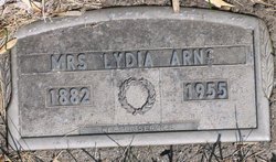
| Description | : | His World War I Draft Registration Card lists his name as Henry EDWARD Arns and he signed it that way. It appears that the grave stone is incorrect. He was buried at Greenlawn Cemetery on December 27, 1939. |
frequently asked questions (FAQ):
-
Where is Henry E. Arns's memorial?
Henry E. Arns's memorial is located at: Mount Vernon Cemetery, Peru, Nemaha County, USA.
-
When did Henry E. Arns death?
Henry E. Arns death on 23 Dec 1939 in Redfield, Spink County, South Dakota, USA
-
Where are the coordinates of the Henry E. Arns's memorial?
Latitude: 40.4768982
Longitude: -95.7208023
Family Members:
Parent

Spouse
Siblings
Children
Flowers:


Nearby Cemetories:
1. Mount Vernon Cemetery
Peru, Nemaha County, USA
Coordinate: 40.4768982, -95.7208023
2. Honey Creek Cemetery
Nemaha Township, Nemaha County, USA
Coordinate: 40.4430199, -95.6980820
3. Sonora Cemetery
Watson, Atchison County, USA
Coordinate: 40.4730988, -95.6521988
4. Karn Cemetery
Glenrock, Nemaha County, USA
Coordinate: 40.4789000, -95.7917000
5. London Cemetery
Peru, Nemaha County, USA
Coordinate: 40.4225006, -95.7621994
6. Highland Methodist Cemetery
Nemaha County, USA
Coordinate: 40.4581850, -95.8097140
7. Highland Baptist Cemetery
Auburn, Nemaha County, USA
Coordinate: 40.4578018, -95.8191986
8. Walnut Grove Cemetery
Brownville, Nemaha County, USA
Coordinate: 40.4023056, -95.6642990
9. Kinser Burial Site
Watson, Atchison County, USA
Coordinate: 40.4974350, -95.5908610
10. Addington Cemetery
Watson, Atchison County, USA
Coordinate: 40.4721985, -95.5828018
11. Clayton-Lewis Cemetery
Rock Port, Atchison County, USA
Coordinate: 40.5439730, -95.6102280
12. Saint Bernards Church Cemetery
Julian, Nemaha County, USA
Coordinate: 40.5078000, -95.8592000
13. Camp Creek Cemetery
Otoe County, USA
Coordinate: 40.5681000, -95.8019028
14. Glenrock Cemetery
Glenrock, Nemaha County, USA
Coordinate: 40.4644012, -95.8764038
15. High Creek Cemetery
Rock Port, Atchison County, USA
Coordinate: 40.5086780, -95.5690380
16. Union Cemetery
Rock Port, Atchison County, USA
Coordinate: 40.5685000, -95.6110000
17. Stoner Cemetery
Atchison County, USA
Coordinate: 40.5127983, -95.5618973
18. Sheridan Cemetery
Auburn, Nemaha County, USA
Coordinate: 40.3936005, -95.8591995
19. Klaus Burial Site
Watson, Atchison County, USA
Coordinate: 40.4917400, -95.5440620
20. Nemaha Cemetery
Nemaha, Nemaha County, USA
Coordinate: 40.3469009, -95.6596985
21. Linden Cemetery
Watson, Atchison County, USA
Coordinate: 40.4856130, -95.5383220
22. Millsap Cemetery
Rock Port, Atchison County, USA
Coordinate: 40.4150009, -95.5532990
23. Sheridan West Memorial Cemetery
Auburn, Nemaha County, USA
Coordinate: 40.3920580, -95.8701320
24. Lansdown family burial site
Rock Port, Atchison County, USA
Coordinate: 40.4154319, -95.5522575