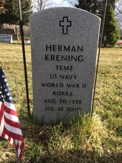
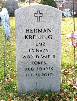
Herman “Pep” Krening
| Birth | : | 20 Aug 1926 Loveland, Larimer County, Colorado, USA |
| Death | : | 26 Jul 2010 Loveland, Larimer County, Colorado, USA |
| Burial | : | Norton St. Philip Churchyard, Norton St Philip, Mendip District, England |
| Coordinate | : | 51.3001680, -2.3279700 |
| Plot | : | Block 46 Lot 162 Grave 1A |
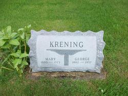
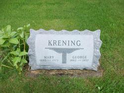
| Description | : | Herman "Pep" Krening, 83, of Loveland, CO, passed away Monday, July 26, 2010 at McKee Medical Center, surrounded by his family. He was born in Loveland on August 20, 1926 to George and Mary (Weiss) Krening. Herman enlisted in the US Navy in 1944 and was honorably discharged on May 17, 1946. Herman met and married Mary Joan Knox on September 17, 1949. They are both natives of Loveland. He was in the Navy Reserve, when they called him back to active duty in November of 1950. He served in the Navy Post Office in Yokosuka, Japan, until he was... Read More |
frequently asked questions (FAQ):
-
Where is Herman “Pep” Krening's memorial?
Herman “Pep” Krening's memorial is located at: Norton St. Philip Churchyard, Norton St Philip, Mendip District, England.
-
When did Herman “Pep” Krening death?
Herman “Pep” Krening death on 26 Jul 2010 in Loveland, Larimer County, Colorado, USA
-
Where are the coordinates of the Herman “Pep” Krening's memorial?
Latitude: 51.3001680
Longitude: -2.3279700
Family Members:
Parent
Spouse
Flowers:
Nearby Cemetories:
1. Norton St. Philip Churchyard
Norton St Philip, Mendip District, England
Coordinate: 51.3001680, -2.3279700
2. St. Lawrence Churchyard
Woolverton, Mendip District, England
Coordinate: 51.2851540, -2.3021790
3. St. John the Baptist Churchyard
Hinton Charterhouse, Bath and North East Somerset Unitary Authority, England
Coordinate: 51.3233330, -2.3219440
4. St Mary's Churchyard
Laverton, Mendip District, England
Coordinate: 51.2757380, -2.3195910
5. All Saints Churchyard
Tellisford, Mendip District, England
Coordinate: 51.2997270, -2.2877180
6. St Leonard Churchyard
Farleigh Hungerford, Mendip District, England
Coordinate: 51.3155390, -2.2884820
7. Farleigh Hungerford Castle
Farleigh Hungerford, Mendip District, England
Coordinate: 51.3173500, -2.2869590
8. Christ Church Churchyard
Rode, Mendip District, England
Coordinate: 51.2861620, -2.2790890
9. All Saints Churchyard
Lullington, Mendip District, England
Coordinate: 51.2661940, -2.3121800
10. St Julian's Churchyard
Wellow, Bath and North East Somerset Unitary Authority, England
Coordinate: 51.3240160, -2.3717630
11. St Lawrence Churchyard
Rode, Mendip District, England
Coordinate: 51.2792750, -2.2765370
12. Freshford Cemetery
Freshford, Bath and North East Somerset Unitary Authority, England
Coordinate: 51.3379620, -2.3082970
13. Midford Burial Ground
Bath, Bath and North East Somerset Unitary Authority, England
Coordinate: 51.3394360, -2.3391424
14. St Mary the Virgin Churchyard
Orchardleigh, Mendip District, England
Coordinate: 51.2576210, -2.3259440
15. Saint Peters Churchyard
Freshford, Bath and North East Somerset Unitary Authority, England
Coordinate: 51.3400570, -2.3033340
16. Saint Michael & All Angels Churchyard
Buckland Dinham, Mendip District, England
Coordinate: 51.2600540, -2.3522580
17. Wellow & Shoscombe Cemetery
Wellow, Bath and North East Somerset Unitary Authority, England
Coordinate: 51.3165527, -2.3916632
18. St George Churchyard
Beckington, Mendip District, England
Coordinate: 51.2635260, -2.2856810
19. Beckington Baptist Chapel Burial Ground
Beckington, Mendip District, England
Coordinate: 51.2610760, -2.2897000
20. Blessed St Mary the Virgin Churchyard
Hemington, Mendip District, England
Coordinate: 51.2758698, -2.3925455
21. Combe Hay Parish Churchyard
Combe Hay, Bath and North East Somerset Unitary Authority, England
Coordinate: 51.3371120, -2.3817390
22. Foxcote St James' The Less Churchyard
Shoscombe, Bath and North East Somerset Unitary Authority, England
Coordinate: 51.2985762, -2.4092987
23. St. James the Less Churchyard
Foxcote, Mendip District, England
Coordinate: 51.2985540, -2.4093370
24. Combe Hay Cemetery
Combe Hay, Bath and North East Somerset Unitary Authority, England
Coordinate: 51.3397819, -2.3814323


